
I took the entire day on September 6th to explore Northwestern Michigan. It was an area I had never been before - so I spent a good 12 hours on the road with plenty of stops.
For the entire flickr set of over 250 photos...go here.
Route: M-72, US 31, M-37, US 31, M-22, M-201, M-22, M-109, Pierce Stocking Scenic Drive, M-109, M-22, M-115, M-42 (or what once was M-42), US 131, M-72, and then back to Torch Lake.
Old Mission Peninsula:
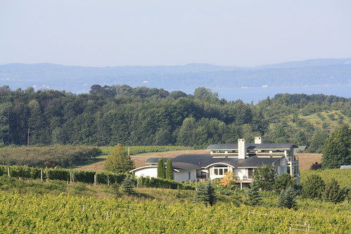
Michigan 37 along the Old Mission Peninsula is a must drive. Amazing country! From views of either arm of Grand Traverse Bay, rolling farmlands and vineyards, the town of Old Mission, and the Old Mission Lighthouse, this road is a must drive for anyone!
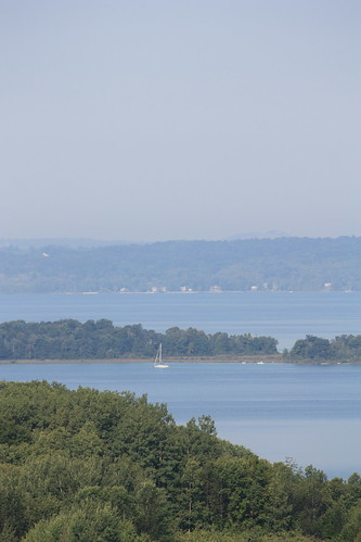
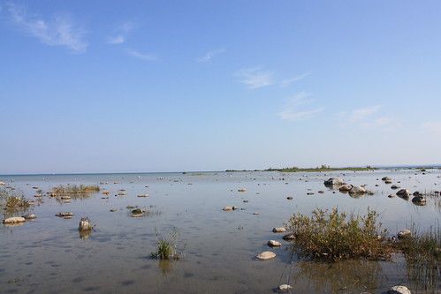
Early in the drive, there is a scenic pullout along M-37 affording amazing views of the East Arm of Grand Traverse Bay and Bowers Harbor. Throw in the vibrant greens of local vineyards and you have a great setting.
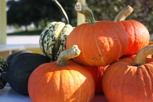
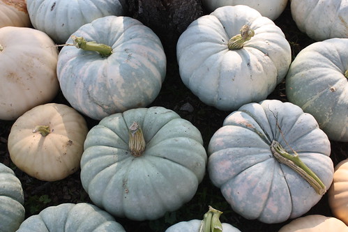
All throughout Old Mission Peninsula and along M-37 are numerous produce stands. These stands offer everything from Peaches and Pumpkins, Maple Syrup and Jellies and a lot more. The produce stands are based on the honor system. It really is a simpler time along here.

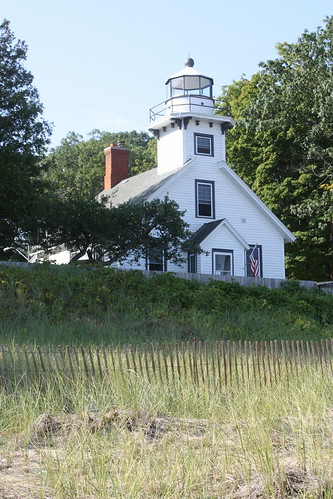
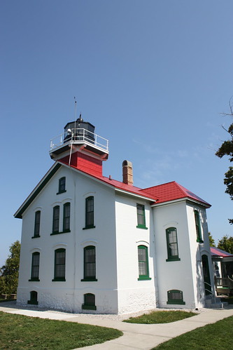
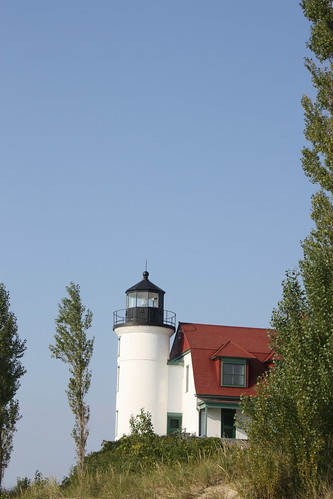
M-37 ends at Old Mission Lighthouse. Lighthouses along the Great Lakes are a lot different than the lighthouses I am used to seeing here along the Atlantic Coast. Most of these lighthouses are more similar to two or three story frame houses with the light attached almost like an extra chimney.
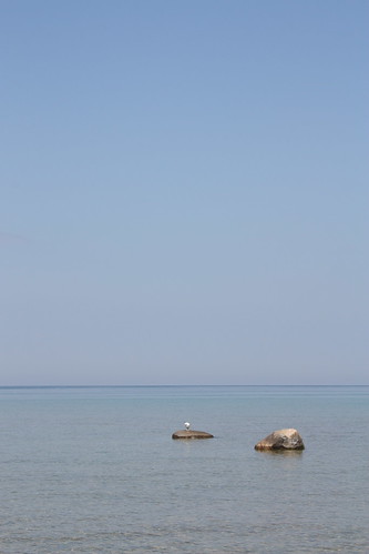
What was also amazing was how still the waters were this morning. It was very serene and a number of people were enjoying the peaceful surroundings.
M-22:
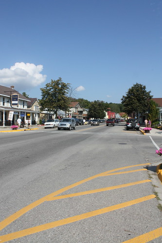
One of the most scenic highways in Michigan is Highway 22 and its journey through Leelanau County. Hugging either the Eastern Arm of Grand Traverse Bay or Lake Michigan itself. M-22 is one of the most popular drives in the area. It's popular enough, that like NC 12 here, bumper stickers with an M-22 shield are available. (Yes, I did get one.) In fact, there is a whole clothing line of M-22 gear.
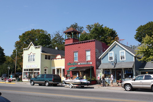
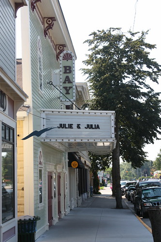
I stopped at Suttons Bay to walk around - and purchase my M-22 sticker. It's a charming lakeside town home to numerous specialty shops, restaurants and of course a giant marina.
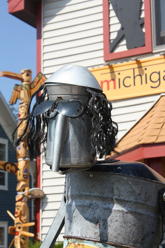
Outside of the Michigan Artists Center in Sutton Bay were these three characters made of used scrap metals as a mini-rock band.
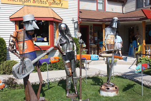
The guitar player and the saxophonist both had this muppet like quality to them. And really caught my eye.

Grand Traverse Lighthouse:
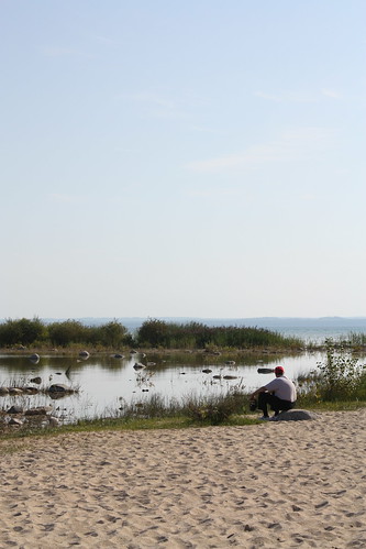
At the northern most point of Leelanau County is the Grand Traverse Lighthouse. It is part of Leelanau State Park - and it costs $8 to enter the park and then $4 to climb the lighthouse.
Similar to Old Mission, the lake was amazingly tranquil.
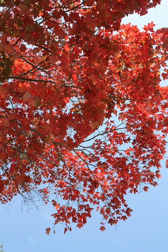
There was even some color on the leaves at this point...but the changes in leaves were very sparse throughout the trip.
Sleeping Bear Dunes National Lakeshore:
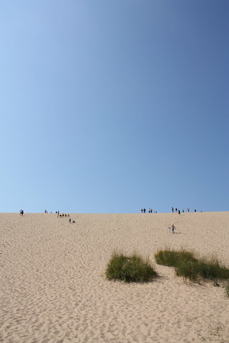
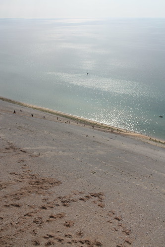
It's a must visit. The dunes are unbelievable - and they are massive. My first stop here was the 'Dune Climb' area. I really thought after hiking/climbing/hang gliding off of Jockey's Ridge here in North Carolina that I had nothing to worry about. Was I wrong. The start of the dune climb is at least a mile and a half from Lake Michigan, and you are not out of the woods when you finish the first hill...or the second...or the third...or the fourth.
I wanted to hike all the way to the lake, but it would have added an extra hour or so to the trip, and there was still plenty to see. I do want to complete this hike (and later scale down and up the 450 foot bluffs) if I ever get back to this area.
This is just after the first hill climb!

This is looking back at Glen Lake...from the climb up the second hill.
Finally, after the fourth hill, you can see Lake Michigan...but as you can tell...it's still a hike to the lake from here.
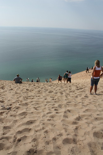
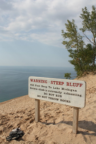
Pierce Stocking Scenic Drive:
It's $10 to take the drive - which has a number of different stops. The highlight is the bluffs overlooking Lake Michigan. The sand dune bluffs are about 450' above the lake and you are able to climb up and down them to the lake. (If you are in shape to do it.) It is amazingly impressive the steep descent from the top of the bluff to the lake. People run - and even tumble - down the slope; only to find themselves literally crawling standing up to get back to the top.
After finishing up the Pierce Stocking Drive, I continued south on M-22 to the Betsie Point Lighthouse. This lighthouse was my favorite of the three that I photographed during the trip.
Overall, the day was fantastic with a ton of photos taken. A good deal of hiking as well - I wish I had more time to really enjoy and hike the dunes along with the whole area. But in 12 hours, I did see a lot, and got to really explore and experience a part of the country I have never been to before.
For the entire flickr set of over 250 photos...go here.
Route: M-72, US 31, M-37, US 31, M-22, M-201, M-22, M-109, Pierce Stocking Scenic Drive, M-109, M-22, M-115, M-42 (or what once was M-42), US 131, M-72, and then back to Torch Lake.
Old Mission Peninsula:
Michigan 37 along the Old Mission Peninsula is a must drive. Amazing country! From views of either arm of Grand Traverse Bay, rolling farmlands and vineyards, the town of Old Mission, and the Old Mission Lighthouse, this road is a must drive for anyone!
Early in the drive, there is a scenic pullout along M-37 affording amazing views of the East Arm of Grand Traverse Bay and Bowers Harbor. Throw in the vibrant greens of local vineyards and you have a great setting.
All throughout Old Mission Peninsula and along M-37 are numerous produce stands. These stands offer everything from Peaches and Pumpkins, Maple Syrup and Jellies and a lot more. The produce stands are based on the honor system. It really is a simpler time along here.
M-37 ends at Old Mission Lighthouse. Lighthouses along the Great Lakes are a lot different than the lighthouses I am used to seeing here along the Atlantic Coast. Most of these lighthouses are more similar to two or three story frame houses with the light attached almost like an extra chimney.
What was also amazing was how still the waters were this morning. It was very serene and a number of people were enjoying the peaceful surroundings.
M-22:
One of the most scenic highways in Michigan is Highway 22 and its journey through Leelanau County. Hugging either the Eastern Arm of Grand Traverse Bay or Lake Michigan itself. M-22 is one of the most popular drives in the area. It's popular enough, that like NC 12 here, bumper stickers with an M-22 shield are available. (Yes, I did get one.) In fact, there is a whole clothing line of M-22 gear.
I stopped at Suttons Bay to walk around - and purchase my M-22 sticker. It's a charming lakeside town home to numerous specialty shops, restaurants and of course a giant marina.
Outside of the Michigan Artists Center in Sutton Bay were these three characters made of used scrap metals as a mini-rock band.
The guitar player and the saxophonist both had this muppet like quality to them. And really caught my eye.
Grand Traverse Lighthouse:
At the northern most point of Leelanau County is the Grand Traverse Lighthouse. It is part of Leelanau State Park - and it costs $8 to enter the park and then $4 to climb the lighthouse.
Similar to Old Mission, the lake was amazingly tranquil.
There was even some color on the leaves at this point...but the changes in leaves were very sparse throughout the trip.
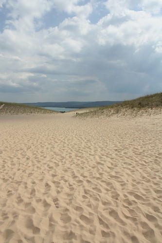
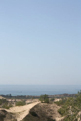
Sleeping Bear Dunes National Lakeshore:
It's a must visit. The dunes are unbelievable - and they are massive. My first stop here was the 'Dune Climb' area. I really thought after hiking/climbing/hang gliding off of Jockey's Ridge here in North Carolina that I had nothing to worry about. Was I wrong. The start of the dune climb is at least a mile and a half from Lake Michigan, and you are not out of the woods when you finish the first hill...or the second...or the third...or the fourth.
I wanted to hike all the way to the lake, but it would have added an extra hour or so to the trip, and there was still plenty to see. I do want to complete this hike (and later scale down and up the 450 foot bluffs) if I ever get back to this area.
This is just after the first hill climb!
This is looking back at Glen Lake...from the climb up the second hill.
Finally, after the fourth hill, you can see Lake Michigan...but as you can tell...it's still a hike to the lake from here.
Pierce Stocking Scenic Drive:
It's $10 to take the drive - which has a number of different stops. The highlight is the bluffs overlooking Lake Michigan. The sand dune bluffs are about 450' above the lake and you are able to climb up and down them to the lake. (If you are in shape to do it.) It is amazingly impressive the steep descent from the top of the bluff to the lake. People run - and even tumble - down the slope; only to find themselves literally crawling standing up to get back to the top.
After finishing up the Pierce Stocking Drive, I continued south on M-22 to the Betsie Point Lighthouse. This lighthouse was my favorite of the three that I photographed during the trip.
Overall, the day was fantastic with a ton of photos taken. A good deal of hiking as well - I wish I had more time to really enjoy and hike the dunes along with the whole area. But in 12 hours, I did see a lot, and got to really explore and experience a part of the country I have never been to before.

Comments
I’m not sure if you recall, but we met at the Wake Forest Arts Festival; looking forward to seeing your pictures of that community event and my Graffiti Monkeys.