
Last Saturday, it was time to set out on the big cross-country roadtrip. Joe Babyak and I would spend a week driving out to and then exploring New Mexico and Arizona before heading back to North Carolina.
Day 1 took us from Raleigh, NC to Lonoke, AR via I-540; I-40; Business I-40; US 52, I-74, I-77, I-81, and I-40.
Our original plan was to go from Wilmington, NC to Lonoke via I-20, future I-22, and I-40 but last minute plans changed the route the first day. The trip was straight driving so unfortunately no stops at small towns or things like that but still as always some good photos.
For the entire day one set on flickr (31 photos overall) head here.
One of the prettiest freeway backdrops in North Carolina is approaching Pilot Mountain along US 52 North.
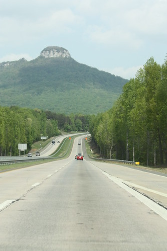
Pilot Mountain sits 2,421 feet above sea level and US 52 runs amazingly close to it. I doubt that a new freeway today could run this close to it. US 52 has direct access to Pilot Mountain State Park, which I have yet to visit! I need to do that this year.
Just north of Pilot Mountain is an overhead sign that I have been wanting to take a photo of for sometime. Not because of anything unique or it's age, but because of the damage done to it by birds over the past decade.
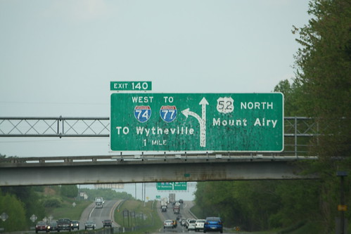
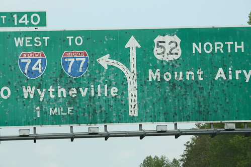
The overhead diagram sign for the US 52/I-74 split near Mount Airy has gradually gotten worse from bird droppings over the past ten or so years. Since, Joe did most of the driving on the trip, I was able to take a number of sign photos I normally wouldn't take. This is one of them. Below, is a closer version of the sign.
As a result of the last minute route change, I was able to ride on I-81 in Eastern Tennessee for the first time in nearly 20 years (freshman year high school band trip to Gatlinburg/Knoxville - wow I am getting old). Obviously, I don't recall anything about I-81 from that trip - most of the driving was at night and we stopped for breakfast somewhere off of I-81 - so it was hard for me to compare. Where I-26 now meets I-40 in the Tri-Cities area, I snapped this shot.
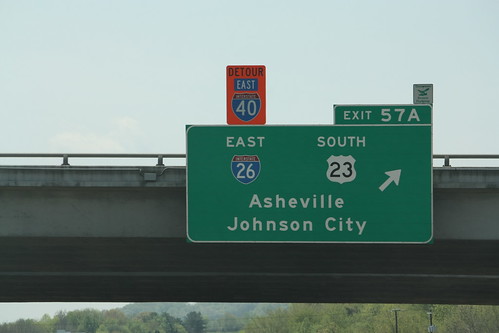
The detour East I-40 banner is for the official detour route due to the I-40 rockslide. With I-40 scheduled to re-open this week, the Detour I-40 shield will most likely come down. I suggest that they keep it up, because they're going to need it again sooner rather than later, and while a detour is not in effect resign it as Alternate I-40 East. But then again what do I know.
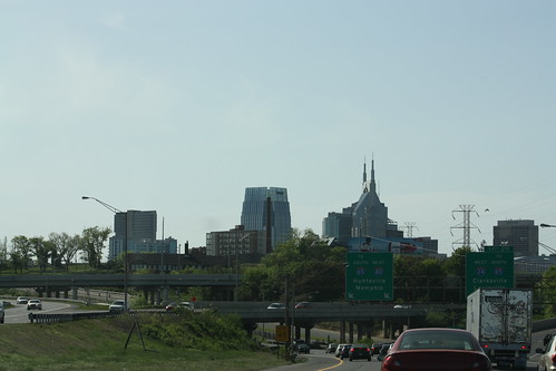
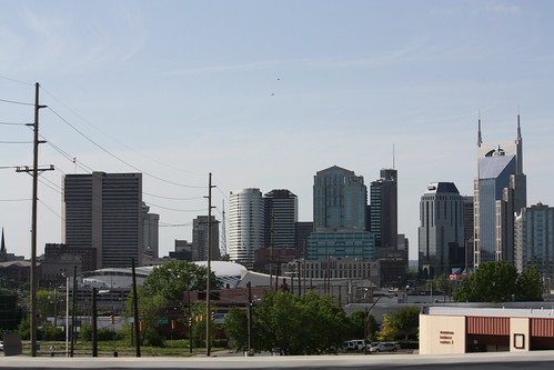
Finally, it's always fun to drive through Nashville - one of my favorite cities. Though this was driving through town vs. an actual visit. I did get a few photos of the skyline while we buzzed along on I-40 West. (Too bad the Predators didn't have a home playoff game that night, I think a stop would have been necessary.)
Next will be Day 2 from Lonoke to Albuquerque...though we had overcast skies much of the route...there will a number of stops on that leg. For now, enjoy!
Day 1 took us from Raleigh, NC to Lonoke, AR via I-540; I-40; Business I-40; US 52, I-74, I-77, I-81, and I-40.
Our original plan was to go from Wilmington, NC to Lonoke via I-20, future I-22, and I-40 but last minute plans changed the route the first day. The trip was straight driving so unfortunately no stops at small towns or things like that but still as always some good photos.
For the entire day one set on flickr (31 photos overall) head here.
One of the prettiest freeway backdrops in North Carolina is approaching Pilot Mountain along US 52 North.
Pilot Mountain sits 2,421 feet above sea level and US 52 runs amazingly close to it. I doubt that a new freeway today could run this close to it. US 52 has direct access to Pilot Mountain State Park, which I have yet to visit! I need to do that this year.
Just north of Pilot Mountain is an overhead sign that I have been wanting to take a photo of for sometime. Not because of anything unique or it's age, but because of the damage done to it by birds over the past decade.
The overhead diagram sign for the US 52/I-74 split near Mount Airy has gradually gotten worse from bird droppings over the past ten or so years. Since, Joe did most of the driving on the trip, I was able to take a number of sign photos I normally wouldn't take. This is one of them. Below, is a closer version of the sign.
As a result of the last minute route change, I was able to ride on I-81 in Eastern Tennessee for the first time in nearly 20 years (freshman year high school band trip to Gatlinburg/Knoxville - wow I am getting old). Obviously, I don't recall anything about I-81 from that trip - most of the driving was at night and we stopped for breakfast somewhere off of I-81 - so it was hard for me to compare. Where I-26 now meets I-40 in the Tri-Cities area, I snapped this shot.
The detour East I-40 banner is for the official detour route due to the I-40 rockslide. With I-40 scheduled to re-open this week, the Detour I-40 shield will most likely come down. I suggest that they keep it up, because they're going to need it again sooner rather than later, and while a detour is not in effect resign it as Alternate I-40 East. But then again what do I know.
Finally, it's always fun to drive through Nashville - one of my favorite cities. Though this was driving through town vs. an actual visit. I did get a few photos of the skyline while we buzzed along on I-40 West. (Too bad the Predators didn't have a home playoff game that night, I think a stop would have been necessary.)
Next will be Day 2 from Lonoke to Albuquerque...though we had overcast skies much of the route...there will a number of stops on that leg. For now, enjoy!
Comments