
From Midland it was pretty much all Interstate home. Day 1 took us from Midland to Tuscaloosa, AL. Day 2 Tuscaloosa to Wilmington where I picked up my vehicle and headed home.
Day 1 Route: I-20, I-30, US 80, I-20, US 82 to Tuscaloosa, AL
Day 2 Route: US 82, I-20, I-459, I-20, I-95, NC 130, US 74 to Wilmington and US 117 and I-40 home.
The entire flickr set (51 photos) is here.
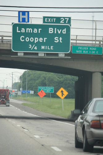
I slept most of the way from Midland to Ft. Worth, but I woke up just in time to catch these button copy signs on I-30 near Arlington.
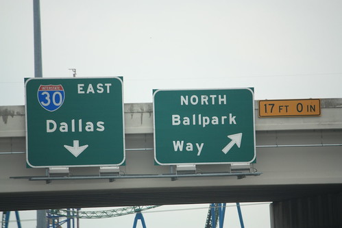
The GPS had told us to use I-30 and US 80 through Dallas vs. I-20 to the South, and we were making excellent time on the trip until this at I-35E.
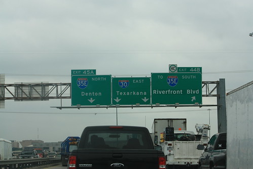
However, sitting in traffic allowed me to get this photo of a rather unique guide sign.
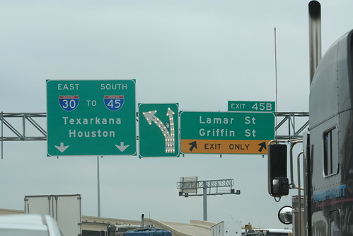
The middle sign actually lights up. The white bulbs from bottom to top and the traffic island lights up in blue. Here's the reason for the 15-20 minute back up.
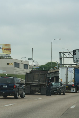
I am still trying to figure out how that pick up truck got turned around like that.
From there the drive east was pretty much uneventful. Around 5 pm we pulled into the Mississippi Welcome Center off of I-20 in Vicksburg. The welcome center has a great vantage point of the two Mississippi River crossings (I-20 and the old US 80 bridges).
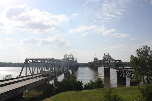
The bridge on the left carries I-20 and US 80 over the Mississippi. It opened in 1973. The bridge on the left is the 'Old Vicksburg Bridge'. It opened in 1930 and carried rail and vehicle traffic. The bridge has been closed to vehicles since 1998. About 12 trains a day still cross the bridge.
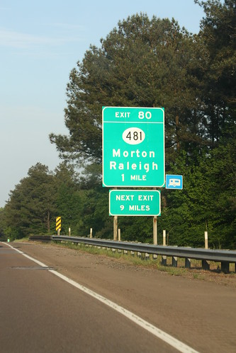
Unfortunately, the Raleigh I am looking for is still a good 750 plus miles away.
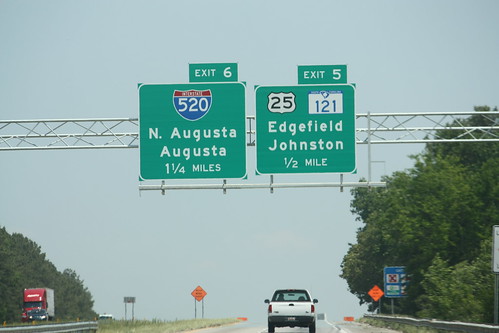
Day 2 - Mornings aren't easy for photos when you are driving east. With the sun shining directly at us, it really wasn't until Atlanta that I could attempt a decent photo. I was hoping to get a few skyline Atlanta shots from I-20, but that wasn't possible. So head east about 150 or so miles and into South Carolina. Interstate 520 has recently been opened to connect to I-20 near North Augusta and here's what the signs look like on I-20 East as you approach the interchange.
The last stop of this week long journey was South of the Border. After years of driving down I-95 on our family vacation to Cherry Grove Beach, you'd think I would have stopped at least once at this true Roadside America attraction. Nope, not once at all. Even with all those catchy billboards - "You've never sausage a place." We never stopped. As a kid, I would count the signs on I-95 South in North Carolina. I think I counted over 50 once - I forget. But finally after 33 years - I stopped at South of the Border.
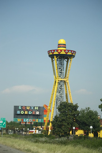
The key landmark of South of the Border is the sombrero observation tower. Promotional materials for the tower tell how you can ride a glass elevator to the top - but it seems like the elevator is always "under repair".
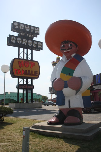
Pedro sure is one 'Hot Tamale'! South of the Border has just recently celebrated its 60th birthday. What Alan Schafer started as a beer stand in 1950 is now one of the more famous stops along Interstate 95. Unfortunately, we really didn't explore more of South of the Border - stop at the various shops and novelty stores, etc. That will have to wait for another time - maybe on the US 301 in North Carolina roadtrip I'd like to do.
From there it was onto Wilmington and home to Raleigh and the end of a week long journey. This trip reminding me of how fortunate we are to live in a country with so many different characteristics not just geographically and physically - but in the people as well. To be able to start a trip in the lush green of the east coast - travel through the flat plains of Oklahoma and Texas - and the desert landscape of New Mexico and Arizona - is an experience I won't forget.
I hope you enjoyed the series of blog entries on this trip - and I look forward to sharing more - large or small - in the years to come.
Day 1 Route: I-20, I-30, US 80, I-20, US 82 to Tuscaloosa, AL
Day 2 Route: US 82, I-20, I-459, I-20, I-95, NC 130, US 74 to Wilmington and US 117 and I-40 home.
The entire flickr set (51 photos) is here.
I slept most of the way from Midland to Ft. Worth, but I woke up just in time to catch these button copy signs on I-30 near Arlington.
The GPS had told us to use I-30 and US 80 through Dallas vs. I-20 to the South, and we were making excellent time on the trip until this at I-35E.
However, sitting in traffic allowed me to get this photo of a rather unique guide sign.
The middle sign actually lights up. The white bulbs from bottom to top and the traffic island lights up in blue. Here's the reason for the 15-20 minute back up.
I am still trying to figure out how that pick up truck got turned around like that.
From there the drive east was pretty much uneventful. Around 5 pm we pulled into the Mississippi Welcome Center off of I-20 in Vicksburg. The welcome center has a great vantage point of the two Mississippi River crossings (I-20 and the old US 80 bridges).
The bridge on the left carries I-20 and US 80 over the Mississippi. It opened in 1973. The bridge on the left is the 'Old Vicksburg Bridge'. It opened in 1930 and carried rail and vehicle traffic. The bridge has been closed to vehicles since 1998. About 12 trains a day still cross the bridge.
Unfortunately, the Raleigh I am looking for is still a good 750 plus miles away.
Day 2 - Mornings aren't easy for photos when you are driving east. With the sun shining directly at us, it really wasn't until Atlanta that I could attempt a decent photo. I was hoping to get a few skyline Atlanta shots from I-20, but that wasn't possible. So head east about 150 or so miles and into South Carolina. Interstate 520 has recently been opened to connect to I-20 near North Augusta and here's what the signs look like on I-20 East as you approach the interchange.
The last stop of this week long journey was South of the Border. After years of driving down I-95 on our family vacation to Cherry Grove Beach, you'd think I would have stopped at least once at this true Roadside America attraction. Nope, not once at all. Even with all those catchy billboards - "You've never sausage a place." We never stopped. As a kid, I would count the signs on I-95 South in North Carolina. I think I counted over 50 once - I forget. But finally after 33 years - I stopped at South of the Border.
The key landmark of South of the Border is the sombrero observation tower. Promotional materials for the tower tell how you can ride a glass elevator to the top - but it seems like the elevator is always "under repair".
Pedro sure is one 'Hot Tamale'! South of the Border has just recently celebrated its 60th birthday. What Alan Schafer started as a beer stand in 1950 is now one of the more famous stops along Interstate 95. Unfortunately, we really didn't explore more of South of the Border - stop at the various shops and novelty stores, etc. That will have to wait for another time - maybe on the US 301 in North Carolina roadtrip I'd like to do.
From there it was onto Wilmington and home to Raleigh and the end of a week long journey. This trip reminding me of how fortunate we are to live in a country with so many different characteristics not just geographically and physically - but in the people as well. To be able to start a trip in the lush green of the east coast - travel through the flat plains of Oklahoma and Texas - and the desert landscape of New Mexico and Arizona - is an experience I won't forget.
I hope you enjoyed the series of blog entries on this trip - and I look forward to sharing more - large or small - in the years to come.
Comments