
Yesterday, I hit the road to check out the newly opened section of I-74 in High Point.
Route: NC 98, US 70, I-85, I-40, NC 66, US 311/I-74, NC 62, NC 22, NC 902, Pittsboro-Moncure Rd., US 1, I-40, I-440, US 64/264 home.
The entire roadtrip is on flickr - 93 photos in total - and can be accessed here.
The newest segment of Interstate 74 begins at the Main Street Interchange (Exit 65). This was where Business US 311 split off into downtown High Point, but it's been recently decommissioned.
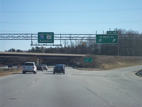
As you can see I-74 is shown on the overhead. There is not a 'BEGIN' I-74 shield - so I-74 East just comes out from out of nowhere.
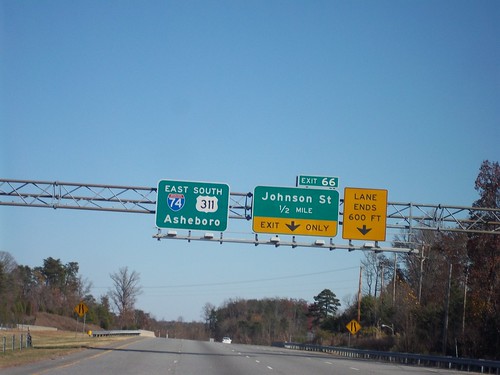
The I-74 East shield is also on an overhead at the next exit for Johnson St.
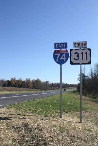
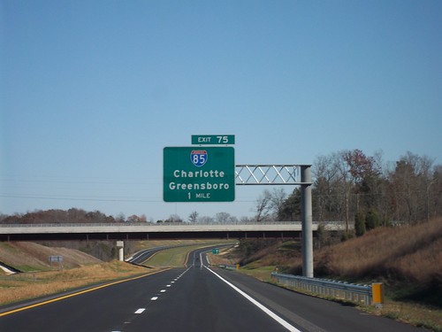
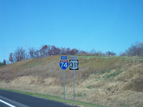
However, at this time there are not any I-74 shields on the ground or at the interchange ramps until Exit 71B - Business I-85. If you are headed Eastbound, the first I-74 East shield stands after the I-85 interchange (Exit 75).
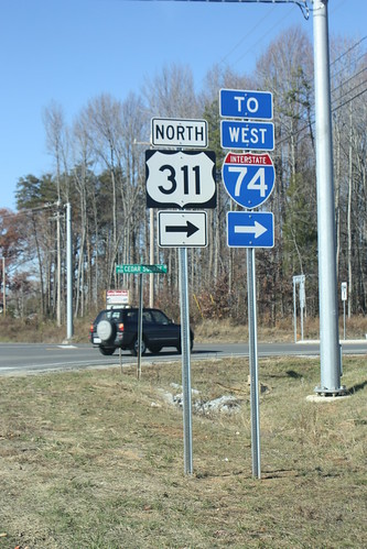
At Cedar Square Road, one of I-74 East's four 'END' signs in North Carolina appear.
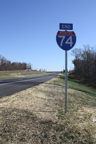
The other 'END' signs are located at the end of the I-74 segment in Mount Airy, this shield, one with I-73 South in Candor, and just east of NC 41 in Robeson County. This doesn't count the 'END' Future 73/74 Corridor at US 1 and US 74 in Rockingham or for Future I-74 in Ellerbe.
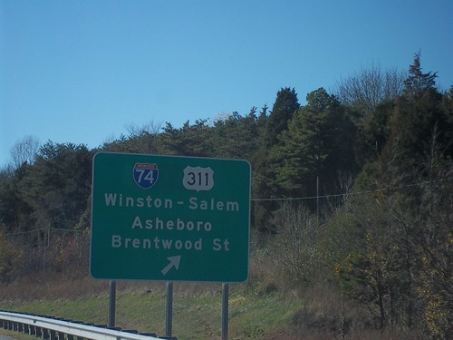
The new, albeit temporary, routing for US 311 is well signed at Cedar Square Road.
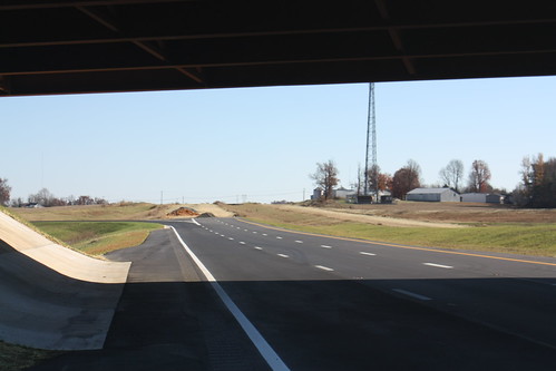
This is a look from the end of the freeway, as Bob reports, this won't be done until 2012.
As soon as you get on the freeway, you're greeted by this.
The newly opened road is rather quiet from Cedar Square Road to I-85. And I must admit, fresh asphalt on a clear blue sky day looks pretty good.
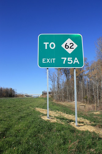
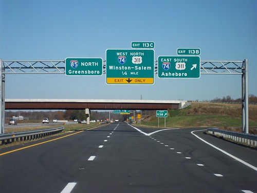
Though you can't access NC 62 from I-74/US 311 you can via I-85 South (more on that later).
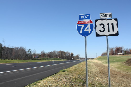
A narrow US 311 shield is posted just west of the I-85 interchange.
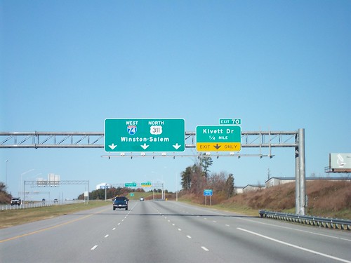
The overheads on westbound I-74 at Kivett Drive is the last mention of I-74 through Main St. - Exit 65.
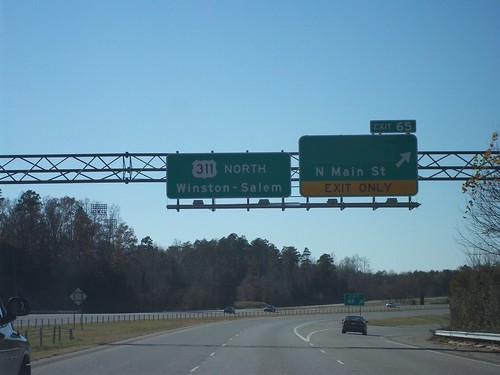
At Main St., it's just plain old US 311 North.
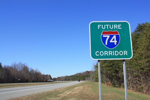
Immediately after the Main St. Interchange - a Future I-74 Corridor sign is posted.
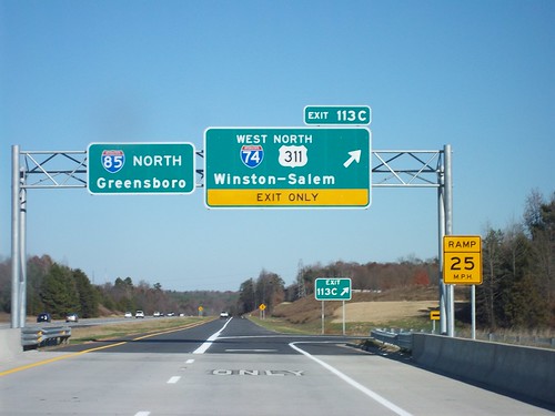
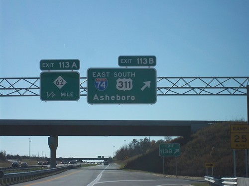
I-74 is signed at Business 85.
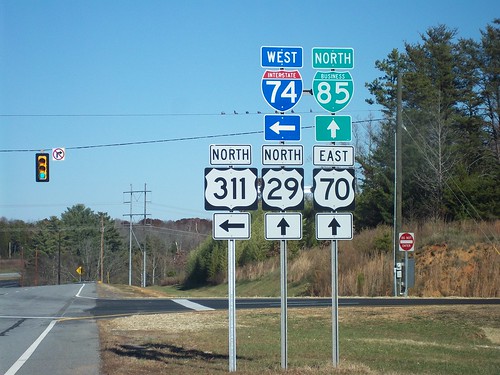
Here are some of the signs for I-74 & US 311 on I-85.
From there, it was a leisurely drive back to Knightdale, with most of my photo time spend in Randolph County.
Route: NC 98, US 70, I-85, I-40, NC 66, US 311/I-74, NC 62, NC 22, NC 902, Pittsboro-Moncure Rd., US 1, I-40, I-440, US 64/264 home.
The entire roadtrip is on flickr - 93 photos in total - and can be accessed here.
The newest segment of Interstate 74 begins at the Main Street Interchange (Exit 65). This was where Business US 311 split off into downtown High Point, but it's been recently decommissioned.
As you can see I-74 is shown on the overhead. There is not a 'BEGIN' I-74 shield - so I-74 East just comes out from out of nowhere.
The I-74 East shield is also on an overhead at the next exit for Johnson St.
However, at this time there are not any I-74 shields on the ground or at the interchange ramps until Exit 71B - Business I-85. If you are headed Eastbound, the first I-74 East shield stands after the I-85 interchange (Exit 75).
At Cedar Square Road, one of I-74 East's four 'END' signs in North Carolina appear.
The other 'END' signs are located at the end of the I-74 segment in Mount Airy, this shield, one with I-73 South in Candor, and just east of NC 41 in Robeson County. This doesn't count the 'END' Future 73/74 Corridor at US 1 and US 74 in Rockingham or for Future I-74 in Ellerbe.
The new, albeit temporary, routing for US 311 is well signed at Cedar Square Road.
This is a look from the end of the freeway, as Bob reports, this won't be done until 2012.
As soon as you get on the freeway, you're greeted by this.
The newly opened road is rather quiet from Cedar Square Road to I-85. And I must admit, fresh asphalt on a clear blue sky day looks pretty good.
Though you can't access NC 62 from I-74/US 311 you can via I-85 South (more on that later).
A narrow US 311 shield is posted just west of the I-85 interchange.
The overheads on westbound I-74 at Kivett Drive is the last mention of I-74 through Main St. - Exit 65.
At Main St., it's just plain old US 311 North.
Immediately after the Main St. Interchange - a Future I-74 Corridor sign is posted.
I-74 is signed at Business 85.
Here are some of the signs for I-74 & US 311 on I-85.
From there, it was a leisurely drive back to Knightdale, with most of my photo time spend in Randolph County.
Comments