
On Christmas Eve, I traditionally take a brief four or five hour loop trip to an area of Southwestern PA I haven't been to before. This Christmas Eve was no different as I headed east into the Laurel Highlands.
Route: PA 48, PA 51, I-70, PA 31, US 119, PA 982, US 22, PA 217, US 30, PA 711, PA 31, PA Tpk, I-70, PA 51, and PA 48.
The entire photo set on flickr is here.
When I got on PA 982 North, I immediately came upon this sign.
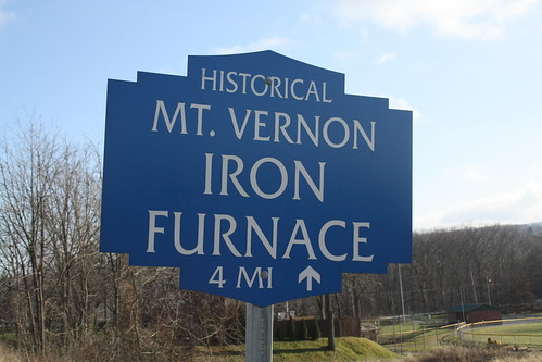
Obviously, I was curious about the Iron Furnace (more on that later); however, the sign style intrigued me. The sign's font, besides being the same font from Law & Order, is what is used for the destination signs throughout the Laurel Highlands. These signs come from the Laurel Highlands Visitor Bureau. The style is slightly similar to the Keystone Town Markers we all know and love, but aren't exact.
So I did travel the four or so miles up PA 982 and then took a quick right turn onto Oremine Hill Road and came to the Mount Vernon Iron Furnace.
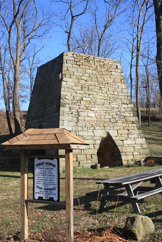
Amazingly, this stone furnace has been standing here since the early 1800s! It was first built my Isaac Mason in 1798 and operated until 1830. It is amazing that something over 200 years old and exposed to the elements like this furnace is pretty good condition.
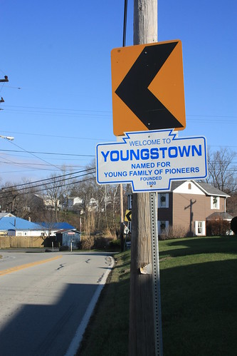
Further north on PA 982 is the town of Youngstown. The town recently had a replica Keystone Town Marker made - but it's nowhere near as nice as the originals.
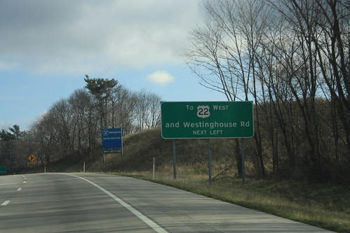
The brief amount of time I was on US 22 between PA 982 and PA 217 in Blairsville. I noticed that there were a lot of jughandle turnaroundd on this recently rebuilt section. Many of the jughandles also had guide signs for advance warning. Like the one shown below.
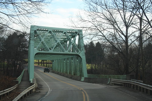
At Blairsville, I exited US 22 to head south on PA 217. However, I did briefly stop in Blairsville, and I am glad I did. First, US 22 had ran through downtown Blairsville until the 1950s when US 22 was moved to the north on a new bypass. US 22 ran through downtown Blairsville on Market Street. But to get to Blairsville from Westmoreland County you had to cross the Conemaugh River over this bridge.
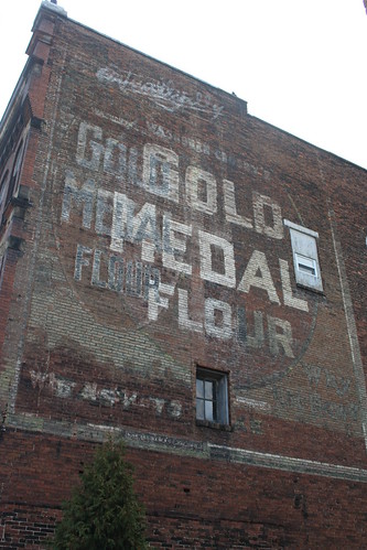
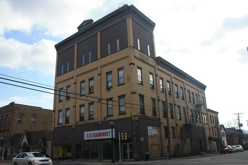
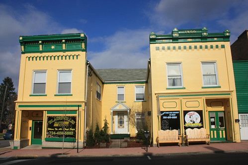
I stopped and did a quick photowalk through Blairsville, and it didn't disappoint.
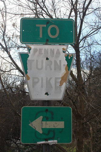
From there, it was a rather uneventful drive down PA 217 to US 30 and then PA 711. However, I did find one decent road item in Donegal. A Pennsylvania Turnpike cutout that has seen better days.
From there it was onto the Turnpike and back to my parent's home to watch the football game and begin the Christmas celebrations. Overall, this was a nice little trip, I do think that the scenery would be enhanced if there was some snowfall, but I did pick up some new mileage on PA 982, 217 and 711, so I can't complain. Happy New Year Everyone!
Route: PA 48, PA 51, I-70, PA 31, US 119, PA 982, US 22, PA 217, US 30, PA 711, PA 31, PA Tpk, I-70, PA 51, and PA 48.
The entire photo set on flickr is here.
When I got on PA 982 North, I immediately came upon this sign.
Obviously, I was curious about the Iron Furnace (more on that later); however, the sign style intrigued me. The sign's font, besides being the same font from Law & Order, is what is used for the destination signs throughout the Laurel Highlands. These signs come from the Laurel Highlands Visitor Bureau. The style is slightly similar to the Keystone Town Markers we all know and love, but aren't exact.
So I did travel the four or so miles up PA 982 and then took a quick right turn onto Oremine Hill Road and came to the Mount Vernon Iron Furnace.
Amazingly, this stone furnace has been standing here since the early 1800s! It was first built my Isaac Mason in 1798 and operated until 1830. It is amazing that something over 200 years old and exposed to the elements like this furnace is pretty good condition.
Further north on PA 982 is the town of Youngstown. The town recently had a replica Keystone Town Marker made - but it's nowhere near as nice as the originals.
The brief amount of time I was on US 22 between PA 982 and PA 217 in Blairsville. I noticed that there were a lot of jughandle turnaroundd on this recently rebuilt section. Many of the jughandles also had guide signs for advance warning. Like the one shown below.
At Blairsville, I exited US 22 to head south on PA 217. However, I did briefly stop in Blairsville, and I am glad I did. First, US 22 had ran through downtown Blairsville until the 1950s when US 22 was moved to the north on a new bypass. US 22 ran through downtown Blairsville on Market Street. But to get to Blairsville from Westmoreland County you had to cross the Conemaugh River over this bridge.
I stopped and did a quick photowalk through Blairsville, and it didn't disappoint.
From there, it was a rather uneventful drive down PA 217 to US 30 and then PA 711. However, I did find one decent road item in Donegal. A Pennsylvania Turnpike cutout that has seen better days.
From there it was onto the Turnpike and back to my parent's home to watch the football game and begin the Christmas celebrations. Overall, this was a nice little trip, I do think that the scenery would be enhanced if there was some snowfall, but I did pick up some new mileage on PA 982, 217 and 711, so I can't complain. Happy New Year Everyone!
Comments