
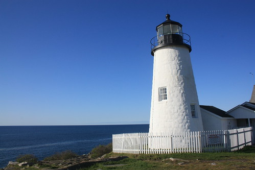
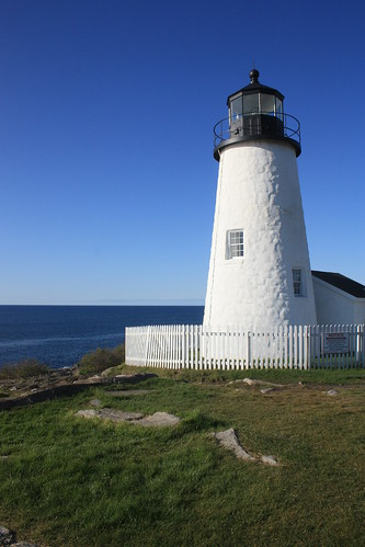
Perhaps my favorite spot in all of Maine is Pemaquid Point and the lighthouse there. I first visited the lighthouse in the fall of 2003 and fell in love with surroundings. The deepest blue water I had ever seen - a cloudless autumn sky - rocky cliffs that you could climb and the reflection of the lighthouse in tidal pools are some of the items I remember from here.
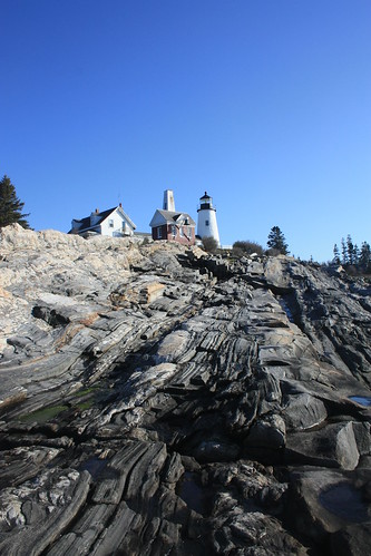
I returned to Pemaquid Point early on a Sunday Morning. The fog and overcast from the past two days finally behind us. A cloudless sky again was the backdrop. The deep blue water was just as vivid if not more. The rocky cliffs were just as I recalled, and this time I got to explore more.
A lighthouse has stood at Pemaquid Point since 1827, and the current light has watched over the rocky cliffs since 1835. The lighthouse was also featured on the back of the Maine State Quarter - minted in 2003.
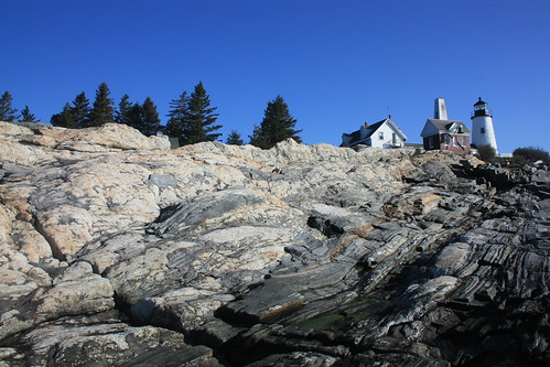
This was Joe and Doug's first visit to Pemaquid Point and they certainly enjoyed walking around the ground and getting the photos. We had the entire grounds to ourselves and were able to work our way up and down the rocks for some great photos. For my entire set on flickr, head here.
I really could spend almost all day here. It's a location that the images, sounds, and smells you don't forget and stay with you forever. Fortunately, I was able to make that return visit this year, and I anxiously await the chance to see it again.
I returned to Pemaquid Point early on a Sunday Morning. The fog and overcast from the past two days finally behind us. A cloudless sky again was the backdrop. The deep blue water was just as vivid if not more. The rocky cliffs were just as I recalled, and this time I got to explore more.
A lighthouse has stood at Pemaquid Point since 1827, and the current light has watched over the rocky cliffs since 1835. The lighthouse was also featured on the back of the Maine State Quarter - minted in 2003.
This was Joe and Doug's first visit to Pemaquid Point and they certainly enjoyed walking around the ground and getting the photos. We had the entire grounds to ourselves and were able to work our way up and down the rocks for some great photos. For my entire set on flickr, head here.
I really could spend almost all day here. It's a location that the images, sounds, and smells you don't forget and stay with you forever. Fortunately, I was able to make that return visit this year, and I anxiously await the chance to see it again.
Comments