
Tour of the now opened Phase II of the Triangle Expressway

VMS announcing hey the road just opened today...you'll be tolled tomorrow

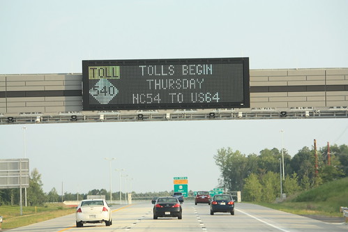
The second phase of the Triangle Expressway from NC 55 near Apex southwards to US 64 opened on August 1st.  It was the only free day for the new highway as tolls on the new highway would go into effect the following day Thursday, August 2nd.  So we had an impromptu Triangle Road Meet and six of us met up at Trali in Brier Creek to check out the new road.  Not bad for 48 hour notice!

126

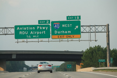
We had a small surprise when we got to I-40.  First Lady Michelle Obama was in town and we just caught her motorcade getting onto I-540 East headed back to RDU.   Here's the temporary roadblock at the ramp from 540 East to 40 East.

127

So now lets get back to touring Phase II of the Triangle Expressway.

Toll NC 540 begins in a half mile

Last Exit before toll and by the way Tolls begin tomorrow.

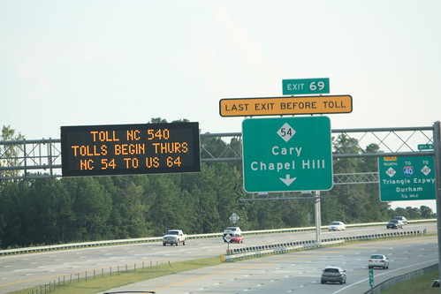
Some of the signs on the now truncated NC 540 (Free) approaching the NC 54 interchange.  This is the only free interchange south of I-40.  If you look closely enough at the bottom of the second photo, you will seen an 'END' sign for the free portion of NC 540.

135

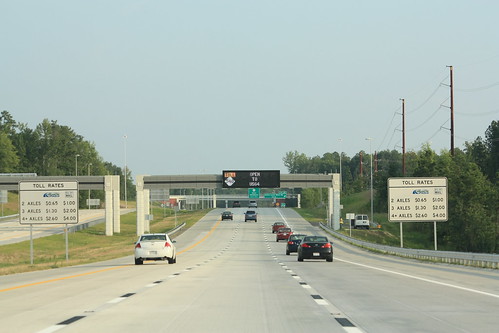
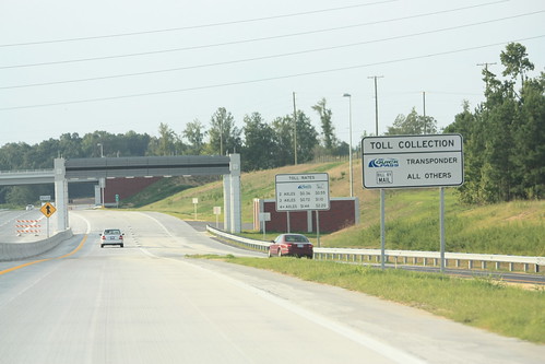
The overhead toll gantries at the NC 540 and NC 147 tolled interchange.  They now work.

NC 540 Toll South approaching NC 55

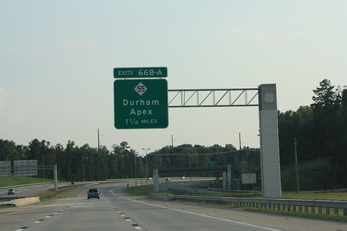
Overhead for NC 55 with the decorative style all sign posts have along the Triangle Expressway.

139

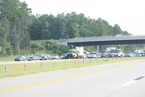
And here we are on the newly opened road.  People are taking advantage of the only 'free' day on the new highway.

141

These pedestal sign gantries are getting more popular in North Carolina.

143

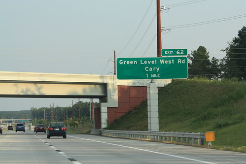
The next overhead toll gantry just prior to the Green Level West Road interchange on NC Toll 540 South.

150

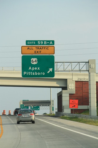
It's a quick drive to the new south end of the highway at US 64 in Apex.

156

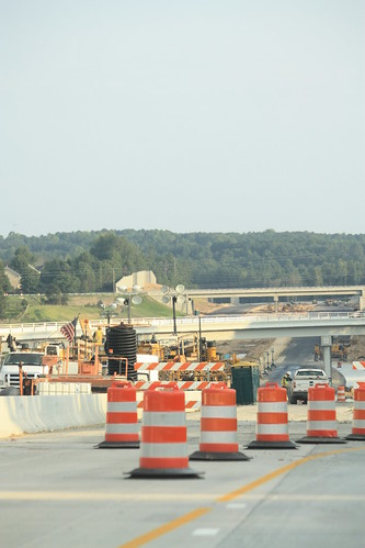
Looking Southbound at the current construction that will extend the highway to NC 55 in Holly Springs.  This next segment should be open in January 2013.

158

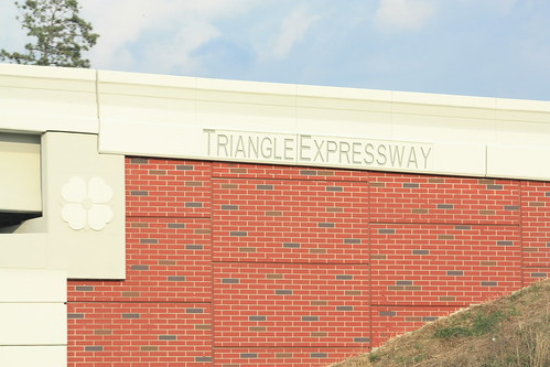
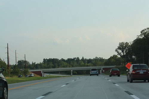
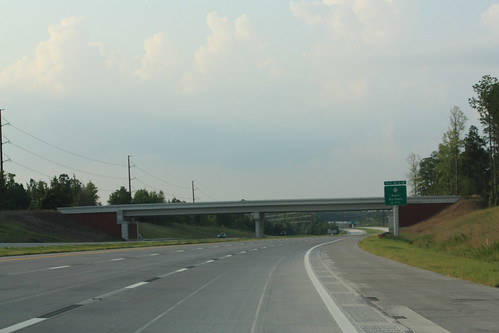
Close-up of the more decorative style for bridges and overpasses along the TriEx.

159

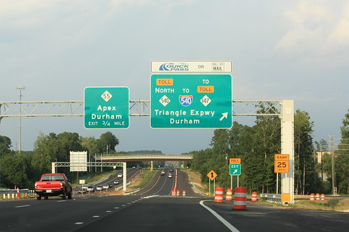
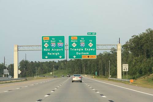
Overheads on US 64 East to go onto NC 540 North.  Surprisingly, there aren't any exit numbers based on US 64 mileage here.

162

Getting back on to the TriEx at US 64 - a on-ramp overhead toll gantry greets you.

167

Morrisville Parkway isn't ready for traffic just yet

Just north of the Green Level West Road interchange is a ghost bridge for Morrisville Parkway.  The NCTA built the bridge for whenever Morrisville Parkway will be extended.  There is no current date for filling in the nearly two mile gap of Morrisville Parkway between NC 55 and Green Level Church Road.  There also are plans to build an interchange with the TriEx at Morrisville Parkway in the future.  However, no grading for a future interchange was apparent.

Overheads approaching Exit 67

Now back on what was once Free NC 540 and now Toll NC 540 approaching the interchange with NC Toll 147. 

TOLL NC 540 ENDS - FREE NC 540 BEGINS

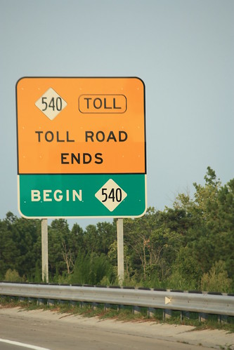
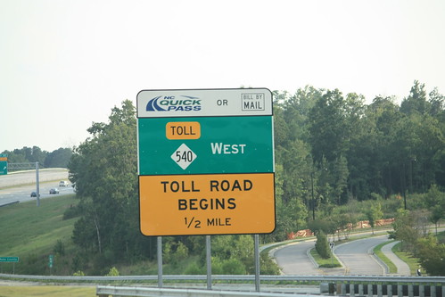
Finally, just prior to the NC 54 interchange this guide sign informs drivers of the end of the tolled section of NC 540 and the beginning of the free section of NC 540. 

Start of I-540 East - Exits 1B and 2

NC 540 doesn't last long for about a mile later is Interstate 40 and NC 540 becomes Interstate 540.  Lots of different '540's I know.  For my entire set on flickr, head here.

Comments

Popular posts from this blog

Bleriot Ferry - Alberta

  Alberta operates six ferries scattered throughout the province. Roughly twenty to twenty-five kilometers up the Red Deer River from the town of Drumheller is one of the most scenic ferry crossings in all of Wild Rose Country, the Bleriot Ferry. Using the North Dinosaur Trail (Alberta Highway 838, or AB 838), the Bleriot Ferry provides a scenic river cruise of sorts in the Canadian Badlands. The Bleriot Ferry started operating in 1913 as the Munson Ferry when a few bridges crossed the Red Deer River. The ferry was started by Andre Bleriot, the brother of famed early aviator Louis Bleriot, who became famous for being the first person to fly over the English Channel. At the time, the Alberta provincial government commissioned local residents to run the ferries. There were several ferries along the Red Deer River, and not only did they serve as vital transportation links, but they also served as local social hubs, since everyone had to take the ferries to go places. Over time, as the...

The Pollasky Bridge

The Pollasky Bridge near modern day Friant is a ruined highway bridge which was completed during early 1906 as part of the Fresno-Fresno Flats Road.  The structure is one of the oldest known arch concrete spans to have been constructed in California.  The bridge briefly carried California State Route 41 following the destruction of the Lanes Bridge in 1940.  The Pollasky Bridge itself was destroyed by flooding during 1951, but the ruins can still be found on the Madera County side of the San Joaquin River.   Pictured as the blog cover is the Pollasky Bridge as it was featured in the 1913 book "The Concrete Bridge."  The structure can be seen crossing the San Joaquin River near Friant below on the 1922 United States Geological Survey Map.   Part 1; the history of the Pollasky Bridge The Pollasky Bridge site is near modern day Friant of Fresno County.  The community of Friant was established as Converse Ferry during 1852 on the San Joaquin Rive...

I-73/I-74 and NC Future Interstates Year in Review 2024

Welcome to another annual review of progress in constructing North Carolina's New and Future Interstate routes. While 2024 was not too exciting, with no new segments of major routes opening, there was 1 new interstate signing, another proposed new interstate route, and the near opening of a new segment for 2 routes. As tradition, I will start off with a review of what happened with I-73 and I-74 and then move on to the major news of the year about the other new and future routes. Work continued on the I-73/I-74 Rockingham Bypass through the year. The last few months have been hoping for news of its opening before 2025, without luck. Signs of its near completion included the placement of new signs, many with interstate shields uncovered, along the Bypass and intersecting roadways. For example, these went up along US 74 East: Overhead signage at Business 74 exit which contains the future ramp to I-73 North/I-74 West. Signage was also updated heading west on US 74 approaching the unop...