
Over Thanksgiving, Maggie and I spent time on the Eastern Shore of Virginia. The day before Thanksgiving, while much of the country was traveling - and stuck in traffic - on Interstates, we took an afternoon day trip to Assateague Island National Seashore.
Neither of us had been to this park, and to be honest we didn't know what to expect. We had read about the wild horses that roam the island, and knew that the Maryland side of the island was going to be built as a housing/beach resort type development in the early 1960s until a Nor'Easter tore apart the island. So we set out to explore the park, walk the beach, and nothing else.
For the entire set on flickr, head here.
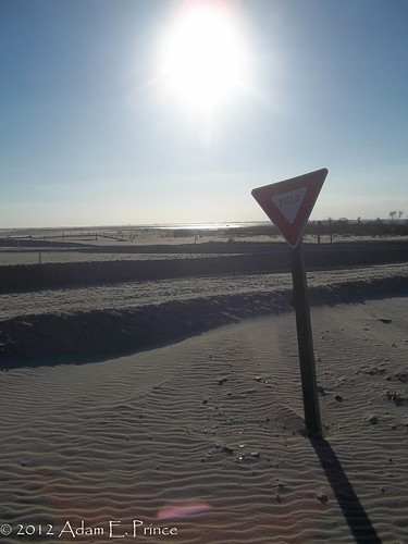
Speaking of storms, Hurrican Sandy did have a significant impact to the island and the park. Damage to the access road that leads to the Tom's Cove Visitors Center forced patrons to park about a 1/3 of a mile before the center and walk to the beach. It was a blustery day for a walk but the views of Tom's Cove were great to take in.
More impact from Sandy could be seen at what was once the parking area around the Visitors Center.
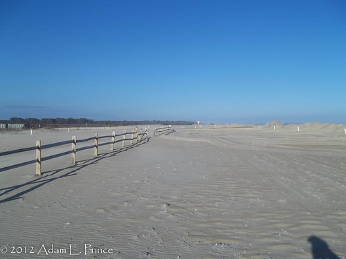
There used to be a road here.
Assateague Island continue to grow. The hook that has created Tom's Cove didn't take shape until the 1960's and it is quite possible that sand deposits will enclose Tom's Cove in the future.
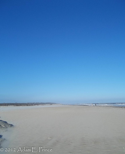
Amazingly, the photo above as all ocean just 50 or so years ago!
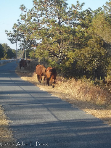
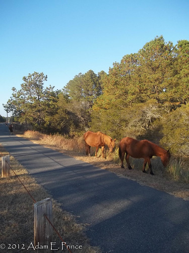
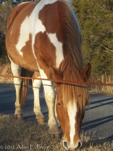
As I mentioned earlier, the wild horses that roam Assateague Island is one of the bigger attractions for the park. The Park Ranger at the Visitor Center mentioned that prior to Sandy that they evacuated the horses to a higher end of the island. After the storm park rangers had investigated their normal feeding and range areas along the Woodland Trail on the Virginia side and it was heavily flooded. Most of the horses remained in the higher ground area; however, a pack of six horses had "broken away" and were freely roaming sections of the park. On our way out from Tom's Cove - we were fortunate enough to encounter the group of six horses grazing along a walking trail.
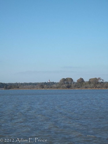
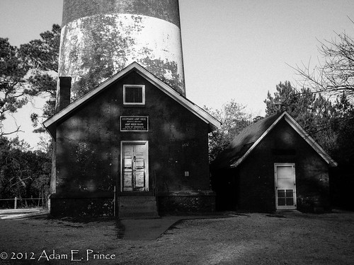
After spending time admiring the band of horses, we headed to the Assateague Lighthouse. There's a short 1/2 mile loop trail that leads to lighthouse and it easily accessible to all. The 142' red brick lighthouse was first lit in 1867 and automated in 1933.
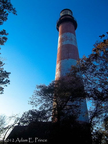
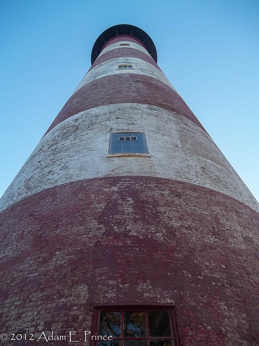
The lighthouse was last repainted in 1994, but somehow the weathering of the white paint gives this lighthouse more character.
Assateague Island National Seashore is a great destination for a daytrip if you are ever on the Eastern Shore of Virginia or any where on the DelMarVa Peninsula. We weren't able to explore the Maryland end of the park, but the next time we are in the area we plan on it.
Neither of us had been to this park, and to be honest we didn't know what to expect. We had read about the wild horses that roam the island, and knew that the Maryland side of the island was going to be built as a housing/beach resort type development in the early 1960s until a Nor'Easter tore apart the island. So we set out to explore the park, walk the beach, and nothing else.
For the entire set on flickr, head here.
Speaking of storms, Hurrican Sandy did have a significant impact to the island and the park. Damage to the access road that leads to the Tom's Cove Visitors Center forced patrons to park about a 1/3 of a mile before the center and walk to the beach. It was a blustery day for a walk but the views of Tom's Cove were great to take in.
More impact from Sandy could be seen at what was once the parking area around the Visitors Center.
There used to be a road here.
Assateague Island continue to grow. The hook that has created Tom's Cove didn't take shape until the 1960's and it is quite possible that sand deposits will enclose Tom's Cove in the future.
Amazingly, the photo above as all ocean just 50 or so years ago!
As I mentioned earlier, the wild horses that roam Assateague Island is one of the bigger attractions for the park. The Park Ranger at the Visitor Center mentioned that prior to Sandy that they evacuated the horses to a higher end of the island. After the storm park rangers had investigated their normal feeding and range areas along the Woodland Trail on the Virginia side and it was heavily flooded. Most of the horses remained in the higher ground area; however, a pack of six horses had "broken away" and were freely roaming sections of the park. On our way out from Tom's Cove - we were fortunate enough to encounter the group of six horses grazing along a walking trail.
After spending time admiring the band of horses, we headed to the Assateague Lighthouse. There's a short 1/2 mile loop trail that leads to lighthouse and it easily accessible to all. The 142' red brick lighthouse was first lit in 1867 and automated in 1933.
The lighthouse was last repainted in 1994, but somehow the weathering of the white paint gives this lighthouse more character.
Assateague Island National Seashore is a great destination for a daytrip if you are ever on the Eastern Shore of Virginia or any where on the DelMarVa Peninsula. We weren't able to explore the Maryland end of the park, but the next time we are in the area we plan on it.
Comments