
(Editor's Note: While there's some slow time in the few week's before
we have a new addition to the family, I'm trying to catch up on blog
entries that I wanted to post or started but never completed. This is
another one of those entries.)
We made it to Key West. A tropical paradise or party. Or both.
I've never been on a Caribbean Cruise or really anywhere tropical, and Key West really gave me first taste of the tropics, or at least to me it did. For the first day in Key West in photos, head to flickr.
Mile 0. The End of US 1. The end of the Overseas Highway. It's most likely is the most photographed road sign in the United States.
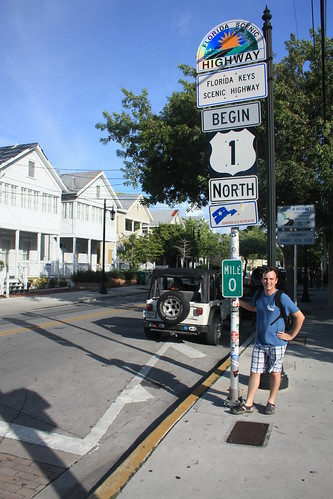
Yup, that's me. It's only 2,377 miles - and oh about 40 or so degrees Fahrenheit less to Fort Kent, ME. And that's a lot of signs for one post.

Yeah, there's an END sign too. Not as many signs though.
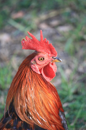
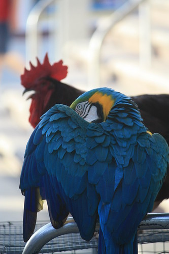
Not sure why, but there sure are a lot of roosters and chickens wandering around various parts of the island. The "gypsy chickens" are descendents of former cock-fighting Cubalya chickens and domesticated chickens that were kept by residents on the island. Just another thing that makes Key West unique.
Of course, no visit to Key West is complete without a walk down Duval Street - where everything and pretty much anything can be seen or done.
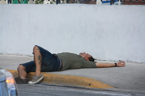
Including a passed out drunk tourist at 4:30 in the afternoon. Last call sure came early for this fella.
The preferred mode of transportation on Duval Street. Rental golf carts or golf cart taxi's. And as these ladies show, it doesn't stop you from having a good time. I'm not allowed to publish the pictures of what they did next. It is a family friendly blog of course!

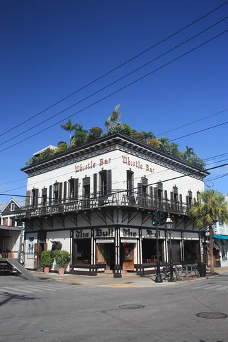
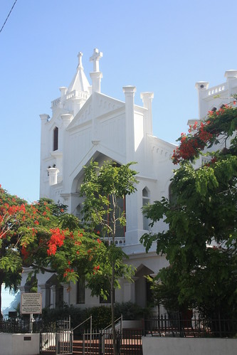
Key West has some great architecture.
And some colorful creatures:
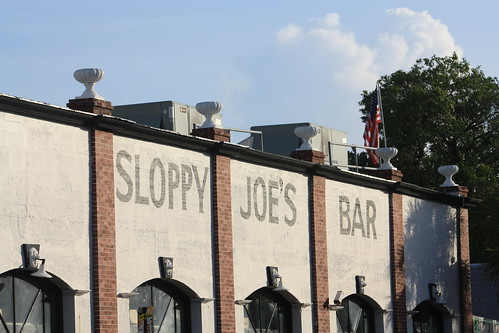
And of course there's Sloppy Joe's Bar. I think a guy named Hemingway liked to hang out here.
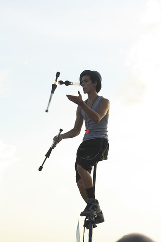
At Mallory Square, every evening there is a Sunset Celebration. Tourists that came by car, or plane, or just arrived via massive cruise ships docked nearby are enertained by this nightly carnival that features juggling acts, acrobatics, musicians, and numerous other types of street performers.

This guy was pretty good.
This man would be performing various gymnastics next.


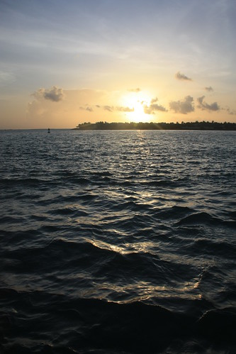
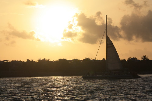
And the sunset...wasn't bad either. Even with Sunset Key in the way.
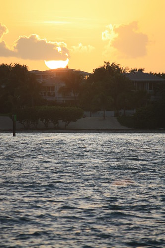
Day 2: Sunrise
This was a quick road trip, so unfortunately the next morning it was time to head back north to Raleigh via Daytona. But I managed to get up for sunrise and a swim in our hotel's outdoor pool before we left the Keys.
Sunrise Day 2 photos can be found here.


I wish we had another day to spend at Key West. It's an amazing place and there was a lot more I would like to have done. I would be fascinated by taking the trip - and even spending the money - to check out Dry Tortuga. But sometimes, the best thing is to get just a little taste of something or somewhere to make you want to go back and enjoy it even more. Key West is certainly one of those places for me.
We made it to Key West. A tropical paradise or party. Or both.
I've never been on a Caribbean Cruise or really anywhere tropical, and Key West really gave me first taste of the tropics, or at least to me it did. For the first day in Key West in photos, head to flickr.
Mile 0. The End of US 1. The end of the Overseas Highway. It's most likely is the most photographed road sign in the United States.
Yup, that's me. It's only 2,377 miles - and oh about 40 or so degrees Fahrenheit less to Fort Kent, ME. And that's a lot of signs for one post.
Yeah, there's an END sign too. Not as many signs though.
Not sure why, but there sure are a lot of roosters and chickens wandering around various parts of the island. The "gypsy chickens" are descendents of former cock-fighting Cubalya chickens and domesticated chickens that were kept by residents on the island. Just another thing that makes Key West unique.
Of course, no visit to Key West is complete without a walk down Duval Street - where everything and pretty much anything can be seen or done.
Including a passed out drunk tourist at 4:30 in the afternoon. Last call sure came early for this fella.
The preferred mode of transportation on Duval Street. Rental golf carts or golf cart taxi's. And as these ladies show, it doesn't stop you from having a good time. I'm not allowed to publish the pictures of what they did next. It is a family friendly blog of course!
Key West has some great architecture.
And some colorful creatures:
And of course there's Sloppy Joe's Bar. I think a guy named Hemingway liked to hang out here.
At Mallory Square, every evening there is a Sunset Celebration. Tourists that came by car, or plane, or just arrived via massive cruise ships docked nearby are enertained by this nightly carnival that features juggling acts, acrobatics, musicians, and numerous other types of street performers.
This guy was pretty good.
This man would be performing various gymnastics next.
And the sunset...wasn't bad either. Even with Sunset Key in the way.
Day 2: Sunrise
This was a quick road trip, so unfortunately the next morning it was time to head back north to Raleigh via Daytona. But I managed to get up for sunrise and a swim in our hotel's outdoor pool before we left the Keys.
Sunrise Day 2 photos can be found here.
I wish we had another day to spend at Key West. It's an amazing place and there was a lot more I would like to have done. I would be fascinated by taking the trip - and even spending the money - to check out Dry Tortuga. But sometimes, the best thing is to get just a little taste of something or somewhere to make you want to go back and enjoy it even more. Key West is certainly one of those places for me.

Comments