For decades, two massive
steel cantilever bridges connecting Charleston and Mount Pleasant, SC rose over the Cooper River, Drum Island, and Town
Creek. The Grace Memorial, opened in 1929, and the Pearman Memorial,
opened in 1966, were part of the fabric of Charleston until the last day
they carried traffic on July 16, 2005. Since that day, the new Ravenel Bridge - a
massive cable stayed span - carries the tradition of the two that came
before it.
The Grace Memorial Bridge was the first to
span the Cooper River. Built at a cost of $6 million, construction
began on the 2.71 mile bridge in March 1928. Seventeen months later,
the bridge opened - in grand celebration - to traffic on August 8, 1929.
(1) The force behind the construction of the then named Cooper River
Bridge was John P. Grace, a former Charleston mayor who led the Cooper
River Bridge Company. Because of his efforts, years later the Cooper
River Bridge would be renamed in his honor. The Grace originally
was operated as a toll bridge until the South Carolina purchased the bridge
in 1945 and removed the tolls one year later. (2)
Early in 1946 on February 24, a family tragedy
would haunt the bridge. That afternoon a freighter, the Nicaragua
Victory, would plow through the bridge on the Mount Pleasant side causing
240 feet of the bridge deck and roadway to collapse. An Oldsmobile
carrying Bill Lawson, his wife, mother, and their two young children died when
the car fell into the river. The vehicle was recovered one month
later with all five bodies still inside. (3)
A ghostly legend from this tragedy was that when the Grace Memorial Bridge was still standing, a green late model Oldsmobile with five occupants would occasionally be reported to be seen on the bridge. This vehicle would strangely start and stop and one eyewitness account claimed that a man and wife were in the front seat with two children and an older woman were in the back - the same configuration of the Lawson family that fateful day. The five individuals seen were described as lifeless and looking straight ahead. (4) The green vehicle would then disappear where the collapsed section of bridge occurred. These sightings were found to most frequently occur in February - the month of the 1946 Lawson tragedy. After the Grace was torn down, the sightings of the Lawson family's car trying to make their journey home ended. (4)
Damage, emergency repairs, and higher traffic
volumes would create the need for a second span. The Pearman
Memorial - dedicated after former highway commissioner Silas N. Pearman
- would open on April 26, 1966 after nearly three years of construction.
(1) The new span would be a wider and more modern structure.
It would carry three lanes of northbound traffic over the Cooper, with
one of the lanes being reversible to handle southbound traffic.
In 1979, an eight ton weight limit would be
placed on the aging Grace Memorial. Years later, because of the weight
limit, narrow ten foot lanes without shoulders, steep grades, and deteriorating
condition of the bridge, the Grace would be declared structurally obsolete.
The weight limit would later be reduced to five tons and the third lane
of the Pearman Memorial would be permanently reversed to handle commercial
traffic heading south into Charleston.
With these problems - along with low shipping
clearances blocking modern freighters access to the Port of Charleston
- the need for a replacement structure increasingly grew. For two
decades, the state and the cities of Charleston and Mount Pleasant would
battle over funding and design of the bridge. Finally in the mid-1990s,
Arthur Ravenel spearheaded a campaign that resulted in the combination
of federal, state and Charleston County funding to build the $632 million
bridge. (5)

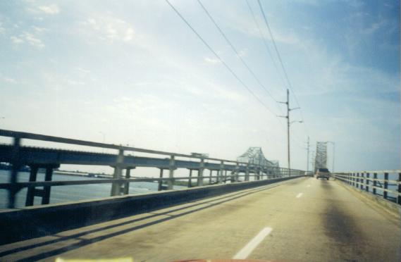
The Ravenel Bridge is colossal cable stayed
system, whose main span stretches for 1,546 feet. The entire bridge
system runs for 3.5 miles. The two diamond shaped cable towers rise
a total of 575 feet above the water and can be seen as far as Summerville.
(6) The bridge deck ascends 186 feet over the Cooper River
allowing clearance for the most modern of ocean freighters to access the
Port of Charleston. The bridge carries eight 12' lanes of traffic,
in addition to 4' outside and inside shoulders. There is also a 12
foot wide pedestrian and bicycle lane on the south side of the bridge.
The glorious Ravenel opened to a week's long
fanfare and celebration in July of 2005. The bridge, which has become
a symbol of pride to the City of Charleston, officially opened to traffic
on July 16, 2005.
There are many great vantage points of the Ravenel Bridge. Two of the best spots are from Patriots Point, which is home to the USS Yorktown and sits south of the bridge off of SC 703. The other is the Mount Pleasant Memorial Waterfront Park which offers some unique views of the bridge from up close.
The panoramic view of the Ravenel from Patriots Point is one of the more popular photography spots of the bridge and of Charleston. Whether it is from the USS Yorktown or from one of the many harbor cruise ships that launch here, the bridge makes its presence known.
Mount Pleasant's Memorial Waterfront Park offers a different perspective of the bridge along with numerous activities. Memorial Waterfront Park offers open space, playgrounds, an arts pavilion for local craftsmen to showcase and sell their work, a war memorial for all local veterans, and a 1,250 foot fishing pier that was built on top of the pilings of the former Pearman Bridge.
The Ravenel Bridge is also the centerpiece of the annual
Cooper River Bridge Run. The 10 kilometer race runs from Mount Pleasant over the bridge and then into Downtown Charleston. Held annually since 1978, the event brings over 40,000 visitors to Charleston just to run the race.
All photos taken by blog author - October 2000, October & November 2011.
Sources & Links:


Comments