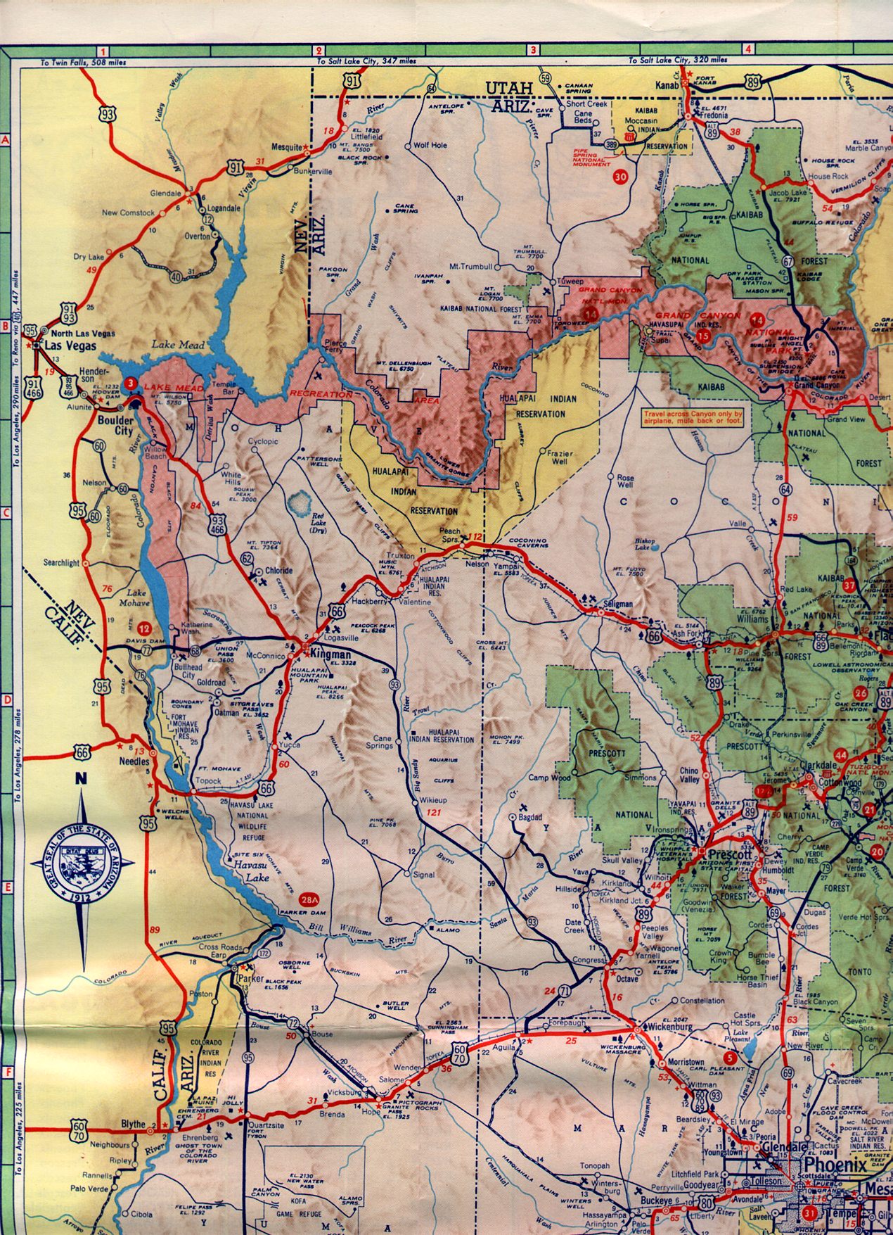
After returning from Old St. Thomas Road I continued north out of the Lake Mead National Recreation Area onto Nevada State Route 169. I next took NV 169 northward on Moopa Valley Boulevard to Interstate 15. My next destination was in Snow Canyon which meant the most direct route through the Virgin River Gorge on I-15.

Part 8 of the 2016 Fall Mountain Trip Series can be found here:
2016 Fall Mountain Trip; Former Nevada State Route 12 on Old St. Thomas Road
NV 169 ends at I-15 exit 93 where I turned north towards Arizona.

On a recent winter trip this year I covered the history of I-15 in Arizona/Virgin River Gorge and how it differs from US Route 91. The previous blog on the Virgin River Gorge section of I-15 can be found here:
2018 Mojave Desert Road Trip Part 5; Interstate 15 in Arizona
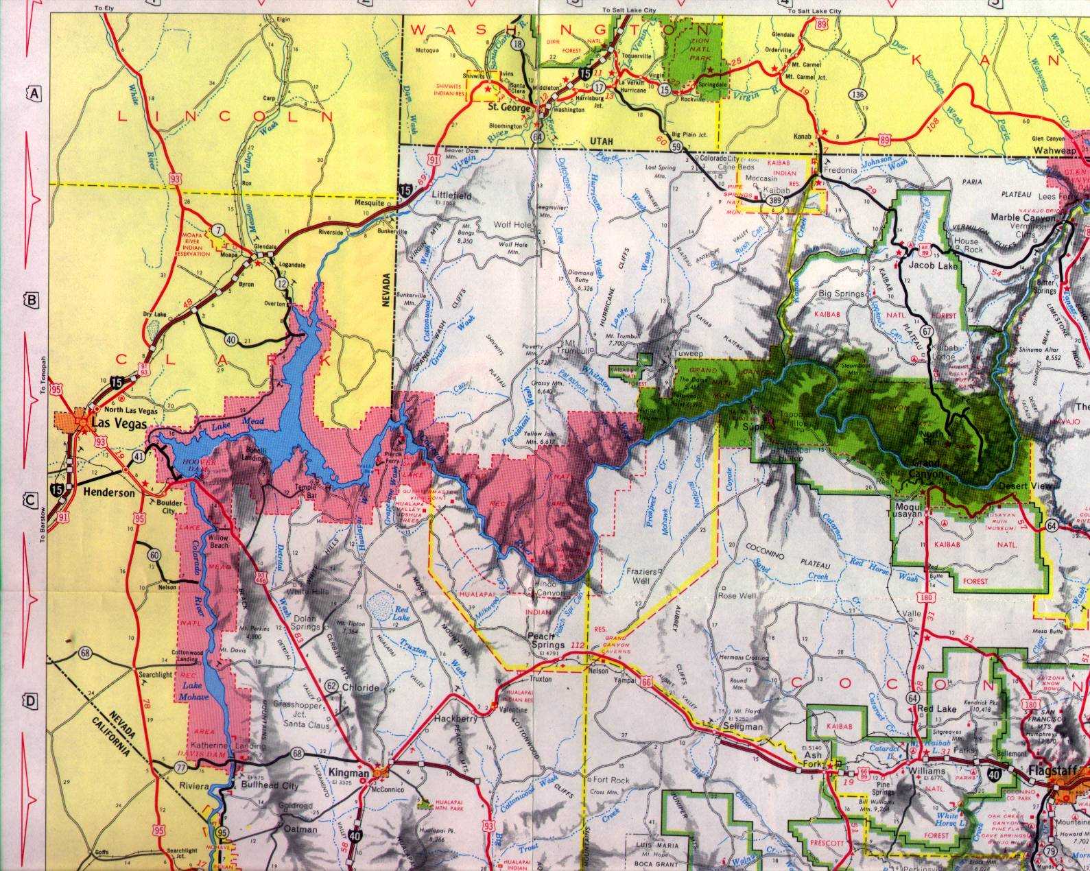
On the previous I-15/Virgin River Gorge blog I noted the following about history of the Interstate in Arizona:
"Unlike US Route 91 which dipped into Utah upstream on the Virgin River the routing of I-15 was constructed through the Virgin River Gorge to save approximately 12 miles. Despite the canyon depths the Virgin River Gorge was found to have more shallow grades than the alignment of US 91. I-15 was under construction in Arizona from the early 1960s until it was completed in 1973. The northwest corner of the Arizona state highway maps in 1961 and 1971 show the progression from US 91 to an almost complete I-15.
1961 Arizona State Highway Map
1971 Arizona State Highway Map
The 2016 Arizona Department of Transportation web map book shows how different the route of I-15 is compared to US 91.
2016 ADOT Map Book"
Ironically my previous blog on the Virgin River Gorge was from I-15 southbound. In 2016 I was headed the opposite way on northbound I-15 which is every bit as scenic.


Part 8 of the 2016 Fall Mountain Trip Series can be found here:
2016 Fall Mountain Trip; Former Nevada State Route 12 on Old St. Thomas Road
NV 169 ends at I-15 exit 93 where I turned north towards Arizona.

On a recent winter trip this year I covered the history of I-15 in Arizona/Virgin River Gorge and how it differs from US Route 91. The previous blog on the Virgin River Gorge section of I-15 can be found here:
2018 Mojave Desert Road Trip Part 5; Interstate 15 in Arizona
On the previous I-15/Virgin River Gorge blog I noted the following about history of the Interstate in Arizona:
"Unlike US Route 91 which dipped into Utah upstream on the Virgin River the routing of I-15 was constructed through the Virgin River Gorge to save approximately 12 miles. Despite the canyon depths the Virgin River Gorge was found to have more shallow grades than the alignment of US 91. I-15 was under construction in Arizona from the early 1960s until it was completed in 1973. The northwest corner of the Arizona state highway maps in 1961 and 1971 show the progression from US 91 to an almost complete I-15.
1961 Arizona State Highway Map
1971 Arizona State Highway Map
The 2016 Arizona Department of Transportation web map book shows how different the route of I-15 is compared to US 91.
2016 ADOT Map Book"
Ironically my previous blog on the Virgin River Gorge was from I-15 southbound. In 2016 I was headed the opposite way on northbound I-15 which is every bit as scenic.


Upon entering Washington County, Utah I pulled off of I-15 onto Utah State Route 18 on Bluff Street in St. George.

Given my next destination was at Snow Canyon State Park I followed UT 18 northward to UT 8 on Sunset Boulevard.

Part 10 of this blog series can be found here:
Comments