Recently I visited the location of the 1889 Lanes Bridge along what was California State Route 41 north of the Fresno City limits on the San Joaquin River.

Previously I touched on former alignments of CA 41 in the Fresno Area which can be found on the following three blogs:
1941 Lanes Bridge Renovations (Old CA 41)
Old CA 41 in Southern Fresno County and the Expressway that never was
Old CA 180 and CA 41 surface alignments in Fresno
As stated in the 1941 Lanes Bridge blog the original crossing of the San Joaquin River was the 1889 Lanes Bridge. The original Lanes Bridge was located about a mile up river north of the 1941 bridge roughly where Lanes Road ends today at the San Joaquin River. The original Lanes Bridge was first called the Yosemite Bridge but soon became known as the Lanes Bridge due Lanes Station which was a general store in close proximity which opened in 1894. In 1917 the original Lanes Bridge had a partial collapse but was quickly repaired. By 1934 the original Lanes Bridge had become part of CA 41 but was considered obsolete even for the standards of the time. The original 1934 alignment of CA 41 used modern Friant Road and Lanes Road to cross the San Joaquin River via the original Lanes Bridge. The original Lanes Bridge was heavily damaged in a 1937 flood along the San Joaquin River but was once again repaired. It wasn't until the summer of 1940 when an overloaded truck crashed through the road deck of that the use of the original Lanes Bridge ended. CA 41 traffic was temporarily rerouted to Friant over the 1906 North Fort Bridge until the 1941 Lanes Bridge was opened.
Fresnobeehive.com has a really good article about bridge crossings over the San Joaquin River. The article includes various photos of the original Lanes Bridge and the 1941 replacement.
Lanes Bridge Spanned Decades
The 1935 Division of Highways Map of Fresno County shows the location of the original Lanes Bridge at the San Joaquin River.

The original alignment of CA 41 was routed along what is now a long abandoned alignment of Abby Street in the River Park neighborhood of northern Fresno (near the annexed community of Pinedale). Abby Street once crossed over what is now the CA 41 freeway to Friant Road. CA 41 followed an older alignment of Friant Road which has been repurposed as part of the Lewis E. Eaton Trail along a ridge above the San Joaquin River northward to Rice Road. CA 41 followed Rice Road to Lanes Road which approached the 1889 Lanes Bridge on the south band of the San Joaquin River. The two maps below illustrate the differences in the alignment of CA 41 related to the 1889 Lanes Bridge, the temporary alignment through Friant and the 1941 Lanes Bridge. Note; the location of the 1889 Lanes Bridge is marked on the first map over the San Joaquin River.


Interestingly Abby Street nowadays barely resembles anything like a State Highway. Abby Street presently is open from traffic from Pinedale Avenue southward towards Beachwood Avenue. This photo below is of the northern end of Abby Street (one the left) at Pinedale Avenue.

Heading southward on Abby Street from Pinedale Avenue traffic can no longer directly cross Minarets Avenue.


Southbound Abby Street passes by Birch Avenue and Spruce Avenue before terminating at Beachwood Avenue. Abby Street terminates within sight of later CA 41 alignment Blackstone Avenue.


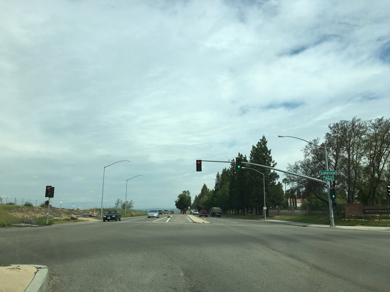
My drive to the location of the 1889 Lanes Bridge began from the modern alignment of Friant Road with a left hand turn onto Rice Road. My path followed the northbound alignment of what was CA 41.


Rice Road crosses under the Lewis E. Eaton Trail and picks up the original alignment of CA 41 descending the ridge line towards the San Joaquin River.


CA 41 would have split left towards the 1889 Lanes Bridge and Lanes Road whereas the temporary alignment through Friant continued to the right.


Lanes Drive currently bears little evidence of an early California State Highway aside from an old sportsmen club and barn approaching the San Joaquin River. It is hard to imagine traffic on northbound CA 41 heading towards the 1889 Lanes Bridge on Lanes Road.


Lanes Road dead-ends at a gate at the San Joaquin River. This would have been the southern approach to the 1889 Lanes Bridge. Sadly the location doesn't even have a historic marker denoting it was the location of an important highway crossing.

Turning back south from the 1889 Lanes Bridge location the ridge line above the San Joaquin River is very apparent. It is easy to see why CA 41 was routed on the higher terrain given the San Joaquin River was much more flood prone in the 1930s.


Previously I touched on former alignments of CA 41 in the Fresno Area which can be found on the following three blogs:
1941 Lanes Bridge Renovations (Old CA 41)
Old CA 41 in Southern Fresno County and the Expressway that never was
Old CA 180 and CA 41 surface alignments in Fresno
As stated in the 1941 Lanes Bridge blog the original crossing of the San Joaquin River was the 1889 Lanes Bridge. The original Lanes Bridge was located about a mile up river north of the 1941 bridge roughly where Lanes Road ends today at the San Joaquin River. The original Lanes Bridge was first called the Yosemite Bridge but soon became known as the Lanes Bridge due Lanes Station which was a general store in close proximity which opened in 1894. In 1917 the original Lanes Bridge had a partial collapse but was quickly repaired. By 1934 the original Lanes Bridge had become part of CA 41 but was considered obsolete even for the standards of the time. The original 1934 alignment of CA 41 used modern Friant Road and Lanes Road to cross the San Joaquin River via the original Lanes Bridge. The original Lanes Bridge was heavily damaged in a 1937 flood along the San Joaquin River but was once again repaired. It wasn't until the summer of 1940 when an overloaded truck crashed through the road deck of that the use of the original Lanes Bridge ended. CA 41 traffic was temporarily rerouted to Friant over the 1906 North Fort Bridge until the 1941 Lanes Bridge was opened.
Fresnobeehive.com has a really good article about bridge crossings over the San Joaquin River. The article includes various photos of the original Lanes Bridge and the 1941 replacement.
Lanes Bridge Spanned Decades
The 1935 Division of Highways Map of Fresno County shows the location of the original Lanes Bridge at the San Joaquin River.

The original alignment of CA 41 was routed along what is now a long abandoned alignment of Abby Street in the River Park neighborhood of northern Fresno (near the annexed community of Pinedale). Abby Street once crossed over what is now the CA 41 freeway to Friant Road. CA 41 followed an older alignment of Friant Road which has been repurposed as part of the Lewis E. Eaton Trail along a ridge above the San Joaquin River northward to Rice Road. CA 41 followed Rice Road to Lanes Road which approached the 1889 Lanes Bridge on the south band of the San Joaquin River. The two maps below illustrate the differences in the alignment of CA 41 related to the 1889 Lanes Bridge, the temporary alignment through Friant and the 1941 Lanes Bridge. Note; the location of the 1889 Lanes Bridge is marked on the first map over the San Joaquin River.


Interestingly Abby Street nowadays barely resembles anything like a State Highway. Abby Street presently is open from traffic from Pinedale Avenue southward towards Beachwood Avenue. This photo below is of the northern end of Abby Street (one the left) at Pinedale Avenue.

Heading southward on Abby Street from Pinedale Avenue traffic can no longer directly cross Minarets Avenue.


Southbound Abby Street passes by Birch Avenue and Spruce Avenue before terminating at Beachwood Avenue. Abby Street terminates within sight of later CA 41 alignment Blackstone Avenue.


My drive to the location of the 1889 Lanes Bridge began from the modern alignment of Friant Road with a left hand turn onto Rice Road. My path followed the northbound alignment of what was CA 41.

Rice Road crosses under the Lewis E. Eaton Trail and picks up the original alignment of CA 41 descending the ridge line towards the San Joaquin River.


CA 41 would have split left towards the 1889 Lanes Bridge and Lanes Road whereas the temporary alignment through Friant continued to the right.


Lanes Drive currently bears little evidence of an early California State Highway aside from an old sportsmen club and barn approaching the San Joaquin River. It is hard to imagine traffic on northbound CA 41 heading towards the 1889 Lanes Bridge on Lanes Road.


Lanes Road dead-ends at a gate at the San Joaquin River. This would have been the southern approach to the 1889 Lanes Bridge. Sadly the location doesn't even have a historic marker denoting it was the location of an important highway crossing.

Turning back south from the 1889 Lanes Bridge location the ridge line above the San Joaquin River is very apparent. It is easy to see why CA 41 was routed on the higher terrain given the San Joaquin River was much more flood prone in the 1930s.

Comments
I have a photo(s? of the original 1889 Lanes Bridge taken about 1920.
Happy to send scans.
As best I can tell , it was on the east bank of the river near where the original Lanes Bridge was....
Appreciate any info you may have
Thanks
Kurt Smith
kurtsmith404@aol.com