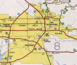
This past year I drove the entirety of Interstate 215 in San Bernardino County and Riverside County.

I-215 is a 54 mile loop of I-15 beginning near Cajon Pass in San Bernardino County and ending to the south in Murrieta of Riverside County. I-215 essentially serves as a limited access replacement of US 66/91/395 on Legislative Route Number 31 south towards I-10. South of I-10 the route of I-215 follows what was US 91/395 on LRN 43 to US 60/LRN 19. I-215 shares a brief multiplex of CA 60 near Riverside and what was US 60/395 on LRN 19 to what was US 395/LRN 78 towards Murrieta.

According to CAhighways.org I-215 was first approved as a Non-Chargeable Interstate south to I-10 as I-215 in 1972. The route designation was swapped to I-15 East by 1973 with an additional portions of Non-Chargeable roadway added south to CA 60. By 1982 the designation of I-15 East was reverted back to I-215.
CAhighways.org on I-215
The 1975 State Highway Map shows I-15E co-signed with US 395 (I guess that kicks the whole date of truncation to Hesperia even further into the 1970s) from Cajon Pass towards Sunnymead in modern day Moreno Valley.

Of note, the map above shows the unsigned CA 194 aligned over all of what would become I-15E. The designation of CA 194 (which was the second time this number was designated) was defined in 1974 and used as a hidden route number since suffixed highways are not allowed legislatively in California. The hidden CA 194 designation of I-15E would disappear when the route was reverted back to I-215 in 1982.
CAhighways.org on CA 194
The 1977 State Highway Map shows US 395 removed completely from I-15E/CA 194. I-15E appears to have been completed signed on it's entire route by 1977 but clearly was using some temporary alignments south of Sun City (modern Menifee). According to CAhighways.org I-215 wouldn't be completed to modern Interstate standards until 1996.


I-15E can be seen changed to I-215 by the 1986 State Highway Map, the 1982 Edition still shows the previous designation. Of interest the non-Interstate standard portions of 215 south of CA 60 are shown as CA 215 on the 1986 map.
1982 State Highway Map City Insert


1986 State Highway Map City Insert

My approach to I-215 south was from I-15 south descending from Cajon Pass.


I-215 south quickly enters San Bernardino and closely follows from US 66/91/395 east of Cajon Boulevard.

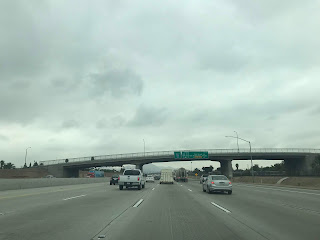
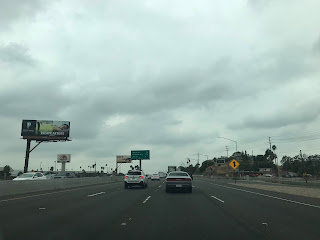
On I-215 south approaching CA 210 traffic headed to CA 18 and CA 330 are directed to exit eastbound.


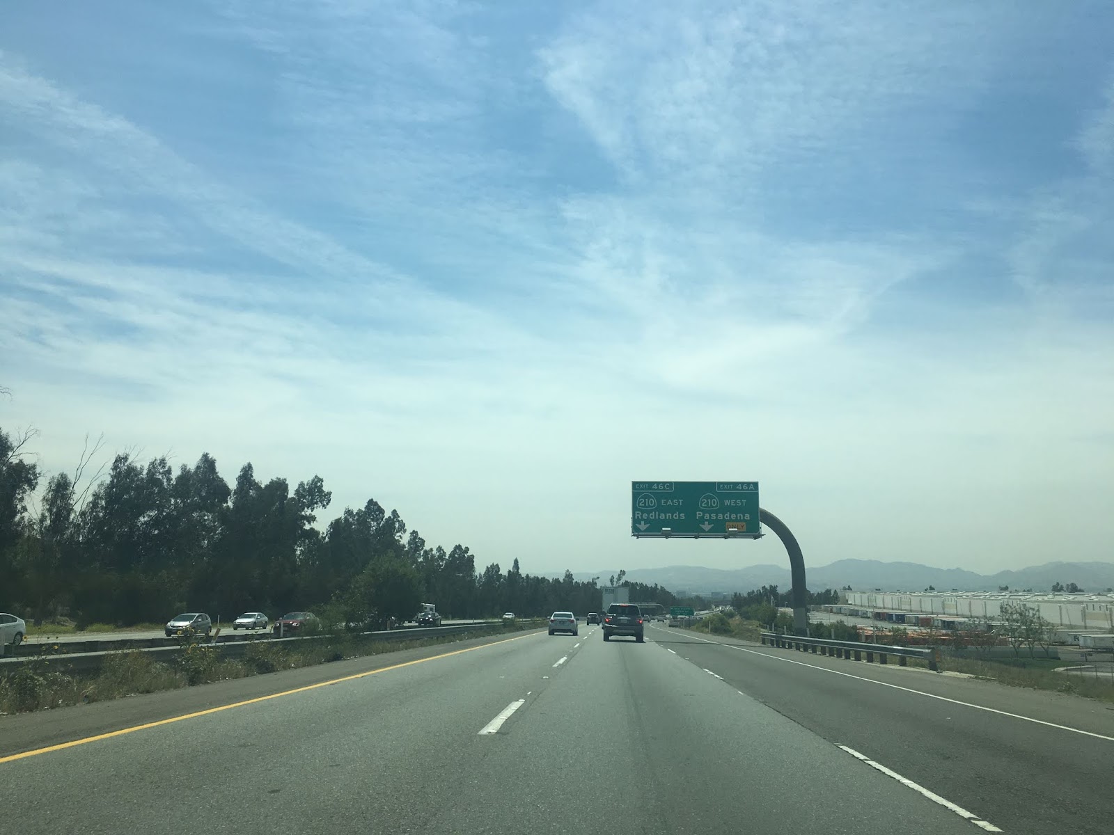
As I-215 south approaches the interchange with CA 210 there are three exits. CA 210 East traffic is directed onto Exit 46C whereas westbound traffic is directed to Exit 46A. Traffic headed to Mount Vernon Avenue and 27th Street is directed to take Exit 46B.


I-215 south Exit 45 accesses Base Line Street.


I-215 south Exit 44 accesses CA 66 which is the former route of US 66.

I-215 south Exit 43 accesses 3rd Street and 2nd Street.


I-215 south Exit 42B accesses Mill Street whereas Exit 42A accesses Island Center Drive.


I-215 south Exit 41 accesses Orange Show Road and Auto Plaza Drive.

I-215 south junctions I-10 in the southern City Limits of San Bernardino and crosses the Santa Ana River into Colton.


I-215 Exit 39 accesses Mount Vernon Avenue and Washington Street.

I-215 south enters Grand Terrace and accesses Barton Road via Exit 38.


I-215 south Exit 37 accesses Iowa Avenue.


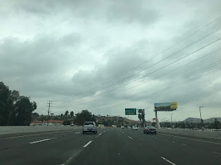
I-215 south enters Riverside County and has access to Center Street at Exit 36 in Highgrove.

I-215 south enters the City of Riverside. At Exit 35 I-215 has access to Columbia Avenue, Exit 34C accesses CA 60 west and Exit 34B accesses CA 91 south. I-215 south crosses through the CA 60/CA 91 junction and begins a multiplex of CA 60 east.


I-215 south/CA 60 east Exit 33 accesses Blaine Street and 3rd Street.

I-215 south/CA 60 east Exit 32B accesses University Avenue whereas Exit 32A accesses Martin Luther King Boulevard.


I-215 south/CA 60 east Exit 30A accesses Fair Isle Drive whereas Exit 30B accesses Central Avenue and Watkins Drive.


I-215 south splits from CA 60 east in Riverside.


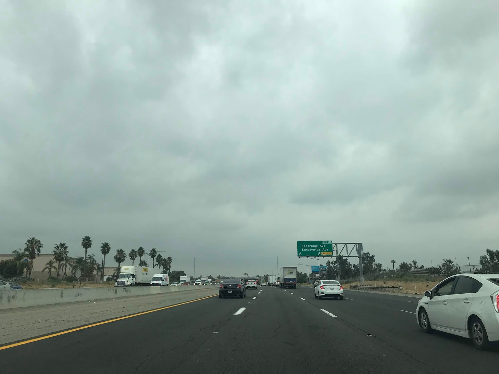
I-215 south enters Moreno Valley. At Exit 28 accesses Eastridge Avenue and Eucalyptus Avenue.


I-215 south of Exit 28 is signed as 25 miles from I-15.

I-215 south Exit 27B is signed as access Cactus Avenue whereas Exit 27A accesses March Air Reserve.


At I-215 Exit 25 March Field Museum is accessible via Van Buren Boulevard.


I-215 south enters Perris and accesses Harley Knox Boulevard at Exit 23.


I-215 south Exit 22 accesses Ramona Expressway and Cajalco Expressway.

I-215 south Exit 19 accesses Nuevo Road.


I-215 Exit 18 accesses Perris and Lake Elsinore via D Street.


I-215 south meets CA 74 via Exit 17 at 4th Street.


I-215 south picks up CA 74 east on a multiplex.

I-215 south/CA 74 east enters Menifee. At Exit 15 CA 74 east splits towards Hemet from I-215 south.


I-215 south Exit 14 accesses Ethanac Road.

I-215 south Exit 12 accesses the Sun City neighborhood of Menifee via McCall Boulevard.


I-215 south Exit 10 accesses Newport Road.


I-215 south enters Murrieta and accesses Scott Road at Exit 7.


I-215 Exit 4 accesses Clinton Keith Road.


I-215 south Exit 2 accesses Los Alamos Road.


I-215 south Exit 1 is signed as access for I-15 northbound via Murrieta Hot Springs Road.


I-215 southbound merges into I-15 southbound and oddly doesn't include any junction signage at the terminus.


I-215 is a 54 mile loop of I-15 beginning near Cajon Pass in San Bernardino County and ending to the south in Murrieta of Riverside County. I-215 essentially serves as a limited access replacement of US 66/91/395 on Legislative Route Number 31 south towards I-10. South of I-10 the route of I-215 follows what was US 91/395 on LRN 43 to US 60/LRN 19. I-215 shares a brief multiplex of CA 60 near Riverside and what was US 60/395 on LRN 19 to what was US 395/LRN 78 towards Murrieta.

According to CAhighways.org I-215 was first approved as a Non-Chargeable Interstate south to I-10 as I-215 in 1972. The route designation was swapped to I-15 East by 1973 with an additional portions of Non-Chargeable roadway added south to CA 60. By 1982 the designation of I-15 East was reverted back to I-215.
CAhighways.org on I-215
The 1975 State Highway Map shows I-15E co-signed with US 395 (I guess that kicks the whole date of truncation to Hesperia even further into the 1970s) from Cajon Pass towards Sunnymead in modern day Moreno Valley.

Of note, the map above shows the unsigned CA 194 aligned over all of what would become I-15E. The designation of CA 194 (which was the second time this number was designated) was defined in 1974 and used as a hidden route number since suffixed highways are not allowed legislatively in California. The hidden CA 194 designation of I-15E would disappear when the route was reverted back to I-215 in 1982.
CAhighways.org on CA 194
The 1977 State Highway Map shows US 395 removed completely from I-15E/CA 194. I-15E appears to have been completed signed on it's entire route by 1977 but clearly was using some temporary alignments south of Sun City (modern Menifee). According to CAhighways.org I-215 wouldn't be completed to modern Interstate standards until 1996.


I-15E can be seen changed to I-215 by the 1986 State Highway Map, the 1982 Edition still shows the previous designation. Of interest the non-Interstate standard portions of 215 south of CA 60 are shown as CA 215 on the 1986 map.
1982 State Highway Map City Insert


1986 State Highway Map City Insert


My approach to I-215 south was from I-15 south descending from Cajon Pass.


I-215 south quickly enters San Bernardino and closely follows from US 66/91/395 east of Cajon Boulevard.

On I-215 south approaching CA 210 traffic headed to CA 18 and CA 330 are directed to exit eastbound.


As I-215 south approaches the interchange with CA 210 there are three exits. CA 210 East traffic is directed onto Exit 46C whereas westbound traffic is directed to Exit 46A. Traffic headed to Mount Vernon Avenue and 27th Street is directed to take Exit 46B.


I-215 south Exit 45 accesses Base Line Street.


I-215 south Exit 44 accesses CA 66 which is the former route of US 66.


I-215 south Exit 43 accesses 3rd Street and 2nd Street.


I-215 south Exit 42B accesses Mill Street whereas Exit 42A accesses Island Center Drive.


I-215 south Exit 41 accesses Orange Show Road and Auto Plaza Drive.

I-215 south junctions I-10 in the southern City Limits of San Bernardino and crosses the Santa Ana River into Colton.


I-215 Exit 39 accesses Mount Vernon Avenue and Washington Street.


I-215 south enters Grand Terrace and accesses Barton Road via Exit 38.


I-215 south Exit 37 accesses Iowa Avenue.


I-215 south enters Riverside County and has access to Center Street at Exit 36 in Highgrove.


I-215 south enters the City of Riverside. At Exit 35 I-215 has access to Columbia Avenue, Exit 34C accesses CA 60 west and Exit 34B accesses CA 91 south. I-215 south crosses through the CA 60/CA 91 junction and begins a multiplex of CA 60 east.


I-215 south/CA 60 east Exit 33 accesses Blaine Street and 3rd Street.

I-215 south/CA 60 east Exit 32B accesses University Avenue whereas Exit 32A accesses Martin Luther King Boulevard.


I-215 south/CA 60 east Exit 30A accesses Fair Isle Drive whereas Exit 30B accesses Central Avenue and Watkins Drive.


I-215 south splits from CA 60 east in Riverside.


I-215 south enters Moreno Valley. At Exit 28 accesses Eastridge Avenue and Eucalyptus Avenue.


I-215 south of Exit 28 is signed as 25 miles from I-15.

I-215 south Exit 27B is signed as access Cactus Avenue whereas Exit 27A accesses March Air Reserve.


At I-215 Exit 25 March Field Museum is accessible via Van Buren Boulevard.


I-215 south enters Perris and accesses Harley Knox Boulevard at Exit 23.


I-215 south Exit 22 accesses Ramona Expressway and Cajalco Expressway.

I-215 south Exit 19 accesses Nuevo Road.


I-215 Exit 18 accesses Perris and Lake Elsinore via D Street.


I-215 south meets CA 74 via Exit 17 at 4th Street.


I-215 south picks up CA 74 east on a multiplex.

I-215 south/CA 74 east enters Menifee. At Exit 15 CA 74 east splits towards Hemet from I-215 south.


I-215 south Exit 14 accesses Ethanac Road.

I-215 south Exit 12 accesses the Sun City neighborhood of Menifee via McCall Boulevard.


I-215 south Exit 10 accesses Newport Road.


I-215 south enters Murrieta and accesses Scott Road at Exit 7.


I-215 Exit 4 accesses Clinton Keith Road.


I-215 south Exit 2 accesses Los Alamos Road.


I-215 south Exit 1 is signed as access for I-15 northbound via Murrieta Hot Springs Road.


I-215 southbound merges into I-15 southbound and oddly doesn't include any junction signage at the terminus.


Comments