This past month while visiting Riverside County I drove Box Canyon Road from Interstate 10 near Chiriaco Summit southwest to Mecca in Coachella Valley. Box Canyon Road is mostly known for being the original alignment of US 60/70 when they were expanded into California.

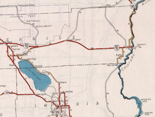
Box Canyon Road is an approximately 15.8 mile road between I-10/Cottonwood Springs Road near Chiriaco Summit which travels southwest through the Mecca Hills to Coachella Valley where it becomes 66th Avenue.

Box Canyon Road follows a naturally cut wash through the terrain of the Mecca Hills. The path of Box Canyon Road has been a known route of travel from Coachella Valley to the Colorado River and eastern Sonoran Desert for centuries. During the California Gold Rush a wagon route known as the Bradshaw Trail was plotted through the Sonoran Desert by William D. Bradshaw. The Bradshaw Trail was plotted in 1862 through the Sonoran Desert east over the Colorado River to a new mining strike found in La Paz, Arizona. Bradshaw consulted the Cahuilla Tribe who advised him the best route was not through Box Canyon (due to a lack of spring water) but a pass between the Orocopia Mountains and Chocolate Mountains. From the Chocolate Mountains the Bradshaw Trail passed through the southern Chuckwalla Range and a pass through the Mule Mountains to Bradshaw's Ferry on the Colorado River near modern day Blythe. The Bradshaw Trail despite it's elongated path essentially was the forerunner of what would become modern; CA 111, Box Canyon Road and I-10 from Palm Springs to the City of Blythe. More information regarding the Bradshaw Trail and where to find it can be found on desertusa.com.
Evidence of how little was known about the Sonoran Desert during Gold Rush era California can be observed by looking at the 1857 Britton & Rey's Road Map of California. The Sonoran Desert east of Coachella Valley and the Salton Sink (which at the time was in San Diego County) is essentially shown as uncharted.

During the advent of modern automobile transport the shorter route through the Sonoran Desert became an attractive alternative to the Bradshaw Trail. Box Canyon Road was added to the State Highway System as part of Legislative Route 64 during the 1919 Third State Highway Bond Act between Mecca and Blythe according to CAhighways.org. The new route of LRN 64 between Mecca and Blythe can be seen on the 1920 Division of Highways Map of California.
The route of LRN 64 is partially shown as graded on the 1926 Division of Highways Map of California.

LRN 64 west of Blythe west to Black Butte shows as a "High Type" road on the 1928 Division of Highways Map of California.

The 1930 Division of Highways Map of California shows LRN 64 fully graded from Blythe west to Desert Center.

According to CAhighways.org LRN 64 was extended east of Blythe to the Arizona State Line in 1931. At the time both Arizona and California sought to get a trans-continental highway through the Sonoran Desert which was approved by the Secretary of Agriculture in 1931. In 1932 US 60 was extended west from Texas to downtown Los Angeles. The 1932 Division of Highways Map of California shows LRN 64 graded from Blythe all the way west to the top of Box Canyon.
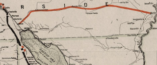
The 1934 Division of Highways Map of California shows US 60 for the first time. US 60 is shown traversing Box Canyon on a newly graded Box Canyon Road west from Chiriaco Summit. The new more direct planned route of LRN 64/US 60 from Chiriaco Summit west to Indio is also shown. 1934 is also notable for being the year that US 70 was approved to be extended into California to Los Angeles.

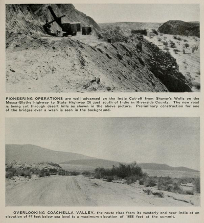
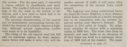
A September 1934 Department of Public Works Guide describes the construction of what was known as the "Indio Cut-Off" route of US 60 bypassing Box Canyon Road. Chiraco Summit at the time was referred to has "Shaver's Summit" and the Guide states that Box Canyon Road was oiled in 1933. The Indio Cut-Off is described as having a 6.3% grade and an anticipated opening of July 1935.


The July 1935 Department of Public Works Guide has a story on US 60 being rerouted onto the spur of LRN 64 on the Indio Cut-Off. The Indio Cut-Off is stated as being completed on June 15th, 1935 and having a saving of 9 miles over the Box Canyon Road spur of LRN 64. Some of the infamous washouts on Box Canyon Road are illustrated in photo form.


The 1935 Goshua Highway Map of California illustrates that US 60/70 were rerouted off Box Canyon Road onto the Indio Cut-Off. To the east the initial 1934 route of CA 195 along the Colorado River can be seen.
In 1940 US 95 was extended south to Blythe and designation of CA 195 was shifted to Box Canyon Road spur of LRN 64. The second CA 195 was routed from US 60/70 at Chiriaco Summit southwest to CA 111 in Mecca. The new route of CA 195 on Box Canyon Road can be seen on the 1940 Division of Highways Map of California.
CA 195 essentially remained unchanged until the 1964 State Highway Renumbering. During the 1964 State Highway Renumbering CA 195 west extended west from Mecca and CA 111 on 66th Avenue on what was LRN 204 and south on Pierce Street on what was LRN 203. Both LRN 203 and LRN 204 were added to the State Highway System in 1935 according to CAhighways.org. The new route of extension of CA 195 is seen to be implied on the 1964 Division of Highways Map of California. The 1964 route definition of CA 195 can be found on CAhighways.org.

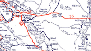
CA 195 on between I-10 and CA 111 on Box Canyon Road was deleted in 1972 according to CAhighways.org. CA 195 was subsequently truncated to CA 111 southwest to CA 86 which can be seen on the 1975 Caltrans Map.

According to CAhighways.org CA 195 on Pierce Street and 66th Avenue to east to the new CA 86 Expressway was relinquished in 2008. The remaining segment of CA 195 on 66th Avenue east to Grapefruit Boulevard in Mecca was transferred to CA 111 in 2014.
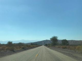
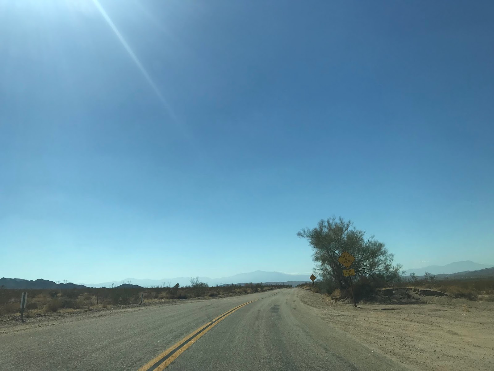
In October of 2018 several large storms struck the Mecca Hills and washed out much of Box Canyon Road. Box Canyon Road was repaired through 2019 and recently reopened. My approach to Box Canyon Road was from Cottonwood Springs Road headed south out of Joshua Tree National Park. At Pinto Road (former US 60/70 west from Chiriaco Summit) the route of Box Canyon Road begins. Mecca is signed as 20 miles from Cottonwood Springs Road/I-10 via Box Canyon Road.


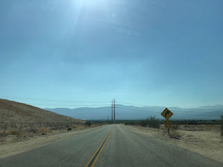
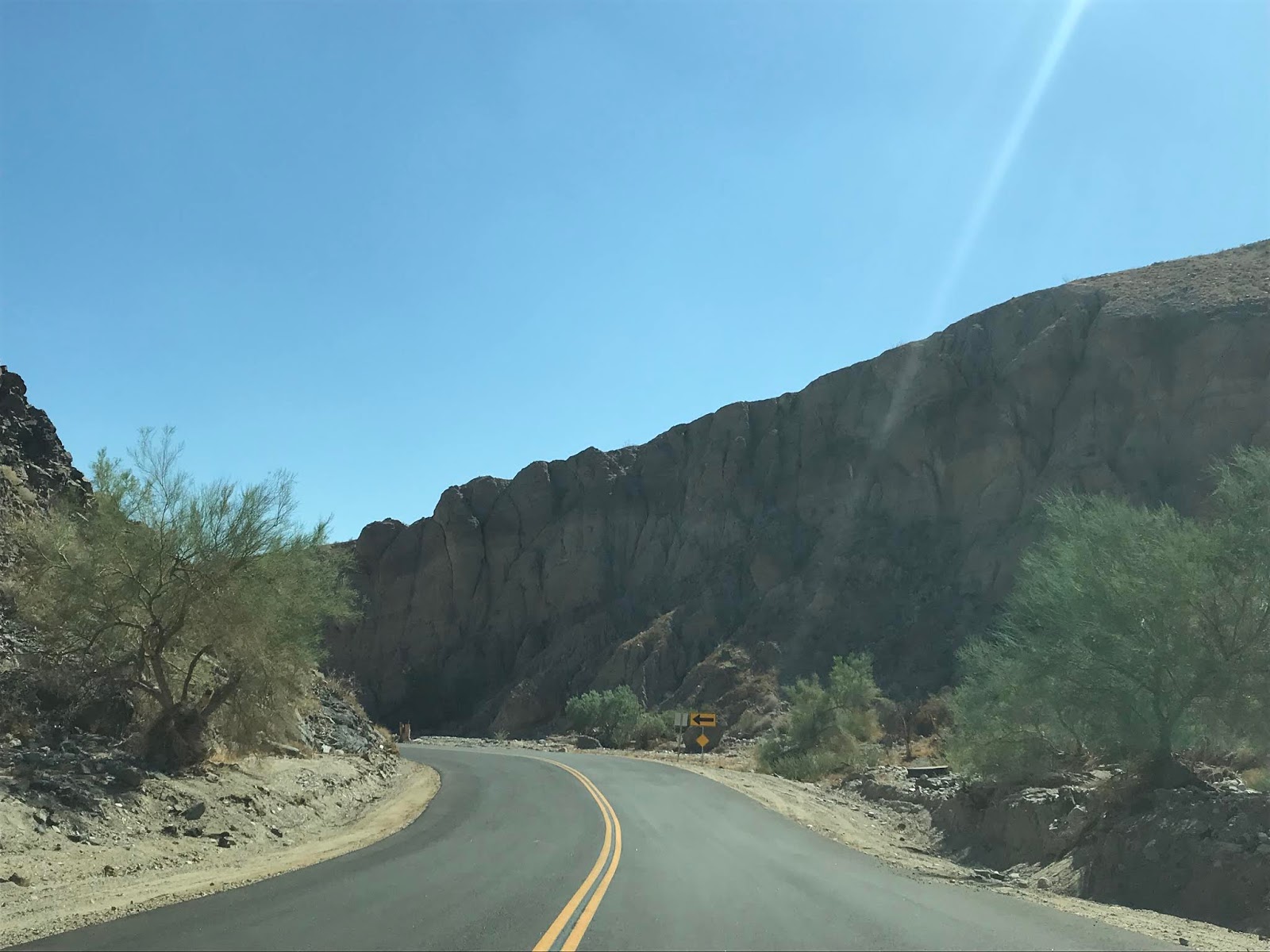
Box Canyon Road is immediately signed as a "Subject to Flooding" zone for the next 15 miles which is somewhat amusing to see considering how much damage it took in 2018.

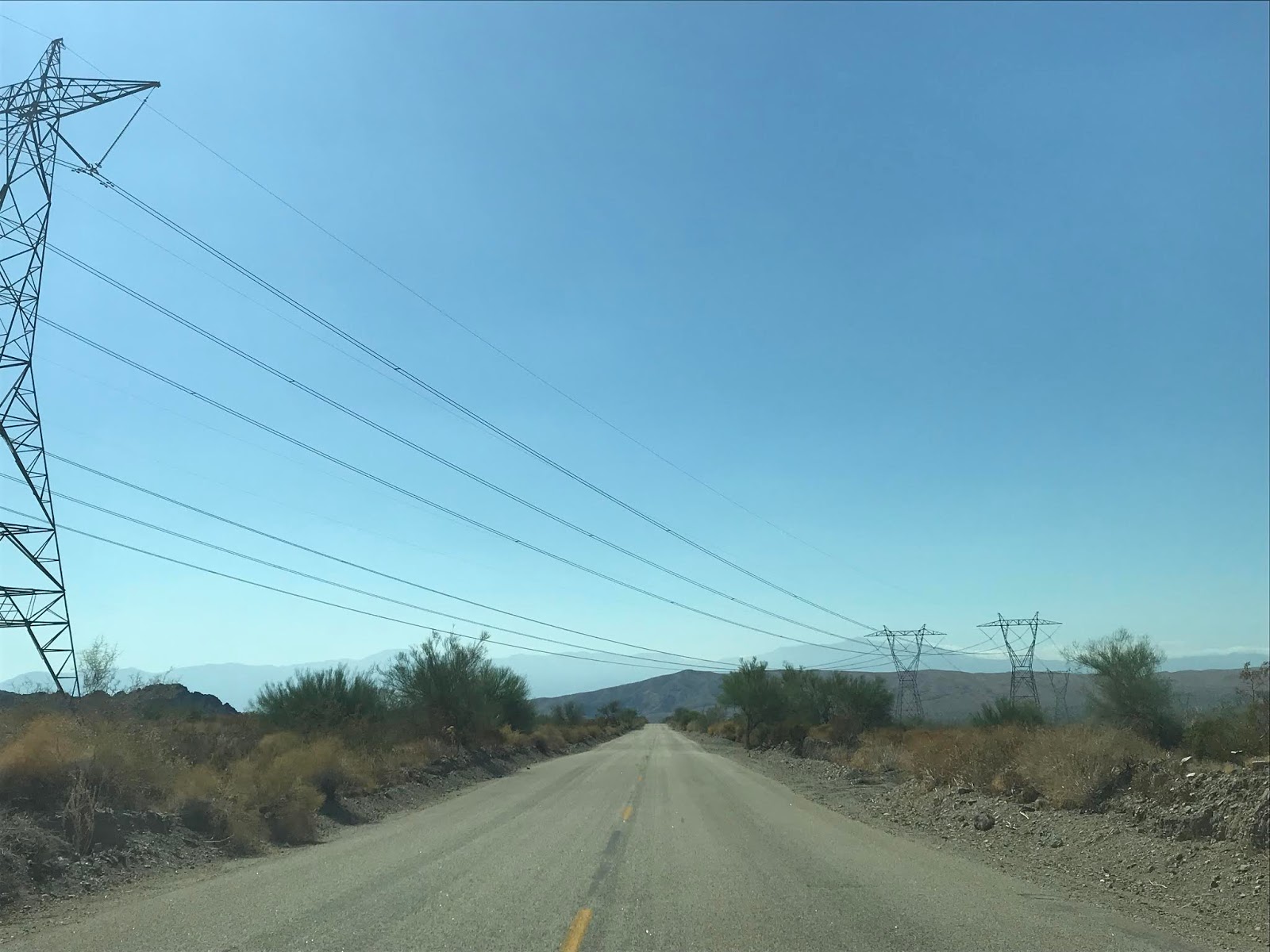
Box Canyon Road has an initially very gentle southwestern descent on very old asphalt that likely dates back to when CA 195 was relinquished in 1972.


Fresh asphalt is encountered on Box Canyon Road on the washed out zone from 2018 as the roadways enters the namesake Box Canyon.


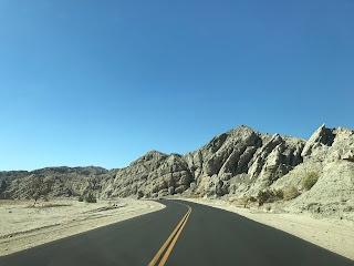
The geological uplift of the San Andreas Fault in the Mecca Hills is very evidence as Box Canyon Road continues to descend. The grade in Box Canyon Road is very slight and makes it apparent why there such a drainage problem with all the surrounding sand in the canyons.


In the middle of Box Canyon the angle of the rocks shows the direction the Mecca Hills are being uplifted. It is somewhat rare to see different colored sediment layers in the rock in the Sonoran Desert but they are full display in Box Canyon.

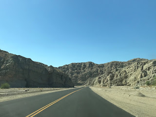
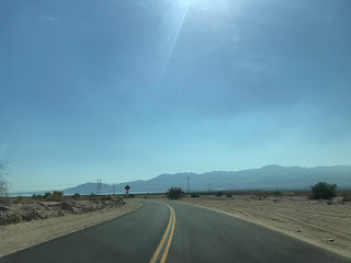
Box Canyon Road continues to wind through the Mecca Hills and finally emerges into Coachella Valley near Painted Canyon Road. Painted Canyon Road is the access road for the notable Ladder Canyon Trail. Painted Canyon Road was also washed out in 2018 and is presently only accessible by high clearance Four Wheel Drive Vehicles.


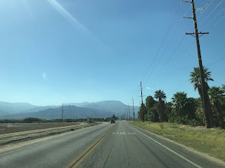
Box Canyon Road climbs over the Coachella Canal and becomes 66th Avenue at the Garfield Street intersection.


The former route of US 60/US 70/CA 195 enters Mecca and would have crossed over the rails via 66th Avenue. Traffic is now required to swing north on Hammond Road which was where CA 195 would have ended at CA 111.


Post 1964 CA 195 would have made a western turn on 4th Street to cross the rails and would have met CA 111 at Grapefruit Boulevard. CA 195 would have multiplexed CA 111 back to 66th Avenue where it would continue west on the alignment of US 60/US 70.


66th Avenue from Grapefruit Boulevard west to CA 86 is now signed as part of CA 111. US 60/US 70/CA 195 would have continued west of the CA 86 expressway.


US 60/US 70 continued west on 66th Avenue to Pierce Street where they once turned right whereas CA 195 would have turned left post-1964. Pierce Street used to be a continuous street north over the Whitewater River. The former alignment of US 60/US 70 north on Pierce Street has been shifted due the Whitewater River being dredged and straightened. From Pierce Street traffic west on 66th Avenue would have entered CA 231 which continued to the old surface alignment of CA 86 at Harrison Street.


Box Canyon Road is an approximately 15.8 mile road between I-10/Cottonwood Springs Road near Chiriaco Summit which travels southwest through the Mecca Hills to Coachella Valley where it becomes 66th Avenue.

Box Canyon Road follows a naturally cut wash through the terrain of the Mecca Hills. The path of Box Canyon Road has been a known route of travel from Coachella Valley to the Colorado River and eastern Sonoran Desert for centuries. During the California Gold Rush a wagon route known as the Bradshaw Trail was plotted through the Sonoran Desert by William D. Bradshaw. The Bradshaw Trail was plotted in 1862 through the Sonoran Desert east over the Colorado River to a new mining strike found in La Paz, Arizona. Bradshaw consulted the Cahuilla Tribe who advised him the best route was not through Box Canyon (due to a lack of spring water) but a pass between the Orocopia Mountains and Chocolate Mountains. From the Chocolate Mountains the Bradshaw Trail passed through the southern Chuckwalla Range and a pass through the Mule Mountains to Bradshaw's Ferry on the Colorado River near modern day Blythe. The Bradshaw Trail despite it's elongated path essentially was the forerunner of what would become modern; CA 111, Box Canyon Road and I-10 from Palm Springs to the City of Blythe. More information regarding the Bradshaw Trail and where to find it can be found on desertusa.com.
Evidence of how little was known about the Sonoran Desert during Gold Rush era California can be observed by looking at the 1857 Britton & Rey's Road Map of California. The Sonoran Desert east of Coachella Valley and the Salton Sink (which at the time was in San Diego County) is essentially shown as uncharted.

During the advent of modern automobile transport the shorter route through the Sonoran Desert became an attractive alternative to the Bradshaw Trail. Box Canyon Road was added to the State Highway System as part of Legislative Route 64 during the 1919 Third State Highway Bond Act between Mecca and Blythe according to CAhighways.org. The new route of LRN 64 between Mecca and Blythe can be seen on the 1920 Division of Highways Map of California.

The route of LRN 64 is partially shown as graded on the 1926 Division of Highways Map of California.

LRN 64 west of Blythe west to Black Butte shows as a "High Type" road on the 1928 Division of Highways Map of California.

The 1930 Division of Highways Map of California shows LRN 64 fully graded from Blythe west to Desert Center.

According to CAhighways.org LRN 64 was extended east of Blythe to the Arizona State Line in 1931. At the time both Arizona and California sought to get a trans-continental highway through the Sonoran Desert which was approved by the Secretary of Agriculture in 1931. In 1932 US 60 was extended west from Texas to downtown Los Angeles. The 1932 Division of Highways Map of California shows LRN 64 graded from Blythe all the way west to the top of Box Canyon.

The 1934 Division of Highways Map of California shows US 60 for the first time. US 60 is shown traversing Box Canyon on a newly graded Box Canyon Road west from Chiriaco Summit. The new more direct planned route of LRN 64/US 60 from Chiriaco Summit west to Indio is also shown. 1934 is also notable for being the year that US 70 was approved to be extended into California to Los Angeles.

A September 1934 Department of Public Works Guide describes the construction of what was known as the "Indio Cut-Off" route of US 60 bypassing Box Canyon Road. Chiraco Summit at the time was referred to has "Shaver's Summit" and the Guide states that Box Canyon Road was oiled in 1933. The Indio Cut-Off is described as having a 6.3% grade and an anticipated opening of July 1935.


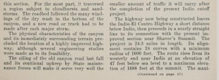
The July 1935 Department of Public Works Guide has a story on US 60 being rerouted onto the spur of LRN 64 on the Indio Cut-Off. The Indio Cut-Off is stated as being completed on June 15th, 1935 and having a saving of 9 miles over the Box Canyon Road spur of LRN 64. Some of the infamous washouts on Box Canyon Road are illustrated in photo form.


The 1935 Goshua Highway Map of California illustrates that US 60/70 were rerouted off Box Canyon Road onto the Indio Cut-Off. To the east the initial 1934 route of CA 195 along the Colorado River can be seen.
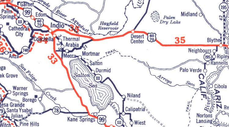
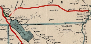
In 1940 US 95 was extended south to Blythe and designation of CA 195 was shifted to Box Canyon Road spur of LRN 64. The second CA 195 was routed from US 60/70 at Chiriaco Summit southwest to CA 111 in Mecca. The new route of CA 195 on Box Canyon Road can be seen on the 1940 Division of Highways Map of California.

CA 195 essentially remained unchanged until the 1964 State Highway Renumbering. During the 1964 State Highway Renumbering CA 195 west extended west from Mecca and CA 111 on 66th Avenue on what was LRN 204 and south on Pierce Street on what was LRN 203. Both LRN 203 and LRN 204 were added to the State Highway System in 1935 according to CAhighways.org. The new route of extension of CA 195 is seen to be implied on the 1964 Division of Highways Map of California. The 1964 route definition of CA 195 can be found on CAhighways.org.

CA 195 on between I-10 and CA 111 on Box Canyon Road was deleted in 1972 according to CAhighways.org. CA 195 was subsequently truncated to CA 111 southwest to CA 86 which can be seen on the 1975 Caltrans Map.

According to CAhighways.org CA 195 on Pierce Street and 66th Avenue to east to the new CA 86 Expressway was relinquished in 2008. The remaining segment of CA 195 on 66th Avenue east to Grapefruit Boulevard in Mecca was transferred to CA 111 in 2014.
In October of 2018 several large storms struck the Mecca Hills and washed out much of Box Canyon Road. Box Canyon Road was repaired through 2019 and recently reopened. My approach to Box Canyon Road was from Cottonwood Springs Road headed south out of Joshua Tree National Park. At Pinto Road (former US 60/70 west from Chiriaco Summit) the route of Box Canyon Road begins. Mecca is signed as 20 miles from Cottonwood Springs Road/I-10 via Box Canyon Road.


Box Canyon Road is immediately signed as a "Subject to Flooding" zone for the next 15 miles which is somewhat amusing to see considering how much damage it took in 2018.
Box Canyon Road has an initially very gentle southwestern descent on very old asphalt that likely dates back to when CA 195 was relinquished in 1972.


Fresh asphalt is encountered on Box Canyon Road on the washed out zone from 2018 as the roadways enters the namesake Box Canyon.


The geological uplift of the San Andreas Fault in the Mecca Hills is very evidence as Box Canyon Road continues to descend. The grade in Box Canyon Road is very slight and makes it apparent why there such a drainage problem with all the surrounding sand in the canyons.


In the middle of Box Canyon the angle of the rocks shows the direction the Mecca Hills are being uplifted. It is somewhat rare to see different colored sediment layers in the rock in the Sonoran Desert but they are full display in Box Canyon.

Box Canyon Road continues to wind through the Mecca Hills and finally emerges into Coachella Valley near Painted Canyon Road. Painted Canyon Road is the access road for the notable Ladder Canyon Trail. Painted Canyon Road was also washed out in 2018 and is presently only accessible by high clearance Four Wheel Drive Vehicles.


Box Canyon Road climbs over the Coachella Canal and becomes 66th Avenue at the Garfield Street intersection.


The former route of US 60/US 70/CA 195 enters Mecca and would have crossed over the rails via 66th Avenue. Traffic is now required to swing north on Hammond Road which was where CA 195 would have ended at CA 111.


Post 1964 CA 195 would have made a western turn on 4th Street to cross the rails and would have met CA 111 at Grapefruit Boulevard. CA 195 would have multiplexed CA 111 back to 66th Avenue where it would continue west on the alignment of US 60/US 70.


66th Avenue from Grapefruit Boulevard west to CA 86 is now signed as part of CA 111. US 60/US 70/CA 195 would have continued west of the CA 86 expressway.


US 60/US 70 continued west on 66th Avenue to Pierce Street where they once turned right whereas CA 195 would have turned left post-1964. Pierce Street used to be a continuous street north over the Whitewater River. The former alignment of US 60/US 70 north on Pierce Street has been shifted due the Whitewater River being dredged and straightened. From Pierce Street traffic west on 66th Avenue would have entered CA 231 which continued to the old surface alignment of CA 86 at Harrison Street.


Comments