
Hawaii Route 76 Fort Weaver Road


Hawaii Route 76 is a 6-mile State Highway located on the Island of O'ahu.  Hawaii Route 76 begins at Interstate H-1/Hawaii Route 750 in Waipahu and follows Fort Weaver Road to the boundary of the Fort Weaver Naval Reservation.


This page is part of the Gribblenation O'ahu Highways page.  All Gribblenation and Roadwaywiz media related to the highway system of O'ahu can be found at the link below:

https://www.gribblenation.org/p/gribblenation-oahu-highways-page.html


Part 1; the history of Hawaii Route 76

The corridor of Fort Weaver Road has been linked to military usage since the U.S. Army acquired land on Ewa Beach during 1905 to support coastline defense.  The Army property was transferred to the U.S. Navy during 1916 and came to be known as the Pu'uloa Military Reservation.  The coastal defense facility by 1922 took the name of Fort Weaver.  Fort Weaver saw the construction of Battery Williston which was completed by 1924.  Battery Weaver was added to Fort Weaver upon being completed during 1934.  

Prior to the Statehood the first signed highways within Hawaii Territory came into existence during World War II.   During World War II the territory of Hawaii saw an influx of military activity following the attack on Pearl Harbor on December 7th, 1941.  Numerous Military Routes and early Hawaii Routes were signed through the Hawaiian Territory to aid military personnel in navigating the islands.  Military Highways were assigned US Route style shields whereas lesser highways were assigned an early variation of what is now the Hawaii Route Spade.  Ewa Beach Road (now Old Fort Weaver Road and Fort Weaver Road) was assigned as Hawaii Route 211 south of Military Route 2/Farrington Highway.  Anti-Motor Torpedo Battery #1 was added to Fort Weaver in 1943.  A full version of the 1946 Army Map of O'ahu can be seen on hawaiihighways.com here.  

Below Hawaii Route 211/Ewa Beach Road can be seen branching from Military Route 2/Farrington Highway.


Circa 1955 following the conclusion of World War II the United States Bureau of Public Roads renumbered the Hawaii Route System.  The 1955 Hawaii Route Renumbering saw most of the conventions utilized by the current Hawaii State Route System established.  Primary Hawaii Routes were given two-digit numbers whereas Secondary Hawaii Routes were given three-digit numbers.  The Hawaii Routes were assigned in sequence for what Island/County they were located on coupled with what Federal Aid Program number they were tied to.  In the case of O'ahu the Island was assigned numbers in the range of 60-99.  In the case of Fort Weaver Road it was assigned as part of Hawaii Route 76 which began south of Hawaii Route 90/Farrington Highway.  A far more detailed explanation of the 1955 Hawaii Route Renumbering can be found at hawaiihighways.com here

Hawaii Route 76 can be seen aligned on Fort Weaver Road on the 1959 Gousha Map of Hawaii


During the 1960s Fort Weaver Road declined in importance and was reassigned as Hawaii Route 760.  The triple digit numbering of Hawaii Route 760 denoted it was a Secondary State Highway.  Hawaii Route 760 can be seen in the vicinity of Honouliuli on the 1968 USGS Map of the Ewa Area on what is now Old Fort Weaver Road.


According to hawaiihighways.com Fort Weaver Road was realigned as an expressway from the Lower Village of West Loch Estates north of Farrington Hawaii directly to Interstate H-1.  Fort Weaver Road was reassigned as Hawaii Route 76 denoting it's restored status as a primary highway.  Hawaii Route 76 consumed what had been Hawaii Route 750 from Farrington Highway north to Interstate H-1.  The realigned Fort Weaver Road and Hawaii Route 76 can be seen immediately east of Old Fort Weaver Road on the 1998 USGS Map of the Ewa Area.  


Part 2; a drive on Hawaii Route 76

Hawaii Route 76/Fort Weaver Road southbound begins from Interstate H-1/Queen Liliuokalani Freeway Exit 5 which also accesses Hawaii Route 750/Kunia Road.  


Hawaii Route 76/Fort Weaver Road begins as an expressway south of Interstate H-1/Queen Liliuokalani.  Hawaii Route 76/Fort Weaver Road southbound intersects Farrington Highway via an interchange which accesses Hawaii Route 7101 and Hawaii Route 7110 via Exit 6A.  Hawaii Route 76/Fort Weaver Road Exit 5 accesses Waipahu.  


Below northbound Hawaii Route 76/Fort Weaver Road can be seen at Aikanaka Road.  


Hawaii Route 76/Fort Weaver Road northbound approaching Renton Road.


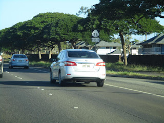
Mile Marker 4 and a reassurance shield on Hawaii Route 76/Fort Weaver Road. 


Hawaii Route 76/Fort Weaver Road Northbound Exit 5 accesses Hawaii Route 7101/Farrington Highway.


Hawaii Route 76/Fort Weaver Road northbound terminates at Interstate H-1/Hawaii Route 750.  


During May of 2019 Dan Murphy of the Roadwaywiz YouTube Channel and Gribblenation featured real-time drives on Hawaii Route 76.  Below southbound Hawaii Route 76 can be viewed.


Below northbound Hawaii Route 76 can be viewed.


Comments

Popular posts from this blog

Old US Route 60/70 through Hell (Chuckwall Valley Road and Ragsdale Road)

Back in 2016 I explored some of the derelict roadways of the Sonoran Desert of Riverside County which were part of US Route 60/70; Chuckwalla Valley Road and Ragsdale Road. US 60 and US 70 were not part of the original run of US Routes in California.  According to USends.com US 60 was extended into California by 1932.  US 60 doesn't appear on the California State Highway Map until the 1934 edition. USends.com on US 60 endpoints 1934 State Highway Map Conversely US 70 was extended into California by 1934, it first appears on the 1936 State Highway Map. USends.com on US 70 endpoints 1936 State Highway Map When US 60 and US 70 were extended into California they both utilized what was Legislative Route Number 64 from the Arizona State Line west to Coachella Valley.  LRN 64 was part of the 1919 Third State Highway Bond Act routes.  The original definition of LRN 64 routed between Mecca in Blythe and wasn't extended to the Arizona State Line until 1931 acc...

Trimmer Springs Road (Fresno County)

Trimmer Springs Road is an approximately forty-mile rural highway located in Fresno County.  The corridor begins near in California State Route 180 in Centerville and extends to Blackrock Road at the Kings River in the Sierra Nevada range near the Pacific Gas & Electric Company town of Balch Camp. The roadway is named after the former Trimmer Springs Resort and was originally constructed to facilitate access to the Sanger Log Flume.  Trimmer Springs Road was heavily modified and elongated after construction of Pine Flat Dam broke ground in 1947.   Part 1; the history of Trimmer Springs Road Much of the original alignment of Trimmer Springs Road was constructed to facilitate access to the Sanger Log Flume.   The  Kings River Lumber Company  had been established in 1888 in the form of a 30,000-acre purchase of forest lands in Converse Basin.  This purchase lied immediately west of Grant Grove and came to be known as "Millwood."  The co...

When was Ventura Avenue east of downtown Fresno renamed to Kings Canyon Road? (California State Route 180)

California State Route 180 was one of the original Sign State Routes designated in August 1934.  The highway east of Fresno originally utilized what was Ventura Avenue and Dunlap Road to reach what was then General Grant National Park.  By late year 1939 the highway was extended through the Kings River Canyon to Cedar Grove.   In 1940 General Grant National Park would be expanded and rebranded as Kings Canyon National Park.  The Kings Canyon Road designation first appeared in publications circa 1941 when the California State Route 180 bypass of Dunlap was completed.  Kings Canyon Road ultimately would replace the designation of Dunlap Road from Dunlap to Centerville and Ventura Avenue west to 1st Street in Fresno.   The Kings Canyon Road would remain largely intact until March 2023 when the Fresno Council designated Cesar Chavez Boulevard.  Cesar Chavez Boulevard was designated over a ten-mile corridor over what was Kings Canyon Road, remaini...