Mount Orne Covered Bridge - New Hampshire and Vermont


The Mount Orne Covered Bridge is a 266 foot long covered bridge spanning over the Connecticut River, connecting Lancaster, New Hampshire with Lunenburg, Vermont. The bridge is listed in the World Guide of Covered Bridges, Numbers 45-05-03 / 29-04-08, and is also New Hampshire Covered Bridge #30 in New Hampshire's inventory of covered bridges. Replacing a toll bridge that was destroyed by a log jam in 1908, the Mount Orne Covered Bridge was built in 1911 using a Howe through truss design. The towns of Lancaster and Lunenburg each contributed $2,500 towards the construction of the covered bridge, with the remaining $1,678 of the cost having been raised by subscription. The pine timber that was used for the bridge was precut and was assembled on site.

As is the case with many covered bridges, the Mount Orne Covered Bridge has taken a beating towards its longevity over the years. In 1969, a truck loaded with salt dropped through the bridge deck and landed on the ice below. The front of the truck became hooked on one of the bridge's steel rods while the truck's rear rested on the ice. The salt from the truck spilled onto the ice and threatened to melt the ice that held the salt truck from breaking through. The truck was raised, was disengaged from the bridge, and lowered to the ice. The truck was quickly dragged away from the area weakened by the salt, was turned upright and was loaded onto a flatbed on the Vermont side of the river. Additional damage to the covered bridge by tractor trailers took place in 2006, 2010 and 2012.

The covered bridge was closed on July 5, 1983 for twelve weeks for rehabilitation at a cost of $133,000. Funding came from the towns of Lancaster and Lunenburg, the states of New Hampshire and Vermont, along with matching grant a federal Historic Preservation Fund matching grant from the National Park Service of the U.S. Department of the Interior through the New Hampshire Division of Historical Resources. The bridge was rededicated on November 23, 1983. The Mount Orne Covered Bridge is also listed on the National Register of Historic Places.

Inside the covered bridge.

A view of the Connecticut River on a nice spring day.

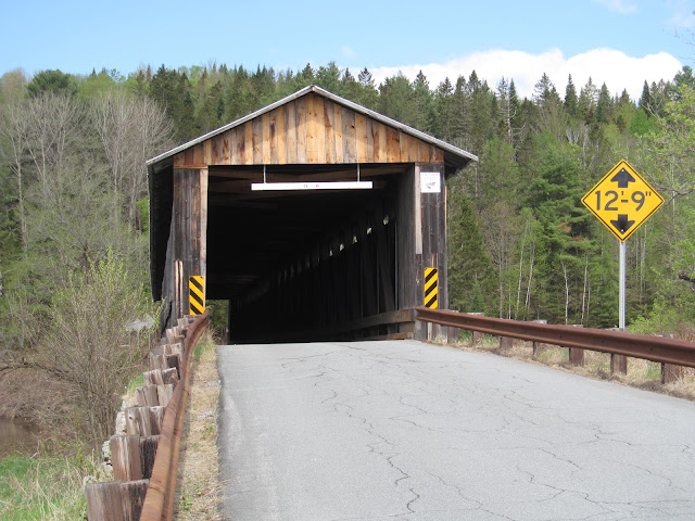
A view of the eastern bridge portal on the New Hampshire side of the bridge.

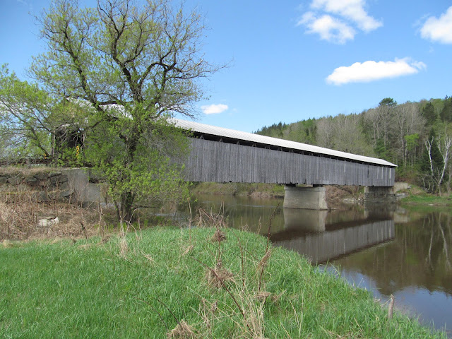
Side profile of the covered bridge.

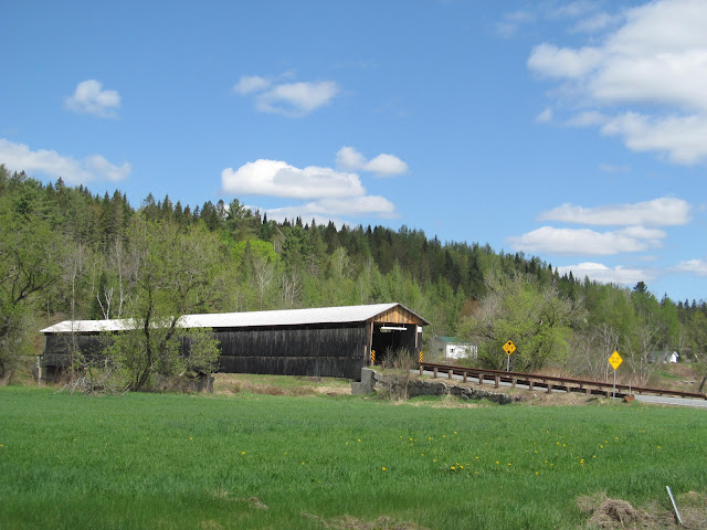
Coming up towards the covered bridge on NH 135.


How to Get There:


Sources and Links:
New Hampshire Bridges - Mt. Orne Bridge
Vermont Covered Bridge Society - The Mount Orne Covered Bridge
Bridgehunter.com - Mt. Orne Covered Bridge 45-05-03 / 29-04-08
NH Tour Guide - Mt. Orne Covered Bridge Lancaster NH and Lunenburg VT

Comments

Popular posts from this blog

Former US Route 50 and the Pioneer Route Lincoln Highway on Johnson's Pass Road

Johnson's Pass Road is one of the oldest highway corridors in California.  Johnson's Pass was part of the Lake Tahoe Wagon Road as it was completed during 1856 over the Sierra Nevada.  The pass would later be incorporated into the Pioneer Branch of the Lincoln Highway in 1913 and US Route 50 in 1926.  Johnson's Pass Road would be bypassed by a new alignment of US Route 50 over Echo Summit in 1938.  A replacement of the Meyers Grade east of Johnson's Pass would be opened to traffic in 1947.   Johnson's Pass Road remains accessible to traffic and is still signed by the Lincoln Highway Association.  Pictured as the blog cover is the view from the top of Johnson's Pass Road overlooking modern US Route 50 and Lake Tahoe.   Part 1; the history of Johnson's Pass Much of the history of what become the Lake Tahoe Wagon Road is discussed in the  September 1950 California Highways & Public Works  during its Centennial Edition.  The or...

Former US Route 50 and the South Lincoln Highway from Folsom east to Placerville

The corridor of Folsom of Sacramento County east to Placerville of El Dorado County has been a long established corridor of overland travel dating back to the California Gold Rush.  The Folsom-Placerville corridor was once part of the path of the Lake Tahoe Wagon Road which became the first California State Highway and later the South Lincoln Highway.  In time the South Lincoln Highway's surface alignment was inherited by US Route 50.  The Folsom-Placerville corridor also includes the communities of; Clarksville, Shingle Springs and El Dorado. Part 1; the history of the Lake Tahoe Wagon Road, South Lincoln Highway and US Route 50 through Folsom-Placerville Folsom is located on the American River/Lake Natoma of eastern Sacramento County.  That lands now occupied by the City of Folsom were part of Rancho Rio de los Americanos prior to the finding of gold at Sutter's Mill during 1848.  During the California Gold Rush the lands of Rancho Rio de los Americanos were p...

Angus L. Macdonald Bridge

At 1.3 kilometers (or about 0.84 miles) in length, the Angus L. Macdonald Bridge is one of two bridges crossing over the Halifax Harbour between Halifax, Nova Scotia and Dartmouth, Nova Scotia, with the other bridge being the A. Murray Mackay Bridge . Opened in 1955 and named after former Nova Scotia Premier and Canadian Minister of Defense for Naval Services Angus L. Macdonald, the Macdonald Bridge was the first bridge that crossed Halifax Harbour that was opened to traffic. The Macdonald Bridge was also the subject of the Big Lift, which was only the second time in history that the span of a suspension bridge were replaced while the bridge was open to traffic. Planning began in 2010 for the Big Lift, while construction took place between 2015 and 2017. Similar work occurred on the Lion's Gate Bridge in Vancouver, British Columbia before the project took place on the Macdonald Bridge. At this time, much of the bridge infrastructure is new, leaving only the towers, main cables and...