Hawaii Route 30 is a 41.8-mile highway which exists on the Island of Maui. Hawaii Route 30 forms a semi-circle of the West Maui Mountains and is largely carried by 35.6 miles of Honoapiilani Highway. Hawaii Route 30 begins on High Street at the Maui County Seat of Wailuku and is carried 0.4-miles south on High Street to Honoapiilani Highway. Hawaii Route 30 from Wailuku continues south on Honoapiilani Highway to Maalaea before turning west/northwest towards Lahaina. From Lahaina, Hawaii Route 30 continues north on Honoapiilani Highway to Honokohau Bay. From Honokohau Bay to Keawalua, Hawaii Route 30 is carried by 5.8 miles of Kahekili Highway to Maui County Route 340. Hawaii Route 3000 which is known as the Lahaina Bypass has been constructed in two phases which opened to traffic during 2013 and 2018.
Part 1; the history of Hawaii Route 30The corridor of Honoapiilani Highway connects the communities of Wailuku and Lahaina. Both Wailuku and Lahaina carry significant historic significance to the Hawaiian Islands.
Wailuku is the Maui County Seat and is the longest-lived continuous community on the Island of Maui. Wailuku was once the location where Maui King Piilani once ruled over the united island. Wailuku was later the site of Kamehameha's victory at the Battle of Kepaniwai during 1790. During 1860s the site of Wailuku became the hub location for the operations of the Wailuku Sugar Company. By 1905 Wailuku became the Maui County Seat and has retained it since.
Lahaina was conquered by Kamehameha during 1795 in the runup to the unification of the Hawaiian Islands as the Kingdom of Hawaii. Lahaina would serve as the capital of the Kingdom of Hawaii from 1802-1812 and 1820-1845. Despite losing it's status as the Hawaiian Capital to Honolulu during 1845 the community of Lahaina would continue to thrive as a center of the whaling industry.
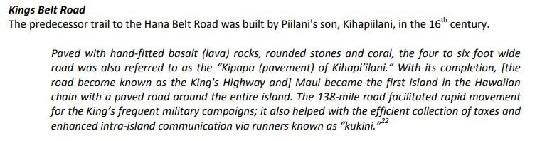
The predecessor to Honoapiilani Highway is the King's Highway. During the 16th Century a 138-mile belt road known as the King's Highway was constructed around the island perimeter under the direction Maui King Kiha-a-Piilani. King's Highway was the paved with hand fitted lava rocks and was the first perimeter road on any Hawaiian Island. King's Highway was four to six feet wide and was intended to facilitate rapid foot travel around Maui.
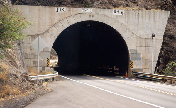
Honoapiilani Highway was the recipient of the first dedicated highway tunnel in Hawaiian Islands. During 1951 the 318-foot long Olowalu Tunnel was constructed as a cutoff of to an older coastal alignment along Aalaloloa Pali. Much of the older alignments of Honoapiilani Highway between Olowalu and Maalaea ran along the coastal cliffs similar to Kahekili Highway. The Olowalu Tunnel and a partially reconstructed Honoapiilani Highway can be seen on the 1954 United States Geological Survey map of Maalaea.
The portals of Olowalu Tunnel can be observed in two close-up photos on hawaiihighways.com:
The Island of Maui seemingly was not part of the original World War II era Hawaii Route System. Circa 1955 the United States Bureau of Public Roads renumbered the Hawaii Route System. The 1955 Hawaii Route Renumbering saw most of the conventions utilized by the current Hawaii State Route System established. Primary Hawaii Routes were given two-digit numbers whereas Secondary Hawaii Routes were given three-digit numbers. The Hawaii Routes were assigned in sequence for what Island/County they were located on coupled with what Federal Aid Program number they were tied to. In the case of the Island of Maui it was assigned numbers in the range of 30-40.
Hawaii Route 30 was assigned over the entire corridor of Honoapiilani Highway and a small segment of High Street in Wailuku. Hawaii Route 30 can be seen on the
1959 Gousha Highway Map of Hawaii. Notably Hawaii Route 30 can be seen terminating at Hawaii Route 33/Kahekili Highway at Honokahau Bay.
During the 1960s the Hawaii Route System was simplified, and numerous minor routes were shed from the State inventory. According to hawaiihighways.com Hawaii Route 33 on North Market Street and Kahekili Highway to Waiehu Beach Road were redesignated as Maui County Route 330 during 1968. The remaining portion of Kahekili Highway was redesignated as Hawaii Route 340 to Camp Maluhia and Maui County Route 340 to Honokohau Bay. Kahekili Highway between Keawalua to Honokohau Bay was added back into the Hawaii State Highway System as an extension of Hawaii Route 30 sometime after 1981 or possibly 1994 according to hawaiihighways.com.
By 1986 Hawaii Route 30 form Mile Marker 26 near Kaanapali to Mile Marker 31 near Honokohau Bay was moved to a new alignment. The older alignment of Hawaii Route 30 between Kaanapali and Honokohau Bay was renamed as Lower Honoapiilani Road.
During April 2009 Phase 1A of the Lahaina Bypass broke ground between Lahainaluna Road to Keawe Street. Phase 1A of the Lahaina Bypass opened during March 2013 as Hawaii Route 3000. The next phase of the Lahaina Bypass opened south to Hokiokio Place opened during December 2013. Phase 2 of the Lahaina Bypass from Hokiokio Place south Launiupoko and Olowalu opened to traffic during
2018. A further northern extension of the Lahaina Bypass north from Keawe Street is being considered by the Hawaii Department of Transportation.
The Lahaina Bypass is the only highway on Maui which features true elements of limited access. Numerous Hawaii Department of Transportation construction photos of the Lahaina Bypass during the 2012-2013 era can be observed below:
Part 2; Hawaii Route 30 and the Lahaina Bypass from the air
From inbound flights to Kahului Airport much of Hawaii Route 30/Honoapiilani Highway and Hawaii Route 3000/Lahaina Bypass west of the West Maui Mountains can be observed. At the bottom of the below photo the east portal of the Olowalu Tunnel along with numerous older/abandoned cliff-side segments of Honoapiilani Highway can be seen. The branching paths of Hawaii Route 30/Honoapiilani Highway and Hawaii Route 3000/Lahaina Bypass can be observed at the top of the photo.
Part 3; Hawaii Route 30 east of the West Maui Mountains
Hawaii Route 310/North Kihei Road terminates at Hawaii Route 30/Honoapiilani Highway on the eastern flank of the West Maui Mountains. Traffic heading to Wailuku is advised the community is 5 miles away on Hawaii Route 30.
Hawaii Route 30/Honoapiilani Highway heads northward and intersects Hawaii Route 380.
Hawaii Route 30/Honoapiilani Highway continues north and intersects Maui County Route 305 at Waiko Road.
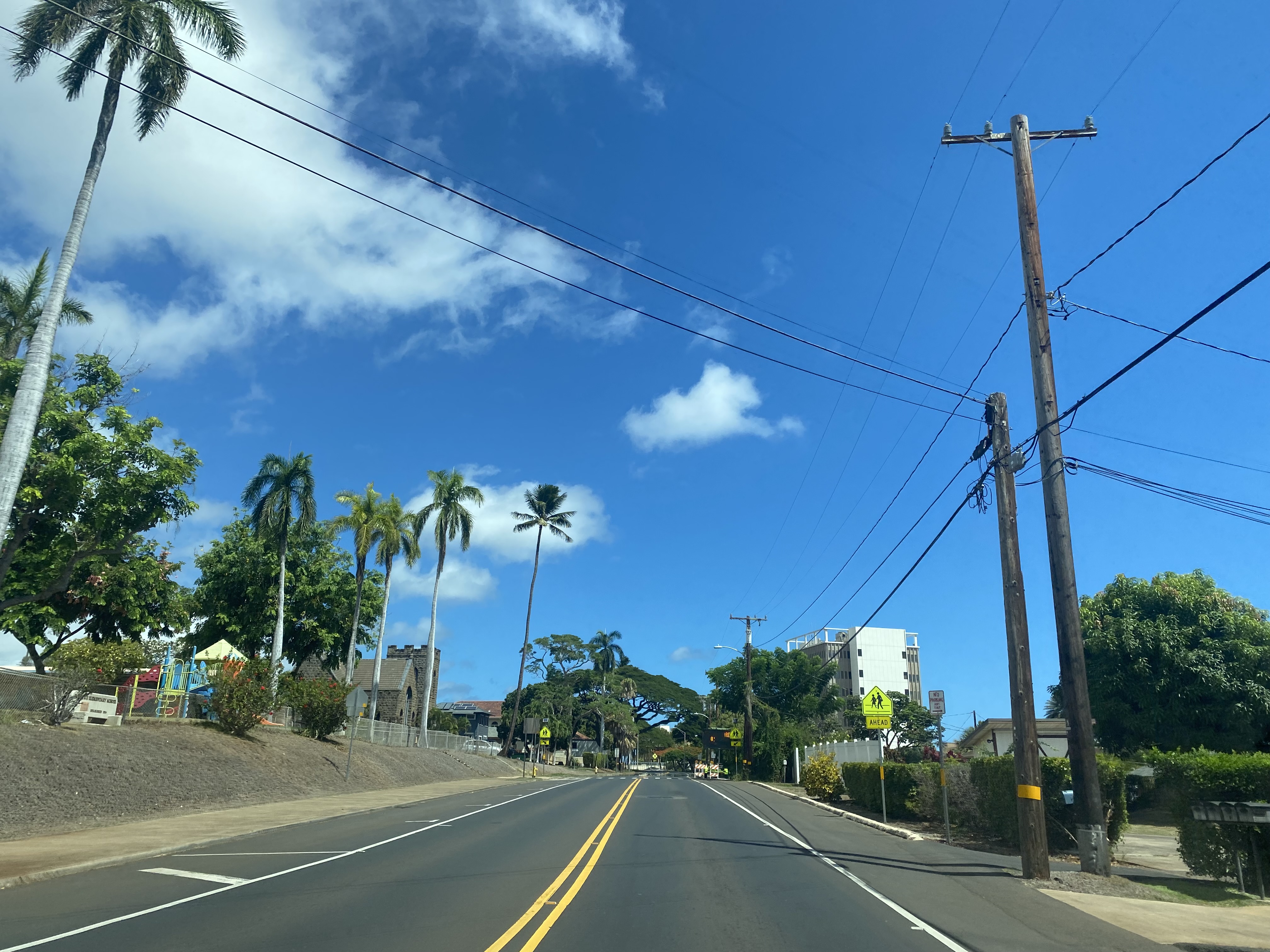
Hawaii Route 30 continues north and enters Wailuku on High Street. At Wells Street, Hawaii Route 30 intersects Hawaii Route 32 Bypass.
Hawaii Route 30 terminates at Main Street in Wailuku. Traffic heading east transitions on Hawaii Route 32 whereas traffic heading west to Iao Valley transitions onto unsigned Maui County Route 320.


Comments