Piilani Highway is a 30.6-mile disconnected highway which is comprised of Hawaii Route 31 and Maui County Route 31. The state-maintained portion of Piilani Highway is 7.2-miles long beginning at Hawaii Routes 310 and 311 in Kihei. The Hawaii Route 31 portion of Piilani Highway ends in Wailea at Wailea Ike Drive and does connect to Maui County Route 31. The Maui County Route 31 portion of Piilani Highway begins at the southern terminus of Hawaii Route 31/Kula Highway and follows the southeastern shore of Maui 23.4 miles to the beginning of Hana Highway at Kalepa Gulch. The Maui County Route 31 portion of Piilani Highway is one of the oldest roads on Maui and is noted for being comprised almost entirely of one-lane highway.
Part 1; the history of Piilani HighwayPiilani is named in of honor the first Ali'nui (roughly "King" in English) of Maui. Piilani was the first ruler to unite the entire Island of Maui under one king. Piilani's son Kiha-a-Piilani would go on to form much of the conceptual basis of Piilani Highway and Hana Highway.
During the 16th Century a 138-mile belt road known as the King's Highway was constructed around the island perimeter under the direction Maui King Kiha-a-Piilani. King's Highway was the paved with hand fitted lava rocks and was the first perimeter road on any Hawaiian Island. King's Highway was four to six feet wide and was intended to facilitate rapid foot travel around Maui.
The King's Highway and Piilani Highway from Makena east to Kalepa Gulch largely seem to be referring to the same general corridor. A primitive road connecting Makena to Hana via Kalepa Gulch appears on the
1906 F.S. Dodge Map of Maui.
Between 1908-1926 Hana was connected to Wailuku and Kahului during the construction of Hana Highway. Hana Highway was opened to Hana on December 18, 1926, following a procession of 200 cars. Hana Highway would continue to be modernized into the 1930s and formed a belt road around eastern Maui coupled with Piilani Highway.
Originally Piilani Highway did not have bridges as the route it inherited from the King's Highway was built as a foot path. \The completion of the Alalele and Kalepa Bridges during 1937 connected Hana Highway to Piilani Highway at Kalepa Gulch. A log inventory of bridges along the State and Maui County portions of Hana Highway can be found on hawaiihighways.com
here.
The Island of Maui seemingly was not part of the original World War II era Hawaii Route System. Circa 1955 the United States Bureau of Public Roads renumbered the Hawaii Route System. The 1955 Hawaii Route Renumbering saw most of the conventions utilized by the current Hawaii State Route System established. Primary Hawaii Routes were given two-digit numbers whereas Secondary Hawaii Routes were given three-digit numbers. The Hawaii Routes were assigned in sequence for what Island/County they were located on coupled with what Federal Aid Program number they were tied to. In the case of the Island of Maui it was assigned numbers in the range of 30-40.
Hawaii Route 31 be seen on the 1959 Gousha Highway Map of Hawaii. Hawaii Route 31 can be originating at Hawaii Route 30/Honoapiilani Highway near Maalaea and terminating at Hawaii Route 36 in Hana.
Hawaii Route 31 can be seen following the below alignment on the 1959 Gousha Highway Map:
- North Kihei Road to South Kihei Road.
- South Kihei Road to Makena Road.
- Makena Road through a once public road to the junction of Hawaii Route 37/Kula Highway and Piilani Highway.
- Piilani Highway to Hana Highway at Kalepa Gulch.
- Hana Highway to Keawe Place and Hawaii Route 36 in Hana.
The 1955 Hawaii Route System was applied with little regard to if the territory or counties maintained the actual roadways. After Hawaii became a state the Hawaii Route System would be simplified through the 1960s. Mileage not maintained by the State of Hawaii was subsequently spun off into Maui County Routes. The County Route shields of Hawaii functionally are the same as the Hawaii Route Spade.
According to hawaiihighways.com, much of Makena Road from Makena east to the junction of Kula Highway/Piilani Highway was recommended for inclusion into the State Highway System during
1967. The corridor of Makena Road was never adopted by the State of Hawaii which led to a gap between Hawaii Route 31 and Maui County Route 31 when the segment was closed during 1984 due to liability concerns.
According to hawaiihighways.com during 1961 North Kihei Road was proposed to be reassigned as Hawaii Route 310. The proposed Hawaii Route 310 corridor included a proposed State Highway connection with the Maui County Route 31 portion of Piilani Highway. The proposed extension of Piilani Highway was shown to turn inland eastward from Keawakapu Beach.
The state-maintained portion of Piilani Highway on Hawaii Route 31 opened in stages according to hawaiihighways.com. The first segment of the state-maintained portion of Piilani Highway opened between Hawaii Route 310/North Kihei Road during April 1981. The state-maintained portion of Piilani Highway south to Wailea Ike Drive was completed by June 1990. The current state-maintained portions of Piilani Highway shifted the corridor of Hawaii Route 31 east from South Kihei Road.
During March 2022 a Hawaii Department of Transportation roundabout project on Piilani Highway at Kulanihakoi Street broke ground. Said roundabout project will provide access from Hawaii Route 31 to a new high school and is anticipated to be completed by January 2023. The Kulanihakoi Street roundabout is located near the planned junction of Hawaii Route 374 and Hawaii Route 31 at Kaonoulu Street. Planned Hawaii Route 374 if constructed would provide direct access to from Kihei to Pukalani and Hawaii Route 37/Haleakala Highway.
Part 2; a drive on the Hawaii Route 31 portion of Piilani Highway
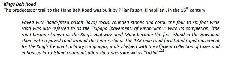
From the terminus of Hawaii Route 310/North Kihei Road the Hawaii Route 31 portion of Piilani Highway begins with a right-hand turn.
Hawaii Route 31/Piilani Highway passes through Kihei and the Kulanihakoi Street project zone.
Hawaii Route 31/Piilani Highway continues southward into Wailea-Makena.
The Hawaii Route 31 portion of Piilani Highway terminates at Wailea Ike Drive.
Part 3; exploring former Hawaii Route 31 on South Kihei Road
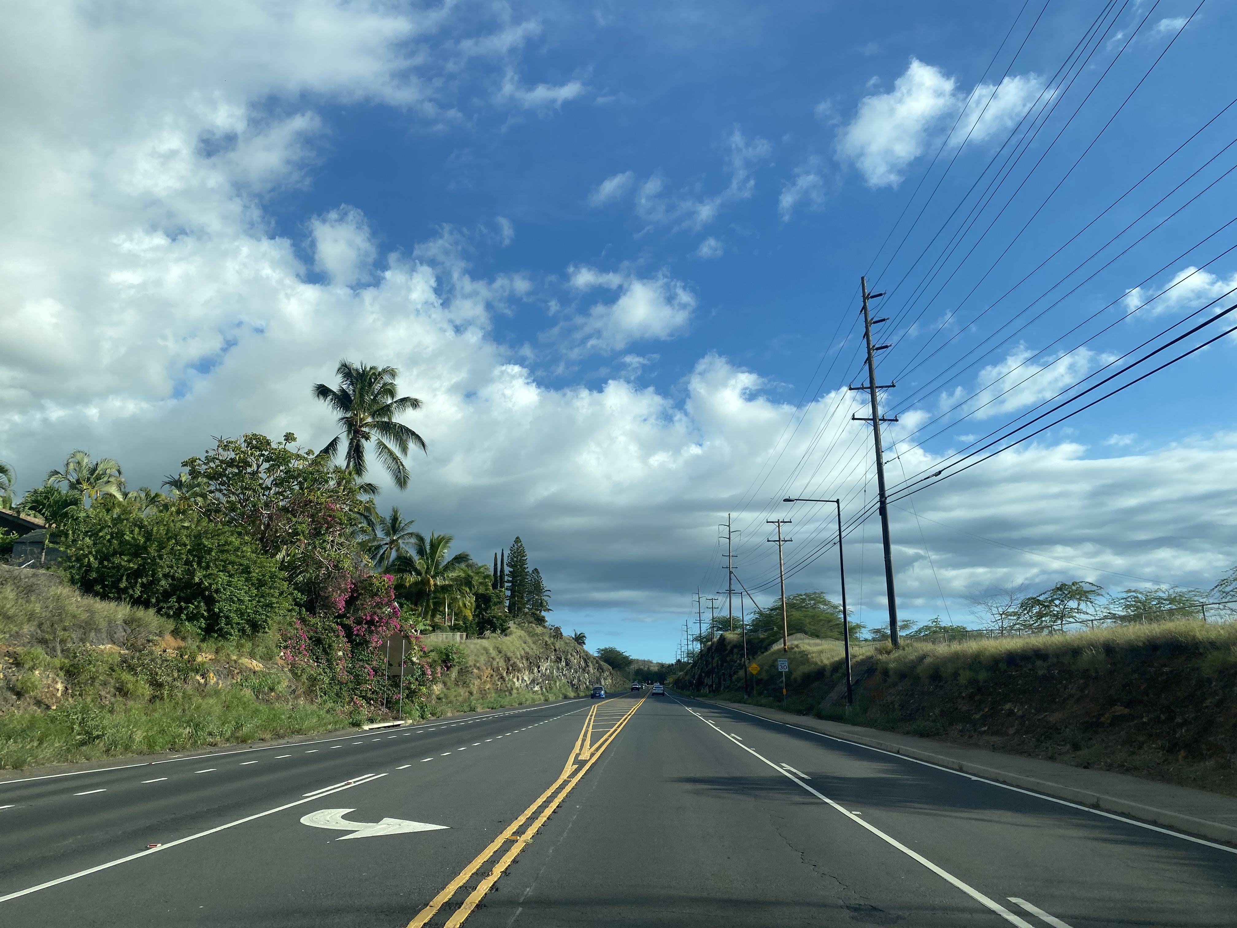
The former portions of Hawaii Route 31 on South Kihei Road are now lined by businesses and resorts. The Molokini Crater and Island of Kahoolawe are easily observed from the beaches on South Kihei Road. The below views are from Kamaole Beach Park facing southwest from South Kihei Road. Molokini Crater is thought to have erupted approximately 230,000 years ago. Kahoolawe is the smallest of the eight main Hawaiian Islands. Kahoolawe historically has been historically very dry and hosted a small population of Hawaiians until the 1940s. Kahoolawe and Molokini Crater were both once used as Naval munition and training grounds.
Numerous Maui County sourced Hawaii Route 31 shields can be found on the evacuation signs along South Kihei Road which direct traffic to the state-maintained portion of Piilani Highway.
Several HDOT spec Hawaii Route 31 shields can also be found on South Kihei Road directing traffic to the state-maintained portion of Piilani Highway.
Kihei and South Kihei Road are among the most popular tourist districts on Maui. Numerous food truck events and even car shows are a common occurrence on South Kihei Road.
Part 4; the County Route 31 portion of Piilani Highway
Contrary to popular belief to my knowledge no rental car agency prohibits travel on the Maui County Route 31 portion of Piilani Highway. The perception seems to come from the fact that Maui County Route 31 has some one-lane dirt over broken asphalt segments which are prone to landslides. Aside from Hana Highway I was most looking forward to driving the Maui County Route 31 portions of Piilani Highway on my 2022 trip. Unfortunately, upon my arrival in Maui I learned that the Maui County Route 31 portion of Piilani Highway between Mile Markers 31-38 was closed due to a large landslide. Suffice to say having to turn around in Hana to backtrack to Kahului via Hana Highway was quite a disappointment.
Below two links pertaining to the Maui County Route 31/Piilani Highway photo pages can be found on hawaiihighways.com.


Comments