
NC by Train has a record 2022 - but further expansion still years away

North Carolina's passenger rail system had a record year in 2022.  Quickly bouncing back from the drastic drop in ridership during the Covid-19 pandemic, the Raleigh-to-Charlotte service saw a record of over 522,000 riders in 2022.  The four-times daily route (three on the Piedmont service and one on the Carolinian that continues to New York City) also had a record-breaking month of 55,493 travelers in October.  The overall ridership numbers within the state do not include passengers that utilized stations on other intercity lines that run through the state. (Silver Star, Crescent, Palmetto, and Silver Meteor)

A Southbound Piedmont Train approaches the Durham Train Station.  More riders used the NCDOT-sponsored Piedmont service in 2022 than any other year prior.

NC by Train celebrated the completion of the first phase of Charlotte's Gateway Station.  The first test runs to the Uptown Charlotte station occurred in November.  The new station will not be ready for passenger rail until at least 2025.  The City of Charlotte is responsible for completing the station lobby, ticketing areas, and platform canopy.  When completed, passengers will be able to disembark in Uptown Charlotte with transit connections to Charlotte's Gold Line street car.

While North Carolina can rightfully celebrate a growing ridership base - the eventual expansion of the intercity rail network within the state is still years away.

Charlotte Gateway Station and additional Piedmont Trips:

Gateway Station's full operation will be the key to the next expansion in North Carolina's rail service.  When the new station opens, North Carolina will most likely add a fourth trip of the Piedmont, increasing service to five daily round trips between Raleigh and Charlotte.

Today, the Charlotte Amtrak Station is located at an outdated and undersized former Southern Railways Station on North Tryon Street, approximately 1.5 miles from Uptown.  It lacks parking and good transit connections.  The Lynx Blue Line is nearby but constitutes crossing over multiple railroad tracks, which obviously is not allowed.

The new station will most likely be an immediate success. Located in Uptown Charlotte, the new station will be within walking distance of Truist Park and Bank of America Stadium.  With the NFL Panthers and MLS Charlotte FC both playing at Bank of America Stadium - the new station will allow for longer-distance fans (Greensboro and Raleigh) easy travel to the Queen City on game days.  The connection to the Lynx Gold Line will provide direct access to the Spectrum Center (home of the NBA's Hornets) for concerts, basketball, and other events.

The current timetable for the Raleigh-Charlotte service is below. (As of March 2023)

TrainLeave RaleighArrive CharlotteTrainLeave CharlotteArrive Raleigh
Piedmont 736:30 am9:40 amCarolinian 806:45 am10:05 am
Piedmont 7510:00 am1:10 pmPiedmont 7410:30 am1:41 pm
Piedmont 773:00 pm6:10 pmPiedmont 763:15 pm6:26 pm
Carolinian 795:30 pm8:56 pmPiedmont 787:00 pm10:11pm

With the most likely addition of a fifth train service between the two cities, I wonder where that would fit. A noon service from Raleigh or Charlotte with a later evening route as the return?   Or does the state go all in and increase to six, seven, or eight daily trips leaving every two hours.  As 2025 gets closer, this will come into a better picture.

The S-Line and Southeast High-Speed Rail:

Slowly but surely, both North Carolina and Virginia have been putting together the puzzle pieces to make the Raleigh to Richmond Southeast HSR connection a reality.  A big step occurred in 2022 when both states received a $58 million grant to begin preliminary engineering on rebuilding and returning the S-Line from Raleigh to Richmond into service.

While NCDOT is optimistic about possible service beginning between 2025-29, when completed, this will be the first significant trackage expansion in the North Carolina passenger rail system.  NC has been moving forward with a transit-development study along 95 miles of the S-Line corridor from Sanford in the south to Norlina.  The study also includes the communities of Apex, Wake Forest, Youngsville, and Henderson.  

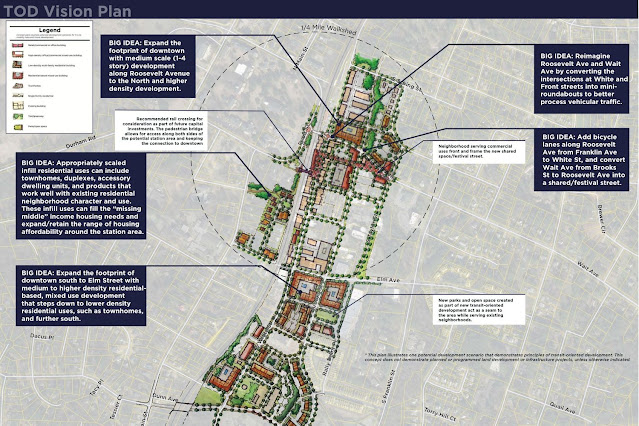
Transit-Oriented Development Plan for Downtown Wake Forest - Town of Wake Forest

While this study does not appear to discuss specific station locations - it is a good guess that new stops in Apex, Wake Forest, Sanford, Youngsville, Henderson, and Norlina are under consideration.   Sanford and Wake Forest are already preparing for a return of passenger rail service to their communities.

Eastern and Western Rail Expansions:

2022 was a quiet year for NC rail expansion to Wilmington to the east and Asheville to the west.  There was not much news in either direction.  And with the state currently focused on the S-Line completion north of Raleigh, I don't expect anything to move forward for either proposal until after 2030.

Commuter Rail - Raleigh:

In 2019, Duke University killed GoTriangle's plan for light rail between Durham, Raleigh, and Chapel Hill.  Since then, the Triangle's loosely constructed transit organization has focused on Bus Rapid Transit (BRT) and a possible commuter rail from Garner and Clayton north and west to Durham.

The station plan for the Triangle Commuter Rail proposal.  Future extensions are the thinner lines.  (GoTriangle)

GoTriangle has completed a feasibility study for commuter rail.  The study split the Durham to Garner route into three sections (Western, Central, and Eastern).  Although there is no timeline on when construction would begin, the study estimated anywhere from 8-12 years to complete depending on the section.  Further expansion east into Johnston County towards Clayton would require additional funding.  Additionally, continuing the train north and west beyond Ellis Road into Downtown Durham currently exceeds any of Durham County's transit budget.

Utilization of the S-Line work from Apex to Wake Forest is a later stage of the project - projected to be sometime after 2050.  In Wake Forest's transit-oriented development plan, three stations are considered in the area - Capital Boulevard near Index Drive, Downtown Wake Forest, and Youngsville.  Although I do not believe all three will be built when the S-Line starts service, my guess is that either the Capital Blvd. or Downtown Wake Forest station will be the first constructed.

However given GoTriangle's history with other rail projects - it is most likely that commuter rail in the Triangle area will be the solution that is just around the corner but never happens.

Commuter & Light Rail - Charlotte:

With Norfolk Southern having no intention of allowing commuter trains to share its O-Line north of Charlotte, the Red Line paralleling Interstate 77 and running north into Huntersville, Davidson, and Mooresville remains stuck in Purgatory.  However, this past October, Charlotte Area Transit System (CATS) allocated $5 million to continue advancing the project with updated designs and corridor reviews. All while CATS continues to attempt to persuade NS to change their mind.

Meanwhile, CATS continues to work towards initiating construction on the Silver Line.  The Silver Line will be a 31-mile east-west light rail transit line running from Matthews west to Belmont.  Recently, CATS leadership has decided to move forward with the Locally Preferred Alternative, which will route the Silver Line along the northern perimeter of Uptown Charlotte and connect to Gateway Station before heading west toward Charlotte-Douglas International Airport.

CATS hopes that the $8.1 billion project will see its first phase - east towards Matthews - under construction by 2030 and in operation by 2036.

Lost in the rail discussion in Charlotte has been utilizing a commuter rail corridor to the west. This corridor would parallel Interstate 85 west of Charlotte running through Belmont, Gastonia, and Kings Mountain.  Some discussions and initial studies started in 2019, but any additional news on this corridor has been quiet since.


Comments

Dumboldboy said…
What a difference 2 months makes. The Gateway is almost complete and Amtrak station personnel schedules are getting re-configured. I would not be surprised if the fifth pair of Piedmont's is rolling by summer's end.
Dumboldboy said…
clarification: 5th round trip including Carolinian

Popular posts from this blog

Hawaii Route 8930

Hawaii Route 8930 is a 2.5-mile State Highway on the Island of O'hau.  Hawaii Route 8930 is aligned over Kualakai Parkway over the course of its entire alignment south from Interstate H-1 to Kapolei Parkway.  Hawaii Route 8930 is one of the newest Hawaii Routes only having been completed during 2010.   This page is part of the Gribblenation O'ahu Highways page.  All Gribblenation and Roadwaywiz media related to the highway system of O'ahu can be found at the link below: https://www.gribblenation.org/p/gribblenation-oahu-highways-page.html Part 1; the history of Hawaii Route 8930 The history of Hawaii Route 8930 is brief given it is a modern facility.  Hawaii Route 8930 and what was known as "North-South Road" were built to facilitate the developing areas of Kapolei on western O'ahu.  According to hawaiihighways.com the first stage of Hawaii Route 8930 was completed from Kapolei Parkway north to Farrington Highway as a four-lane highway during November...

Former US Route 50 and the Pioneer Route Lincoln Highway on Johnson's Pass Road

Johnson's Pass Road is one of the oldest highway corridors in California.  Johnson's Pass was part of the Lake Tahoe Wagon Road as it was completed during 1856 over the Sierra Nevada.  The pass would later be incorporated into the Pioneer Branch of the Lincoln Highway in 1913 and US Route 50 in 1926.  Johnson's Pass Road would be bypassed by a new alignment of US Route 50 over Echo Summit in 1938.  A replacement of the Meyers Grade east of Johnson's Pass would be opened to traffic in 1947.   Johnson's Pass Road remains accessible to traffic and is still signed by the Lincoln Highway Association.  Pictured as the blog cover is the view from the top of Johnson's Pass Road overlooking modern US Route 50 and Lake Tahoe.   Part 1; the history of Johnson's Pass Much of the history of what become the Lake Tahoe Wagon Road is discussed in the  September 1950 California Highways & Public Works  during its Centennial Edition.  The or...

Old NC 10 - The Central Highway: Old Fort to Black Mountain through the Royal Gorge

A unique way of tracing the remnants of the Central Highway is through the mountainous terrain of Eastern Buncombe and Western McDowell Counties.  From the east on US 70, you reach the base of Blue Ridge Mountains at the town of Old Fort.  Old Fort is a tiny rail town that the old Central Highway and now US 70 goes through.  The Central Highway can be followed via a right onto Mill Creek Road from US 70.  Follow the highway as it takes you closer to the mountains.  When Mill Creek Road bears right to head towards Andrews Geyser stay straight until the road ends at a gate.  The nearby Piney Grove Church can be used for parking.  At this point, the old Central Highway began a 3.5 mile climb of the mountain to Swannanoa Gap.  NC 10 and later US 70 travelers followed this road for over 30 years until a new and modern four lane US 70 was built to the south.  This same four lane road would eventually become Interstate 40.    The Centra...