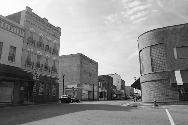
Small Towns of Virginia Series: Lawrenceville


Lawrenceville serves as the seat of government and the agricultural and industrial hub of rural Brunswick County.  Though the home of the county courthouse since 1783, the Town of Lawrenceville did not form until 1814 and did not incorporate until 1874.

The Albertis S. Harrison, Jr Courthouse opened in 1999.

It is believed that the town's name came from a racehorse named Lawrence, who was owned by a wealthy landowner who had built a nearby racetrack in the late 1700s.  For most of the 1800s, Lawrenceville sat at the intersection of two stagecoach lines.  The town would later prosper when the Atlantic and Danville Railroad established its shops here.  Today, Downtown Lawrenceville is listed in the National Register of Historic Places

It was in 1888 that a former slave, James Solomon Russell, established what would become known as Saint Paul's College.  The historically black institution was affiliated with the Episcopal Church and first focused on teaching and agricultural and industrial careers.  By the 1940s, the school began offering four-year degrees and grew to include the liberal arts.  Unfortunately, the school closed in 2013, and nearly all of the former 183-acre campus sits abandoned.


A trip to Lawrenceville or Brunswick County would not be complete without some Brunswick Stew.  The tomato-based stew that includes beans, vegetables like corn and okra, and typically chicken or even rabbit is a way of life here.  The Taste of Brunswick Festival - held every October - has a Brunswick Stew cookoff plus other traditional festival activities.

Site Navigation:

Sources & Links:

How To Get There:

Comments

Popular posts from this blog

The history of US Route 80 and Interstate 8 in California

The historic corridor of US Route 80 and Interstate 8 through the borderlands of southern California share a largely mutual history.  Both highways originated in the city of San Diego and departed the state at the Colorado River into Yuma, Arizona.  Both highways share numerous famous geographical components such as the Mountain Springs Grade and Algodones Sand Dunes.  This article serves as a comprehensive history of the combined US Route 80/Interstate 8 corridor in California from the tolled stage route era of the nineteenth century to the development of the modern freeway.   The blog cover photo features US Route 80 along the Mountains Springs Grade through In-Ko-Pah Gorge during late 1920s.  This photo is part of the Caltrans McCurry Collection. Part 1; the history of US Route 80 and Interstate 8 in California US Route 80 and Interstate 8 in California share a largely mutual history.  The backstory of both highways is tied heavily to the corridors of the Old Spanish Trail, Legisl

The Central Freeway of San Francisco (US Route 101)

The Central Freeway is a 1.2-mile elevated limited access corridor in the city of San Francisco.  As presently configured the Central Freeway connects from the end of the Bayshore Freeway to Market Street.  The Central Freeway carries the mainline of northbound US Route 101 from the Bayshore Freeway to Mission Street. The Central Freeway has origins with the establishment of Legislative Route Number 223 and is heavily tied to the history of the once proposed Panhandle Freeway.  The Central Freeway between the Bayshore Freeway and Mission Street was completed during 1955.  The corridor was extended to a one-way couplet located at Turk Street and Golden Gate Avenue in 1959 which served to connect US Route 101 to Van Ness Avenue.  The Central Freeway was damaged by the 1989 Loma Prieta Earthquake and has since been truncated to Market Street.   The Central Freeway as pictured on the blog cover was featured in the May/June 1959 California Highways & Public Works.  The scan below is fro

The Bayshore Freeway (US Route 101)

The Bayshore Freeway is a 56.4-mile component of US Route 101 located in the San Francisco Bay Area.  The Bayshore Freeway connects the southern extent of San Jose to the Central Freeway in the city of San Francisco.  The corridor was originally developed as the Bayshore Highway between 1923 and 1937.  The Bayshore Highway would serve briefly as mainline US Route 101 before being reassigned as US Route 101 Bypass in 1938.  Conceptually the designs for the Bayshore Freeway originated in 1940 but construction would be delayed until 1947.  The Bayshore Freeway was completed by 1962 and became mainline US Route 101 during June 1963.   Part 1; the history of the Bayshore Freeway Prior the creation of the Bayshore Highway corridor the most commonly used highway between San Jose and San Francisco was El Camino Real (alternatively known as Peninsula Highway).  The  American El Camino Real  began as an early example of a signed as an Auto Trail starting in 1906.  The era of State Highway Mainte