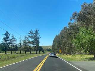
Old Sonoma Road is an approximately five-mile highway located in the Mayacamas Mountains of western Napa County. The roadway is part of the original stage road which connected Napa Valley west to Mission San Francisco Solano as part of El Camino Real. Much of Old Sonoma Road was bypassed by the start of the twentieth century by way of Sonoma Highway. A portion of Old Sonoma Road over the 1896 Carneros Creek Bridge (pictured as the blog cover) was adopted as part of Legislative Route Number 8 upon voter approval of the 1909 First State Highway Bond Act. The 1896 Carneros Creek Bridge served as a segment of California State Route 37 and California State Route 12 from 1934 through 1954.
Part 1; the history of Old Sonoma Road
Old Sonoma Road has origins tied to the formation of Mission San Francisco Solano and the Spanish iteration of El Camino Real. Mission San Francisco Solano was founded as the last and most northern Spanish Mission of Alta California on July 4, 1823. The new Mission was plotted amid the Mexican War of Independence and would solidly be under control of the then new country by the 1830s. The city of Sonoma would be founded at the site of Mission San Francisco Solano during 1835. The city of Napa would be plotted in Napa Valley during 1847 during the Mexican-American War.
Mission San Francisco Solano and Sonoma were connected to Napa Valley by a stage road over the Mayacamas Mountains which was part of El Camino Real north of San Francisco Bay. During the period of early American statehood in California the major stage roads used the highways inherited from Mexican Alta California. Sonoma and Napa were both assigned as the initial seats of their namesake counties in 1850. Sonoma County and Napa County were both original counties in the state of California.
Sonoma Road between Napa and Sonoma can be seen on the 1857 Britton & Rey's Map of California.
Sonoma Road can be seen in greater detail connecting Napa west to Sonoma on the 1882 Bancroft's Map of California. Sonoma Road originated near downtown Napa jogging west of Jefferson Street through the Mayacamas Mountains towards Carneros Creek.
The 1902 United States Geological Survey Map of Napa reveals Napa County had constructed Sonoma Highway which bypassed the southern hills of the Mayacamas Mountains. Sonoma Highway is shown to originate from what is now Old Sonoma Road near downtown Napa departing south through Entre Napa. Sonoma Highway is shown turning west through Rincon De Los Carneros and consolidating with Sonoma Road near the 1896 Carneros Creek Bridge.
The 1909 First State Highway Bond Act would be approved by state voters in 1910. The bond measure formed the basis for a large percentage of the modern State Highway System. Legislative Route Number 8 would be defined as "Ignacio to Cordelia via Napa." The new state highway would incorporate the 1896 Carneros Creek Bridge and Sonoma Highway into Napa. This alignment can be seen (red line) on the 1917 California State Automobile Association Map.
Sonoma Highway would be announced as part of California State Route 37 and California State Route 12 in the August 1934 volume of California Highways & Public Works.
California State Route 37/California State Route 12 can be seen using Sonoma Highway to bypass Old Sonoma Road towards the 1896 Carneros Creek Bridge on the 1935 Division of Highways Map of Napa County.
The November/December 1954 California Highways & Public Works announced a contract to replace the 1896 Carneros Creek Bridge had been awarded the previous August. The new Carneros Creek Bridge project included a realignment of California State Route 37 bypassing the older structure and part of Sonoma Highway.
As part of the 1964 State Highway Renumbering California State Route 37 was shifted south to Sonoma Road on San Pablo Bay. The multiplex of California State Route 12 west of Napa to the Sonoma County line was joined with the then newly designated California State Route 121. California State Route 12 and California State Route 121 still utilize the Carneros Creek Bridge constructed in 1954.
Part 2; a drive on Old Sonoma Road
Pictured is a series of photos from the western city limit of Napa through Mayacamas Mountains to Old Sonoma Highway. As noted in part one Old Sonoma Highway west over the 1896 Carneros Creek Bridge was part of the State Highway System through 1910-1954.
The Carneros Creek Bridge features a placard which denotes it was constructed in 1896.
Old Sonoma Road has a western terminus at modern California State Route 12 and California State Route 121.


Comments