
Pictured as the blog cover is eastbound Jefferson Avenue in the Detroit neighborhood of Delray. Jefferson Avenue in this neighborhood was once part of the eastern branch of the Dixie Highway in Michigan. The neighborhood has been called "the closest thing to a ghost town within a city" by the Detroit Metro Times.
Largely missed in the road community hubbub about the construction of the Gordie Howe Bridge is the project consuming much of what was left of Delray. The neighborhood was once an incorporated town (incorporated in 1897) prior to being annexed by Detroit in 1906. The neighborhood was plotted as Belgrade in 1836 and assumed the name it has now in 1851. Delray reached a peak population of approximately 24,000 residents by 1930 and had a large Hungarian populace. The neighborhood was known for being home of numerous heavy industries which were located near the confluence of River Rouge and the Detroit River. A wastewater treatment plant built in 1940 consumed large portions of the neighborhood which signaled the beginning of a rapid population decline.
During the 1969 the Detroit City Planning Commission elected to zone future development in Delray for industrial purposes only. A mock funeral was held for the neighborhood in 1975. By the turn of the century, it was found to have approximately 3,100 remaining residents.
In 2013 Delray was chosen as the site for the construction of the Gordie Howe Bridge. Construction of the plaza facility saw eminent domain declared for all the properties bounded by the Michigan Southern Railway tracks, Post Street, Jefferson Avenue and Campbell Street. Much of the American side of the Gordie Howe Bridge was constructed over abandoned industrial properties between Springwells Court and Zug Island Road.
The history of the neighborhood of Delray (by Challenger Tom)
Construction of the Gordie Howe Bridge has consumed much of the Detroit neighborhood of Delray. Delray probably has seen the greatest decline of any neighborhood in Detroit during the last seven decades. The neighborhood was called "the closest thing to a ghost town within a city" in an October 21, 2009, Detroit Metro Times article. The neighborhood has no official boundaries but is generally considered to be bounded by River Rouge, Fort Street (M-85), the Detroit River and Clark Street.
Delray was plotted in 1836 as "Belgrade" in what was then Springwells Township of Wayne County. During the 1840s the Michigan Southern Railway would be constructed west from Detroit through the community. The emergence of railroad traffic and close proximity to the Detroit River ensured Belgrade would remain relevant as a commercial hub
During 1842 construction of the United States Army Fort Wayne would commence in Belgrade on the Detroit River. The fortification would be complete by 1851, and the community would be renamed as "Del Ray" by October 14 the same year. The name was suggested by local resident Augustus D. Burdeno in refence to a village he encountered during the Mexican-American War known as Molino del Rey.
On February 8, 1870, the community's name was anglicized to "Delray" when it received United States Post Office Service. Delray can be seen along Fort Street and the Detroit Division of Lake Shore & Michigan Southern Railway on the 1873 Walling Atlas of Wayne County.
Delray can be seen along the Detroit Division of Lake Shore & Michigan Southern Railway on the 1879 United States Postal Service map of Michigan and Wisconsin.
During 1889 Delray was the site of the Detroit International Exposition. The exposition was a combined agricultural and industrial fair which was intended to showcase the rising economical prominence of the Detroit area. The main Exposition building can be seen in an 1889 photo from the Jex Bardwell collection.
During the 1890s Delray would see a major influx of heavy industry. The Detroit International Exposition site was razed during 1895 by the Solvay Process Company to make way for a salt mine. Numerous other notable companies moved to the community such as the Malleable Iron Company, the Michigan Carbon Company and the Detroit Iron & Steel Company which operated a steel mill on Zug Island. Delray would incorporate as a village on October 26, 1897, at the time it had an approximate population of about 15,000.
The village of Delray can be seen bounded by River Rouge, Fort Street, Artillery Avenue (now Brady Street) and River Street (now Jefferson Avenue) on 1897 Rand McNally Map of Detroit. The city limit of Detroit is shown to extend west to Artillery Avenue.
The village Delray can be seen west of Detroit on the 1899 George Franklin Cram map of Michigan.
At the turn of the twentieth century Delray had become a hub for immigrants out of Eastern Europe. In particular it was known for having a large populace of Hungarian settlers. The community can be seen on the
1901 George Franklin Cram map of Detroit.

Despite a booming population Delray struggled with development of modern infrastructure and only had a single paved road. The community along with the village of Woodmere and a portion of Springwell Township were annexed into the city of Detroit on April 1, 1906.
The annexation increased the population of Detroit by approximately 20,000 residents. The city began to implement infrastructure improvements to modernize Delray. River Street was renamed as an extension of Jefferson Avenue.
During the Auto Trail era the highway corridor between Rockwood and downtown Detroit was part of the Eastern Dixie Highway in Michigan. The Dixie Highway was a concept of Lincoln Highway founder Carl G. Fisher and was organized during December 1914 in Chattanooga, Tennessee. What was intended to be originally a singular route between Chicago.
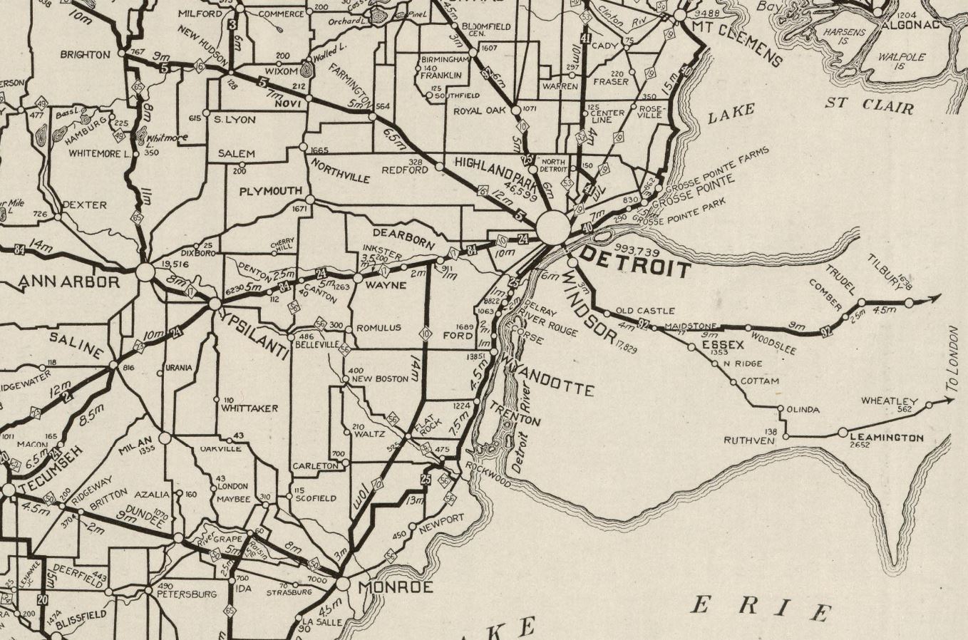
The Dixie Highway from Monroe utilized what is now signed as "Dixie Highway," U.S. Turnpike, Jefferson Avenue, Biddle Avenue and Jefferson Avenue via Delray to reach downtown Detroit. The 1924 Rand McNally Map displays the Monroe-Detroit routing of the Dixie Highway (25). The map also displays M-10 and M-17 entering Detroit via Oakwood Boulevard and River Rouge towards Fort Street.
Fort Street in Delray would become a component of M-17 when the original Trunkline Sign Route designations were announced in 1919. The community would continue to see an influx of heavy industry during the 1920s. Fort Street would become a segment of US Route 25 following the establishment of the US Route System by the American Association of State Highway Officials during November 1926. The neighborhood would reach a peak population of approximately 24,000 by 1930.
The decline in Delray began around 1940 when a wastewater treatment plant opened in the neighborhood. Construction of the plant led to the demolition of approximately 600 homes which reduced the population to approximately 20,000. Following World War II, the population began to leave for more upscale neighborhoods and the suburbs. By 1950 the population in the neighborhood had reduced to approximately 17,000 residents. More homes were demolished in 1957 to make way for an expansion to the wastewater treatment plant.
During the 1960s Delray was in a period of rapid decline. The situation was worsened by the increasing exodus of industry, suburban flight and worsening racial tensions in Detroit. In 1967 US Route 25 was truncated out of Michigan following the completion of Interstate 75 which saw Fort Street re-designated as part of M-85. Construction of Interstate 75 saw required right of way in Delray which led to the demolition of significant portions of residential property. During the 1969 the Detroit City Planning Commission elected to zone future development in Delray for industrial purposes only.
The January 11, 1970, Detroit Free Press reported on the worsening pollution and prospective grim future of Delray. The wastewater treatment plant was expanded again in 1974 which led to the demolition of another large swath of homes. The April 6, 1975, Detroit Free Press reported on local residents holding a mock funeral for Delray.
The May 30, 1983, Detroit Free Press reported that Delray had the highest rate of serious crime in all of Detroit's fifty-one neighborhoods. The General Motors Fleetwood body plant in the community would close in 1987 which led to the loss of approximately 3,000 jobs.
Delray was found to have only approximately 3,100 remaining residents as of the 2000 census. During 2009 U.S. Steel would impose layoffs at the Zug Island facility which saw another large round of jobs leave the neighborhood.
In 2013 Delray was chosen as the site for the construction of the Gordie Howe Bridge. Construction of the plaza facility saw eminent domain declared for all the properties bounded by the Michigan Southern Railway tracks, Post Street, Jefferson Avenue and Campbell Street. Much of the American side of the Gordie Howe Bridge was constructed over abandoned industrial properties between Springwells Court and Zug Island Road. During
2021 the city of Detroit offered eligible Delray residents impacted by the construction of the Gordie Howe Bridge up $20,000 for home repairs.
A drive along Jefferson Avenue in Delray (by Challenger Tom)
This may come as a surprise to Gribblenation readers who are used to my west coast centric road posts, but I am Detroit native. Visiting my home city is often a strange experience given much of the landscape resembles something I'd expect to see in an abandoned mining community out west. Delray in particular highlights the worst aspects of the dramatic decline I saw in Detroit when I was growing up. The neighborhood is equally as depressing as it is fascinating to observe in person.
Delray can be accessed from northbound Interstate 75 by way of Exit 44 onto Dearborn Street. The bridge over River Rouge offers a sweeping view of the neighborhood in addition to downtown Detroit.
Pictured is the terminus of Dearborn Street at Jefferson Avenue. The Gordie Howe Bridge can be seen looming above the ruined industrial building. The traffic light present here is probably no longer necessary.
Jefferson Avenue east of Dearborn Street is strewn with crumbling buildings and is largely devoid of people.
Jefferson Avenue crosses under the approach to the Gordie Howe Bridge east of Zug Island Road.
The Gordie Howe Bridge can be viewed at Delray Park which is at the end of Rademacher Street.
Downtown Detroit and the Ambassador Bridge can also be seen at Delray Park.
Delray Park itself is in rough shape and doesn't appear very park-like aside from the fishing stands on the Detroit River. The area is one of the few places one will find regular human presence in Delray.
The U.S. side plaza for the Gordie Howe Bridge can be observed facing north along Rademacher Street approaching Jefferson Avenue.
Fort Wayne can be found on Jefferson Avenue east of Rademacher Street. The Gordie Howe Bridge can be seen rising above the barracks buildings.
Jefferson Avenue continues east to Clark Street. Jefferson used to be continuous but is now bisected by an industrial lot.
Clark Street jogs north to M-85 at Fort Street and marks the boundary of Delray.


Comments