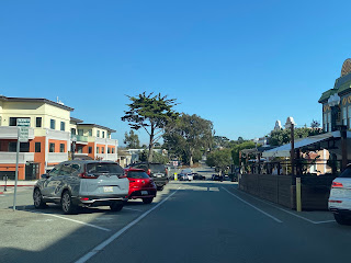
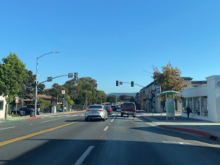
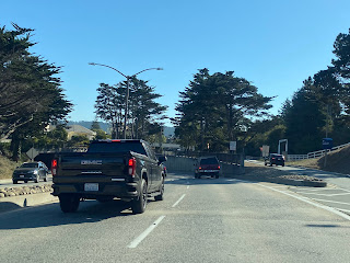
Lighthouse Avenue is an arterial street located on the Monterey Peninsula of California which serves the cities of Pacific Grove and Monterey. The corridor begins at Asilomar Avenue in Pacific Grove and extends approximately three miles east to Del Monte Avenue in downtown Monterey. Lighthouse Avenue is named after the 1855-era Point Pinos Lighthouse and was plotted in 1874. Originally the corridor ended in downtown Monterey at Pacific Street but was extended Del Monte Avenue via the Lighthouse Avenue Tunnel in 1967.
Part 1; the history of Lighthouse Avenue
Lighthouse Avenue is named in reference to the Point Pinos Lighthouse located at the end of the Monterey Peninsula. The lighthouse was lit on February 1, 1855, as a navigational aid for ships attempting to navigate the waters of Monterey Bay. The structure is stone basement design with a concrete tower. The light at Point Pinos is the oldest continually operating on the west coast of the United States and was automated in 1975. The structure was later added to the National Register of Historic Places in 1977.
In 1874 Lighthouse Avenue was plotted as the baseline street for the then new community of Pacific Grove. The then new roadway served the dual function of permitting supplies to be hauled easily overland from Monterey to Point Pinos Lighthouse. Pacific Grove was formally founded in 1875 and would incorporate as a city on July 9, 1889.
As originally configured Lighthouse Avenue had an eastern terminus at Pacific Street in downtown Monterey. This became a choke point for traffic commuting through downtown westward towards Cannery Row, New Monterey and the Presidio of Monterey.
The original configuration of Lighthouse Avenue can be seen on the 1928 Hotel Del Monte map of the Monterey Peninsula.
During 1967 Lighthouse Avenue was extended east through downtown Monterey underneath Monterey State Historic Park to Del Monte Avenue via the Lighthouse Tunnel. Said tunnel is a cut and cover design which avoided disrupting the many historic State Park structures such as the Customs House. The tunnel is now used by traffic to bypass downtown Monterey and directly links with westward locations on the Monterey Peninsula.
The Lighthouse Avenue Tunnel can be seen below facing west from the Monterey Bay Coastal Trail. Said trail was once part of the Monterey Branch Railroad which connected Pacific Grove to Castroville.
Part 2; a drive on Lighthouse Avenue
Point Pinos Lighthouse can be found in the city of Pacific Grove near the intersection of Asilomar Avenue and Lighthouse Avenue.
Lighthouse Avenue begins as an undivided two-lane street east from Asilomar Avenue. The roadway intersects 17 Mile Drive which leads to the Pebble Beach Golf Course.
Lighthouse Avenue expands to a divided two-lane street approaching downtown Pacific Grove at Alder Street.
Lighthouse Avenue passes through downtown Pacific Grove. The median of the roadway is used for public parking and numerous median plants such as Monterey Cypress can be found.
Lighthouse Avenue continues east from downtown Pacific Grove to the Monterey city limit at David Avenue. The street continues to be divided but is on grades located on varying elevations.
Traffic wishing to continue on eastbound Lighthouse Avenue in Monterey must follow a brief jog a block north on David Avenue.
Lighthouse Avenue continues east through the neighborhood known as "New Monterey" as a four-lane street and passes the Private Bolio Gate for the Presidio of Monterey.
Lighthouse Avenue picks up the grade of the Monterey Bay Coastal Trail and passes under Monterey State Historic Park via the Lighthouse Avenue Tunnel. The street emerges in downtown Monterey and terminates at Del Monte Avenue.


Comments