The day following traversing US 129 over The Dragon traversed through Great Smoky Mountain National Park and the Blue Ridge Parkway.

I started the morning early in Alcoa and used TN 35 southbound to reach US 411 which I took to connect to US 321.


There was a fairly substantial fog on US 321 but I took it eastward to Scenic TN 73.

I took Scenic TN 73 to the Townsend Entrance Road to Great Smoky Mountains National Park. Apparently Scenic TN 73 becomes signed on the opposite side of Great Smoky Mountains National Park.

I took Townsend Entrance Road to Little River Gorge Road. The Little River Gorge Road was part of the Little River Railroad grade until the late 1930s and follows a river of the same name. Little River Gorge Road has numerous waterfalls along the road which are easily observed from the side of the road or a short hike.


Little River Gorge Road crosses over the Little River in an area called "The Sinks."


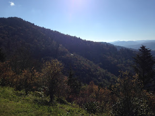
The Little River Gorge Road continues eastward on the south bank of the Little River before splitting away at Elkmont Road. The road becomes Fighting Creek Gap Road which continues east to Newfound Gap Road which is the implied alignment of US 441 through Great Smoky Mountains National Park. I had a hell of a view of sunrise and even had a run-in with a wild turkey on the roadway.


Newfound Gap Road traverses southbound rising rapidly high into the Great Smoky Mountains. Newfound Gap Road doesn't have any US 441 shields but almost every map service has it listed on it. Newfound Gap Road is one of the few roadways I've ever found a 360 degree road loop.


Newfound Gap Road was completed in 1932 but the pass had been known of since 1872. Indian Gap Road was the previous road used to cross the Great Smoky Mountains which was built in 1839. The implied alignment of US 441 into Newfound Gap into Tennessee wasn't extended over the Smokys until 1952.

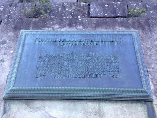
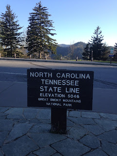
Newfound Gap is at an elevation of 5,048 feet above sea level and marks the State Line of Tennessee and North Carolina. There is plenty to see from the top in regards to vistas and historical information.


Cherokee is 20 miles southward from Newfound Gap.

The descent to Cherokee is particularly scenic with vistas of the Blue Ridge Mountains.


I stopped at the Oconaluftee Visitor Center along Oconaluftee River to check out the Mountain Farm Museum. Apparently Mountain Farm Museum is a collection of actual farm buildings that were present in Great Smoky Mountains National Park because the park was created.


Since it was early in the day and I had a lot of time of ahead of me I planned on some taking the Blue Ridge Parkway. The terminus for the Blue Ridge Parkway is at the Newfound Gap Road at a crossing of the Oconaluftee River.


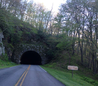
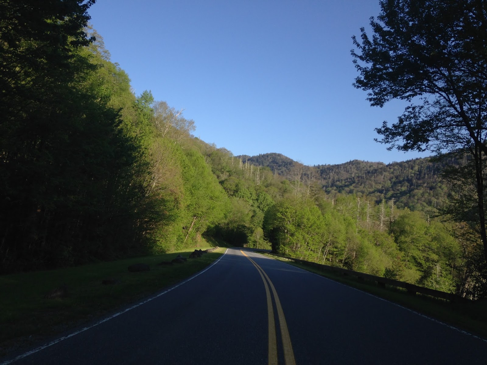
The Blue Ridge Parkway is a 469 mile roadway between the Newfound Gap Road in Great Smoky Mountains National Park to Skyline Boulevard in Shenandoah National Park in Virginia. The Blue Ridge Parkway was built from 1935 in sections up until 1987. The Blue Ridge Parkway is considered an individual National Park unit which was created in 1936. The Parkway is known for it's high vistas and hiking trails. I encountered all these vistas and tunnels between Newfound Gap Road and junction with US 19.


The Blue Ridge Parkway isn't exactly known for high speed limits but 45 MPH seemed fair given the huge mountain grades.

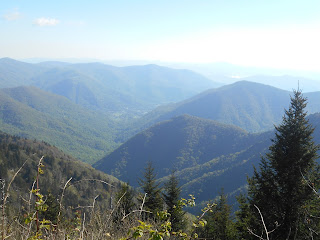
My ultimate destination was the Water Rock Knob Trailhead but there was plenty of vistas with worth while views still to stop at.


The Water Rock Knob is the highest visitor center on the Blue Ridge Parkway at 5,820 feet. I had blown out my Achilles Tendon about a month prior trail running in Sequoia National Park. I had recovered enough to the point where I thought that I could handle a 1.2 mile climb to the 6,273 foot summit. I actually did run pretty much the entire trail which was a good sign for my tendon, by the end of the day I got about 5 additional miles in. The views of the Blue Ridge Parkway and the Blue Ridge Mountains were spectacular from the summit trail.


My next destination was in Asheville for lunch at a friend's house so I took the Blue Ridge Parkway to the junction of US 23/74 and turned east.


I started the morning early in Alcoa and used TN 35 southbound to reach US 411 which I took to connect to US 321.


There was a fairly substantial fog on US 321 but I took it eastward to Scenic TN 73.

I took Scenic TN 73 to the Townsend Entrance Road to Great Smoky Mountains National Park. Apparently Scenic TN 73 becomes signed on the opposite side of Great Smoky Mountains National Park.

I took Townsend Entrance Road to Little River Gorge Road. The Little River Gorge Road was part of the Little River Railroad grade until the late 1930s and follows a river of the same name. Little River Gorge Road has numerous waterfalls along the road which are easily observed from the side of the road or a short hike.


Little River Gorge Road crosses over the Little River in an area called "The Sinks."


The Little River Gorge Road continues eastward on the south bank of the Little River before splitting away at Elkmont Road. The road becomes Fighting Creek Gap Road which continues east to Newfound Gap Road which is the implied alignment of US 441 through Great Smoky Mountains National Park. I had a hell of a view of sunrise and even had a run-in with a wild turkey on the roadway.


Newfound Gap Road traverses southbound rising rapidly high into the Great Smoky Mountains. Newfound Gap Road doesn't have any US 441 shields but almost every map service has it listed on it. Newfound Gap Road is one of the few roadways I've ever found a 360 degree road loop.


Newfound Gap Road was completed in 1932 but the pass had been known of since 1872. Indian Gap Road was the previous road used to cross the Great Smoky Mountains which was built in 1839. The implied alignment of US 441 into Newfound Gap into Tennessee wasn't extended over the Smokys until 1952.

Newfound Gap is at an elevation of 5,048 feet above sea level and marks the State Line of Tennessee and North Carolina. There is plenty to see from the top in regards to vistas and historical information.


Cherokee is 20 miles southward from Newfound Gap.

The descent to Cherokee is particularly scenic with vistas of the Blue Ridge Mountains.


I stopped at the Oconaluftee Visitor Center along Oconaluftee River to check out the Mountain Farm Museum. Apparently Mountain Farm Museum is a collection of actual farm buildings that were present in Great Smoky Mountains National Park because the park was created.


Since it was early in the day and I had a lot of time of ahead of me I planned on some taking the Blue Ridge Parkway. The terminus for the Blue Ridge Parkway is at the Newfound Gap Road at a crossing of the Oconaluftee River.


The Blue Ridge Parkway is a 469 mile roadway between the Newfound Gap Road in Great Smoky Mountains National Park to Skyline Boulevard in Shenandoah National Park in Virginia. The Blue Ridge Parkway was built from 1935 in sections up until 1987. The Blue Ridge Parkway is considered an individual National Park unit which was created in 1936. The Parkway is known for it's high vistas and hiking trails. I encountered all these vistas and tunnels between Newfound Gap Road and junction with US 19.


The Blue Ridge Parkway isn't exactly known for high speed limits but 45 MPH seemed fair given the huge mountain grades.

My ultimate destination was the Water Rock Knob Trailhead but there was plenty of vistas with worth while views still to stop at.


The Water Rock Knob is the highest visitor center on the Blue Ridge Parkway at 5,820 feet. I had blown out my Achilles Tendon about a month prior trail running in Sequoia National Park. I had recovered enough to the point where I thought that I could handle a 1.2 mile climb to the 6,273 foot summit. I actually did run pretty much the entire trail which was a good sign for my tendon, by the end of the day I got about 5 additional miles in. The views of the Blue Ridge Parkway and the Blue Ridge Mountains were spectacular from the summit trail.


My next destination was in Asheville for lunch at a friend's house so I took the Blue Ridge Parkway to the junction of US 23/74 and turned east.


Comments