Challenger Adventures in the Coast Ranges Part 2; California State Route 1 in Big Sur (County Route G16 to Nacimiento-Fergusson Road)
I started off Friday morning leaving Monterey on California State Route 1 southbound. Friday was the highlight day starting with the open section of CA 1 north of the Mud Creek Slide in Big Sur.

The Big Sur section of CA 1 is generally defined as starting at the Carmel River which is just south of Signed County Route G16/Carmel Valley Road. I've visited Big Sur many times this year as the damage from the Mud Creek Slide, Paul's Slide, and Pfeiffer Canyon Bridge failure have been largely been repaired. At present moment CA 1 is open about 60 miles south of the Carmel River to Gorda where work is ongoing to rebuild the roadway over the Mud Creek Slide.

The 74 miles ahead are just as curvy as advertised. On a good weekday with little tourist traffic CA 1 in Big Sur is probably the finest mix of mountain driving intermixed with scenery you can find in California.

The first major state park encountered south on CA 1 is Point Lobos.

CA 1 passes through Carmel Highlands which is where a series of 1930s era bridges begin. I didn't photograph every one of them this time around but I did stop at the Malposo Creek Bridge.

The weather was unusually warm and was completely clear ahead of an advancing cold front. Hurricane Ridge and Point Sur were plainly visible looking southbound.

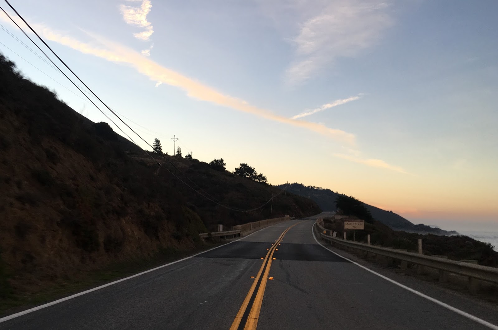
The Granite Canyon Bridge just before sunrise.

Ahead of Granite Canyon the Rocky Creek Bridge is plainly visible. I would put the Rocky Creek Bridge as my second favorite on CA 1 in Big Sur only behind the Bixby Creek Bridge.

The highlight bridge along CA 1 in Big Sur is without question the Bixby Creek Bridge. The Bixby Bridge was construction during 1931-1932 which has a 260 foot clearance above Bixby Creek. The views of Hurricane Point directly to the south are pretty damn outstanding and there is all sorts of features like sea caves and arches that are visible near the water. Before the Bixby Bridge was constructed traffic had to use Coast Road to get over Bixby Creek.


Hurricane Point is a high ridge overlooking both Bixby Creek to the north and Point Sur to the south.


CA 1 southbound descends quickly from Hurricane Point to the Little Sur River.

South of the Little Sur River CA 1 passes the Point Sur Lighthouse. The Point Sur Lighthouse dates back to 1889 and has a focal point of 270 feet above the waters of the Pacific. Apparently the lighthouse is only open to be viewed on Wednesdays and Weekends, I've never actually been up to it before.

South of Point Sur CA 1 dips slightly inland following the Big Sur River into the forest and passes Andrew Molera State Park.


Probably the most notable state park in Big Sur is Pfeiffer Big Sur State Park which dates back to the early 1930s. The park is a popular hiking destination along the Big Sur which has several notable overlooks and Coastal Redwood Groves.

South of Pfeiffer Big Sur State Park is the new Pfeiffer Canyon Bridge which just opened after the previous span was damaged in storms earlier in the year. Caltrans still had active crews removing some of the construction materials underneath the bridge deck.


South of Pfeiffer Canyon CA 1 ascends to over 900 feet above the ocean into the community of Posts. Posts dates back to the to the 1940s and really isn't much more than a collections of homes near each other. When the Pfeiffer Canyon Bridge was damaged the residents of Posts were isolated and had to be supplied by helicopter until a walking path was built.

The construction sign ahead says CA 1 is closed 32 miles to the south in Gorda.

The road south along CA 1 towards the Fire Road Trail Head Parking Lot has fantastic views looking south. Apparently a lot of folks don't like traveling south on CA 1 through this section of Big Sur given the cliffs but I think it is pretty tame. Pretty much CA 1 was completely empty south of Pfeiffer Big Sur State Park as I didn't encounter anyone else heading southbound.


The Fire Road Trailhead Parking Lot actually has a really cool overlook of a natural arch in the waters below.

The next state park is Julia Pfeiffer Burns which is home to several 300 foot tall redwoods which are apparently over 2,500 years old.

Lucia was still signed as a destination point to the south but everything else on the guide signage was still covered up.


The next site southbound of real significance is the Big Creek Bridge over Big Creek Cove. The overlook had a new historic piece on the construction of the highway through Big Sur.


The flowers were in bloom along much of CA 1 southbound. Neat to see bounding along at 55-60 MPH with the backdrop of a loud V8 engine, it was way too nice out not to have the windows down and radio off.

CA 1 was undergoing repaving near Lucia and Paul's Slide. This section of CA 1 was heavily damaged in slides in the winter but was ultimately cleared to the south relatively quickly. Apparently Lucia dates back to the 1900s and once was large enough to justify post office service. Pacific Valley is actually listed on the guide sign through Paul's Slide.


Scenic view through the Rock Shed south of Paul's Slide.

The State Park is Limekiln State Park which follows Limekiln Creek.


Back in June I took the Nacimiento-Fergusson Road to Big Sur which at the time was the only access to Gorda and Lucia. I stopped at Limekiln State Park and took some really rough water beaten trails to Limekiln Falls. It was weird to see CA 1 so empty when it was isolated then, it was stranger to see it so empty even now.


South of Lime Kiln State Park there are some amazing views of the mountains to the south.

At Kirk Creek CA 1 meets the Nacimiento-Fergusson Road which travels east over the Santa Lucia Range through Fort Hunter Liggett to County Route G14. Since CA 1 was obviously closed to the south and the weather was good I decided to cross the Santa Lucias on the Nacimiento-Fergusson Road which would put me in position for the western segment of CA 198 as well.


The vast majority of construction along the highway that became CA 1 in Big Sur occurred in the 1930s. CA 1 wasn't completed in Big Sur until 1938 which can be clearly observed in stages from 1930 onward.
By 1930 much of the roadway south of Monterey existed but did not much further than likely the Big Sur River.
1930 State Highway Map
By 1934 CA 1 became a signed state highway. Not much was work was completed between Point Sur and Lucia but the road quality was definitely improved from not being graded.
1934 State Highway Map
The 1935 Monterey County Highway Map from the California Division of Highways shows much more detail of the construction of CA 1. The Nacimiento-Fergusson Road is observable running alongside the Nacimiento River well into the Santa Lucia Range west of Jolon.
1935 Monterey County Highway Map
By the 1936-37 State Highway Map CA 1 is shown as complete through the Big Sur region.
1936-37 State Highway Map
By 1938 the Nacimiento-Fergusson Road is shown connecting over the Santa Lucia Range to CA 1.
1938 State Highway Map

The Big Sur section of CA 1 is generally defined as starting at the Carmel River which is just south of Signed County Route G16/Carmel Valley Road. I've visited Big Sur many times this year as the damage from the Mud Creek Slide, Paul's Slide, and Pfeiffer Canyon Bridge failure have been largely been repaired. At present moment CA 1 is open about 60 miles south of the Carmel River to Gorda where work is ongoing to rebuild the roadway over the Mud Creek Slide.

The 74 miles ahead are just as curvy as advertised. On a good weekday with little tourist traffic CA 1 in Big Sur is probably the finest mix of mountain driving intermixed with scenery you can find in California.

The first major state park encountered south on CA 1 is Point Lobos.

CA 1 passes through Carmel Highlands which is where a series of 1930s era bridges begin. I didn't photograph every one of them this time around but I did stop at the Malposo Creek Bridge.

The weather was unusually warm and was completely clear ahead of an advancing cold front. Hurricane Ridge and Point Sur were plainly visible looking southbound.

The Granite Canyon Bridge just before sunrise.
Ahead of Granite Canyon the Rocky Creek Bridge is plainly visible. I would put the Rocky Creek Bridge as my second favorite on CA 1 in Big Sur only behind the Bixby Creek Bridge.

The highlight bridge along CA 1 in Big Sur is without question the Bixby Creek Bridge. The Bixby Bridge was construction during 1931-1932 which has a 260 foot clearance above Bixby Creek. The views of Hurricane Point directly to the south are pretty damn outstanding and there is all sorts of features like sea caves and arches that are visible near the water. Before the Bixby Bridge was constructed traffic had to use Coast Road to get over Bixby Creek.


Hurricane Point is a high ridge overlooking both Bixby Creek to the north and Point Sur to the south.


CA 1 southbound descends quickly from Hurricane Point to the Little Sur River.

South of the Little Sur River CA 1 passes the Point Sur Lighthouse. The Point Sur Lighthouse dates back to 1889 and has a focal point of 270 feet above the waters of the Pacific. Apparently the lighthouse is only open to be viewed on Wednesdays and Weekends, I've never actually been up to it before.

South of Point Sur CA 1 dips slightly inland following the Big Sur River into the forest and passes Andrew Molera State Park.


Probably the most notable state park in Big Sur is Pfeiffer Big Sur State Park which dates back to the early 1930s. The park is a popular hiking destination along the Big Sur which has several notable overlooks and Coastal Redwood Groves.

South of Pfeiffer Big Sur State Park is the new Pfeiffer Canyon Bridge which just opened after the previous span was damaged in storms earlier in the year. Caltrans still had active crews removing some of the construction materials underneath the bridge deck.


South of Pfeiffer Canyon CA 1 ascends to over 900 feet above the ocean into the community of Posts. Posts dates back to the to the 1940s and really isn't much more than a collections of homes near each other. When the Pfeiffer Canyon Bridge was damaged the residents of Posts were isolated and had to be supplied by helicopter until a walking path was built.

The construction sign ahead says CA 1 is closed 32 miles to the south in Gorda.

The road south along CA 1 towards the Fire Road Trail Head Parking Lot has fantastic views looking south. Apparently a lot of folks don't like traveling south on CA 1 through this section of Big Sur given the cliffs but I think it is pretty tame. Pretty much CA 1 was completely empty south of Pfeiffer Big Sur State Park as I didn't encounter anyone else heading southbound.


The Fire Road Trailhead Parking Lot actually has a really cool overlook of a natural arch in the waters below.

The next state park is Julia Pfeiffer Burns which is home to several 300 foot tall redwoods which are apparently over 2,500 years old.

Lucia was still signed as a destination point to the south but everything else on the guide signage was still covered up.


The next site southbound of real significance is the Big Creek Bridge over Big Creek Cove. The overlook had a new historic piece on the construction of the highway through Big Sur.


The flowers were in bloom along much of CA 1 southbound. Neat to see bounding along at 55-60 MPH with the backdrop of a loud V8 engine, it was way too nice out not to have the windows down and radio off.

CA 1 was undergoing repaving near Lucia and Paul's Slide. This section of CA 1 was heavily damaged in slides in the winter but was ultimately cleared to the south relatively quickly. Apparently Lucia dates back to the 1900s and once was large enough to justify post office service. Pacific Valley is actually listed on the guide sign through Paul's Slide.


Scenic view through the Rock Shed south of Paul's Slide.

The State Park is Limekiln State Park which follows Limekiln Creek.


Back in June I took the Nacimiento-Fergusson Road to Big Sur which at the time was the only access to Gorda and Lucia. I stopped at Limekiln State Park and took some really rough water beaten trails to Limekiln Falls. It was weird to see CA 1 so empty when it was isolated then, it was stranger to see it so empty even now.


South of Lime Kiln State Park there are some amazing views of the mountains to the south.

At Kirk Creek CA 1 meets the Nacimiento-Fergusson Road which travels east over the Santa Lucia Range through Fort Hunter Liggett to County Route G14. Since CA 1 was obviously closed to the south and the weather was good I decided to cross the Santa Lucias on the Nacimiento-Fergusson Road which would put me in position for the western segment of CA 198 as well.


The vast majority of construction along the highway that became CA 1 in Big Sur occurred in the 1930s. CA 1 wasn't completed in Big Sur until 1938 which can be clearly observed in stages from 1930 onward.
By 1930 much of the roadway south of Monterey existed but did not much further than likely the Big Sur River.
1930 State Highway Map
By 1934 CA 1 became a signed state highway. Not much was work was completed between Point Sur and Lucia but the road quality was definitely improved from not being graded.
1934 State Highway Map
The 1935 Monterey County Highway Map from the California Division of Highways shows much more detail of the construction of CA 1. The Nacimiento-Fergusson Road is observable running alongside the Nacimiento River well into the Santa Lucia Range west of Jolon.
1935 Monterey County Highway Map
By the 1936-37 State Highway Map CA 1 is shown as complete through the Big Sur region.
1936-37 State Highway Map
By 1938 the Nacimiento-Fergusson Road is shown connecting over the Santa Lucia Range to CA 1.
1938 State Highway Map
Comments