
Blenheim Covered Bridge

They say that you never forget your first. In this case, the Blenheim Covered Bridge in Schoharie County was the first covered bridge that I saw, back when I was a young boy during the 1980s. Since then, I have seen numerous covered bridges stretching from coast to coast in both the United States and Canada, but I will always have an affinity towards the Blenheim Covered Bridge and its unique design.

The old Blenheim Covered Bridge in October 2008.

The original Blenheim Bridge was built in 1855 by Nicholas Montgomery Powers, who was a prominent covered bridge builder of his day. Spanning over the Schoharie Creek, the bridge was located in the Town of Blenheim in southeastern Schoharie County on NY 30 in North Blenheim, until it was washed away during the floods caused by the remnants of Hurricane Irene on August 28, 2011. During its existence, the Blenheim Bridge was the longest single span bridge in the world at 228 feet in length and was one of only just a few remaining bridges in the world with two separated (or double barreled) lanes. The old Blenheim Bridge was open to vehicular traffic until 1932, when New York State built a new bridge for traffic about 100 feet downstream of the covered bridge. The covered bridge was supposed to removed back then, but there was enough public outcry that caused the covered bridge to remain open for sightseeing, thus allowing future generations to enjoy this local treasure.


After floods had destroyed the original bridge, efforts have been made to build a replica of the Blenheim Bridge. In 2016, funds were approved to pay for the construction of a new covered bridge using federal and state funds. Construction on the new bridge commenced in 2017, with an expected opening of the new bridge in July 2018. I'll be there as soon as I can after it opens, so I can create new memories.


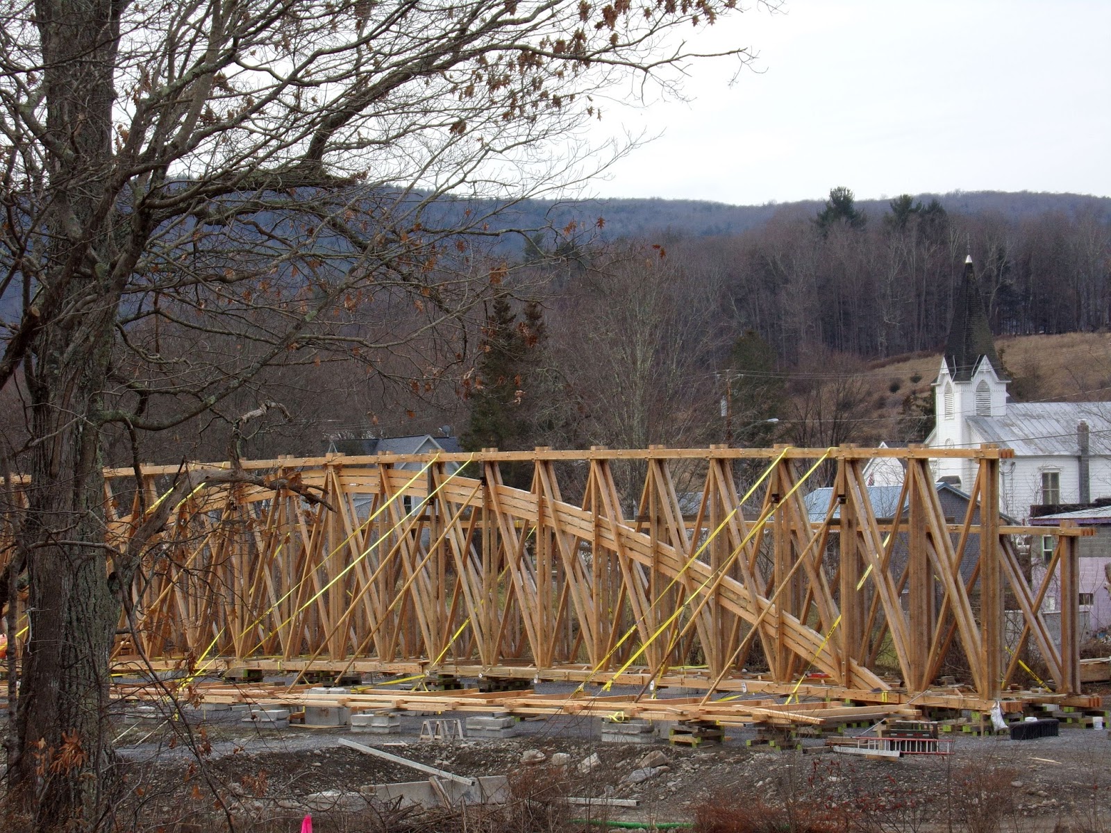
Construction of one of the sides of the new bridge in December 2017.


Sources and Links:
National Historic Landmarks Program - Old Blenheim Bridge
New York State Covered Bridge Society - Blenheim Covered Bridge
Watershed Post - Schoharie County Approves Final Design for new Blenheim Bridge 
Cobleskill Times-Journal - Work on Blenheim Bridge Starting Soon

Crossposted from my Blenheim Covered Bridge post at the Unlocking New York blog.

Comments

Popular posts from this blog

Hawaii Route 8930

Hawaii Route 8930 is a 2.5-mile State Highway on the Island of O'hau.  Hawaii Route 8930 is aligned over Kualakai Parkway over the course of its entire alignment south from Interstate H-1 to Kapolei Parkway.  Hawaii Route 8930 is one of the newest Hawaii Routes only having been completed during 2010.   This page is part of the Gribblenation O'ahu Highways page.  All Gribblenation and Roadwaywiz media related to the highway system of O'ahu can be found at the link below: https://www.gribblenation.org/p/gribblenation-oahu-highways-page.html Part 1; the history of Hawaii Route 8930 The history of Hawaii Route 8930 is brief given it is a modern facility.  Hawaii Route 8930 and what was known as "North-South Road" were built to facilitate the developing areas of Kapolei on western O'ahu.  According to hawaiihighways.com the first stage of Hawaii Route 8930 was completed from Kapolei Parkway north to Farrington Highway as a four-lane highway during November...

Madera County Road 607 and the Stockton-Los Angeles Road

Madera County Road 607 is an approximately seven-mile rural unsurfaced highway which spans from Road 600 near Raymond west to Road 29.   Road 607 west from Raymond Road Cemetery (established in 1905) is part of the Stockton-Los Angeles Road corridor surveyed in 1853. The corridor lies in the gap between Fresno Crossing at the Fresno River west to Newton's Crossing at the Chowchilla River. The Buchanan Copper Mine would be along what is now Road 607 in the namesake Buchanan Hollow during July 1863. The Buchanan Mine is thought to have once had a population of between 1,000-1,500 residents by the early 1870s. Copper prices would decline in the decade after the Civil War and much of the activity at Buchanan shifted towards cattle ranching. The last businesses in the community would shutter during World War II and it is now a true ghost town. Part 1; the history of Madera County Road 607 and the Stockton-Los Angeles Road What is now Road 607 was a component of the larger Sto...

Old US Route 60/70 through Hell (Chuckwall Valley Road and Ragsdale Road)

Back in 2016 I explored some of the derelict roadways of the Sonoran Desert of Riverside County which were part of US Route 60/70; Chuckwalla Valley Road and Ragsdale Road. US 60 and US 70 were not part of the original run of US Routes in California.  According to USends.com US 60 was extended into California by 1932.  US 60 doesn't appear on the California State Highway Map until the 1934 edition. USends.com on US 60 endpoints 1934 State Highway Map Conversely US 70 was extended into California by 1934, it first appears on the 1936 State Highway Map. USends.com on US 70 endpoints 1936 State Highway Map When US 60 and US 70 were extended into California they both utilized what was Legislative Route Number 64 from the Arizona State Line west to Coachella Valley.  LRN 64 was part of the 1919 Third State Highway Bond Act routes.  The original definition of LRN 64 routed between Mecca in Blythe and wasn't extended to the Arizona State Line until 1931 acc...