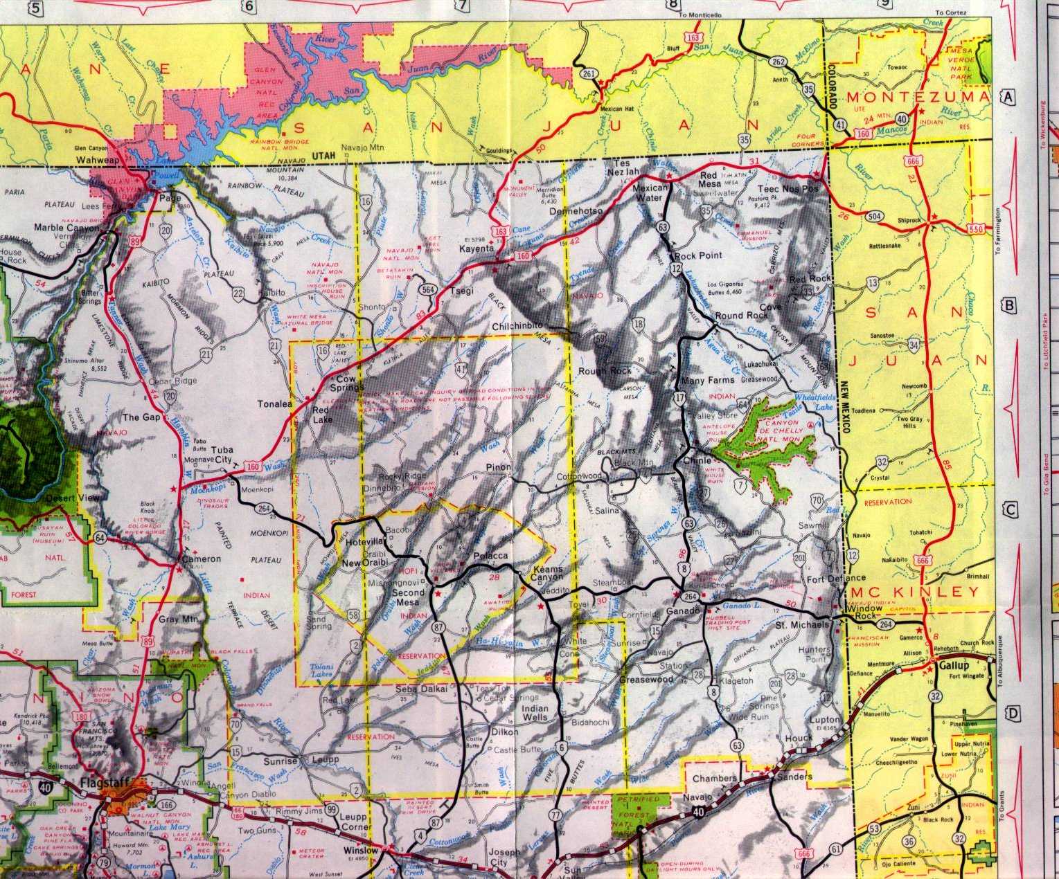
Eleven miles east of the ruins of the Twin Arrows Trade Post at I-40/US 180 exit 230 is the ruins of Two Guns on the rim of Canyon Diablo.

The service station in Two Guns was replaced sometime after 1971 as evidenced by the modern structure on the site. Gradually Two Guns continued to decline in importance as travelers bypassed it for services in more major cities along the route of I-40. Today Two Guns is a crumbling ruin sitting off to the side of the eastbound lanes of I-40/US 180.
It is odd to see brick ruins from the early 20th century sitting within sight of modern Interstate traffic whizzing by at close to 80 MPH.


The ruins of the Two Guns Zoo are extensive and still display markings from when the site housed animals. The Mountain Lion cages still have metal wiring as though they are still waiting for something to display.


The 1915 Canyon Diablo Bridge still can easily be walked across. The bend in Canyon Diablo ahead in the first photo is the site of the Apache Death Cave. In 1878, the Death Cave was the site of a mass murder of 42 Apache who hid in the cave from their Navajo pursuers. The Navajo used fire to funnel smoke into the Death Cave killing all within.


Looking north past Canyon Diablo I'm fairly certain that traffic on the NOTR would have turned an immediate right.

High above the east cliff of Canyon Diablo is the remains of the Two Guns service station and campground.

Surprisingly the service station is completely open and anyone can walk in. If I really wanted I could have explored the abandoned service center at a whim, I figured a photo from the window would be enough.

The Two Guns campground still displays legible signs and painted imagery.


Site Navigation:

The Two Guns Trade Post predates even US Route 66 being on an old alignment of the National Old Trails Road. The Canyon Diablo Bridge located in Two Guns dates 1915 and spans the canyon of the same name. A store was set up near the Canyon Diablo Bridge in 1922 and eventually grew to a small community that became known as Two Guns. In 1926 US Route 66 was commissioned to run through Arizona on the alignment of the National Old Trails Road.
In 1938 the 1915 Canyon Diablo Bridge was replaced by a more modernized span which was located near the current eastbound lanes of I-40/US 180 Canyon Diablo. The Canyon Diablo Trade Post grew in size during the heyday of Route 66 and eventually had a small zoo in addition to a campground. I'm to understand the service station in Two Guns burned in 1971 which probably didn't help considering US 66/US 180 were multiplexed on I-40which was completed from Flagstaff east to the outskirts of Winslow by that time.
The service station in Two Guns was replaced sometime after 1971 as evidenced by the modern structure on the site. Gradually Two Guns continued to decline in importance as travelers bypassed it for services in more major cities along the route of I-40. Today Two Guns is a crumbling ruin sitting off to the side of the eastbound lanes of I-40/US 180.
It is odd to see brick ruins from the early 20th century sitting within sight of modern Interstate traffic whizzing by at close to 80 MPH.


The ruins of the Two Guns Zoo are extensive and still display markings from when the site housed animals. The Mountain Lion cages still have metal wiring as though they are still waiting for something to display.


The 1915 Canyon Diablo Bridge still can easily be walked across. The bend in Canyon Diablo ahead in the first photo is the site of the Apache Death Cave. In 1878, the Death Cave was the site of a mass murder of 42 Apache who hid in the cave from their Navajo pursuers. The Navajo used fire to funnel smoke into the Death Cave killing all within.


Looking north past Canyon Diablo I'm fairly certain that traffic on the NOTR would have turned an immediate right.

High above the east cliff of Canyon Diablo is the remains of the Two Guns service station and campground.

Surprisingly the service station is completely open and anyone can walk in. If I really wanted I could have explored the abandoned service center at a whim, I figured a photo from the window would be enough.

The Two Guns campground still displays legible signs and painted imagery.


Site Navigation:
Comments