One of the goals of my recent Florida trip was to drive over all the highway bridges over Old Tampa Bay. After completing Interstate 275 I returned to Tampa and turned west on Florida State Road 60 towards Courtney Campbell Causeway.

Courtney Campbell Causeway is a 9.9 causeway bridging structure carrying FL 60 west from Rocky Point in Tampa over Old Tampa Bay to Clearwater. Courtney Campbell Causeway was constructed by a local dredging company owned by Ben T. David from 1927 through early 1934. Courtney Campbell Causeway opened in January of 1934 as Davis Causeway and had a $0.25 cent toll. The Davis Causeway cost $900,000 dollars to build and was the longest structure of it's kind at the time of it's completion.
The Davis Causeway appears on this 1939 Florida State Road Map as a privately held toll road.
1939 Florida State Road Map
In 1944 Davis Causeway was purchased by Federal Public Works Administration and Florida State Road Department for $1,085,000. The Federal Public Works Administration turned over their share to the Florida State Road Department which assumed maintenance of Davis Causeway and removed the toll. In 1945 FL 60 was assigned to the Davis Causeway during the Florida State Road renumbering. In 1948 Davis Causeway was re-designated as Courtney Campbell Causeway. Courtney Campbell was a local Clearwater resident who was a U.S. Representative and member of the Florida Road Board.
Modern FL 60 is routed west from Dale Mabry Highway/US 92 on Kennedy Boulevard. At the I-275 junction FL 60 west becomes a short freeway which passes by Tampa International Airport and the south terminus of FL 589 on the Veterans Expressway. My approach onto FL 60 west was from I-275 westbound.


Signage on FL 60 implies a multiplex with FL 589 given the exit numbers are concurrent with the latter. FL 60 continues west towards Courtney Campbell Causeway on Exit 2A.


The original access point used by FL 60 west to Courtney Campbell Causeway was on Columbus Drive from Dale Mabry Highway/US 92. Columbus Drive still partially exists west of US 92 but most of it has largely been razed for expansion of Tampa International Airport.
FL 60 west on Courtney Campbell Causeway enters Rocky Point which essentially is now an island.

FL 60 has post miles on Courtney Campbell Causeway indicating how far away the end of the bridge structure is. Below FL 60 west at Rocky Point is shown 7.5 miles away from the western end of Courtney Campbell Causeway.

FL 60 west on Courtney Campbell Causeway has access to several beaches. Ben T. Davis beach is located immediately west of Rocky Point and is a nice call back to the original builder of the Causeway.

FL 60 and Courtney Campbell Causeway has raised parts of the bridge structure to allow boats to pass underneath.


FL 60 west on Courtney Campbell Causeway approaching the Pinellas County line becomes a Scenic Highway. Shortly after crossing the Pinellas County line FL 60 west is signed as the "Purple Heart Trail."


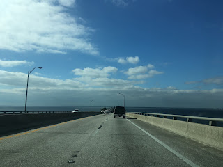
FL 60 west on Courtney Campbell Causeway has one additional open water crossing before entering Clearwater.


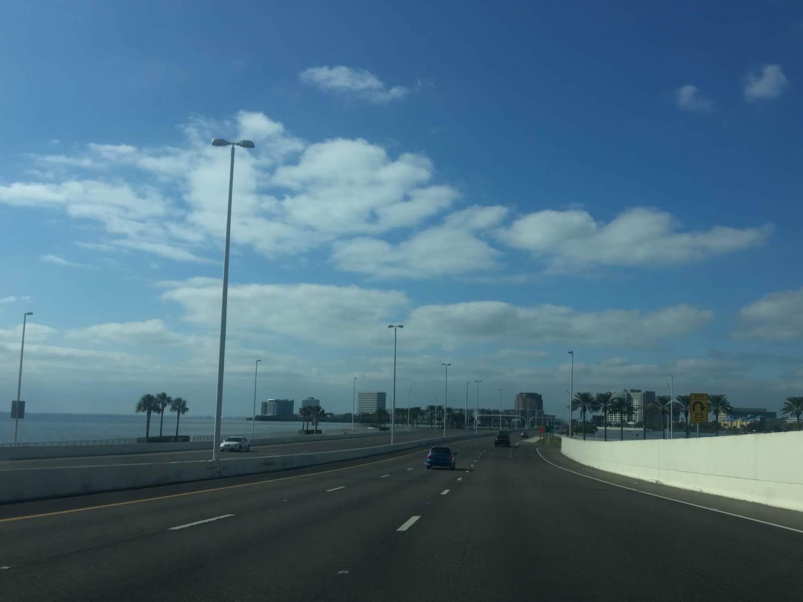
I continued west on FL 60 into Clearwater which quickly junctions CR 611.

I continued on FL 60 west until US 19 where I turned north towards Tarpon Springs.


Courtney Campbell Causeway is a 9.9 causeway bridging structure carrying FL 60 west from Rocky Point in Tampa over Old Tampa Bay to Clearwater. Courtney Campbell Causeway was constructed by a local dredging company owned by Ben T. David from 1927 through early 1934. Courtney Campbell Causeway opened in January of 1934 as Davis Causeway and had a $0.25 cent toll. The Davis Causeway cost $900,000 dollars to build and was the longest structure of it's kind at the time of it's completion.
The Davis Causeway appears on this 1939 Florida State Road Map as a privately held toll road.
1939 Florida State Road Map
In 1944 Davis Causeway was purchased by Federal Public Works Administration and Florida State Road Department for $1,085,000. The Federal Public Works Administration turned over their share to the Florida State Road Department which assumed maintenance of Davis Causeway and removed the toll. In 1945 FL 60 was assigned to the Davis Causeway during the Florida State Road renumbering. In 1948 Davis Causeway was re-designated as Courtney Campbell Causeway. Courtney Campbell was a local Clearwater resident who was a U.S. Representative and member of the Florida Road Board.
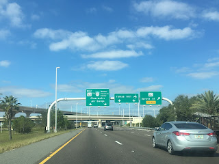
Modern FL 60 is routed west from Dale Mabry Highway/US 92 on Kennedy Boulevard. At the I-275 junction FL 60 west becomes a short freeway which passes by Tampa International Airport and the south terminus of FL 589 on the Veterans Expressway. My approach onto FL 60 west was from I-275 westbound.


Signage on FL 60 implies a multiplex with FL 589 given the exit numbers are concurrent with the latter. FL 60 continues west towards Courtney Campbell Causeway on Exit 2A.


The original access point used by FL 60 west to Courtney Campbell Causeway was on Columbus Drive from Dale Mabry Highway/US 92. Columbus Drive still partially exists west of US 92 but most of it has largely been razed for expansion of Tampa International Airport.
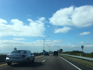
FL 60 west on Courtney Campbell Causeway enters Rocky Point which essentially is now an island.

FL 60 has post miles on Courtney Campbell Causeway indicating how far away the end of the bridge structure is. Below FL 60 west at Rocky Point is shown 7.5 miles away from the western end of Courtney Campbell Causeway.

FL 60 west on Courtney Campbell Causeway has access to several beaches. Ben T. Davis beach is located immediately west of Rocky Point and is a nice call back to the original builder of the Causeway.

FL 60 and Courtney Campbell Causeway has raised parts of the bridge structure to allow boats to pass underneath.


FL 60 west on Courtney Campbell Causeway approaching the Pinellas County line becomes a Scenic Highway. Shortly after crossing the Pinellas County line FL 60 west is signed as the "Purple Heart Trail."


FL 60 west on Courtney Campbell Causeway has one additional open water crossing before entering Clearwater.


I continued west on FL 60 into Clearwater which quickly junctions CR 611.

I continued on FL 60 west until US 19 where I turned north towards Tarpon Springs.


Comments