Hollywood Freeway; California State Route 170, US Route 101, US Route 66 and California State Route 2
This past weekend I drove the entirety of the Hollywood Freeway from San Fernando Valley over Cahuenga Pass into downtown Los Angeles.

The Hollywood Freeway is a 17 mile segment of limited access road which is segmented in parts by CA 170, US 101 and CA 2. The Hollywood Freeway southbound begins in the Sun Valley neighborhood of Los Angeles in San Fernando Valley where CA 170 splits from I-5. The Hollywood Freeway merges onto US 101 and traverses over Cahuenga Pass through the Santa Monica Mountains to CA 110 at what is known as the "Four Level Interchange" in downtown Los Angeles. A small portion of Hollywood Freeway from Santa Monica Boulevard to Alvarado Street carries CA 2 multiplexed with US 101.
The alignment of US 101 described above can be seen on the 1930 State Highway Map City Insert.
1930 State Highway City Insert
The US Routes in Los Angeles were not signed until 1930. The initial alignment of US 101 in Los Angeles was signed by Automobile Club of Southern California through the city following:
- Ventura Boulevard to Cahuenga Boulevard.
- Cahuenga Boulevard through Cahuenga Pass to Sunset Boulevard.
- Sunset Boulevard to Macy Street (modern Cesar E. Chavez Avenue)
- Macy Street over the Los Angeles River to Pleasant Avenue.
- Pleasant Avenue to Boyle Avenue.
- Boyle Avenue to Whittier Boulevard.
The surface alignment of US 101 described above can be seen on the 1935 California Division of Highways Map of downtown Los Angeles.
Division of Highways Map of downtown Los Angeles
The AASHTO would approve an extension of US 66 to Santa Monica in June of 1935 which became effective in January 1936. The new alignments of the US 101 and US 66 can be seen on the 1936-37 State Highway Map.
1936-37 State Highway Map City Insert
Further, the shift of US 66 west to Santa Monica by proxy truncated CA 2 to US 101/US 66 at Sunset Boulevard via Hyperion Avenue. The original 1934 definition of CA 2 had it end in Santa Monica.
1934 Department of Public Works Guide Announcing the Signed State Highways
The first segment of the Hollywood Freeway opened in June of 1940 through a new 1.5 mile segment in Cahuenga Pass. This new freeway was known at the time as the Cahuenga Pass Freeway and was notable since it featured trolleys running through the center median until 1952. The 1940 doesn't really display in great deal the new freeway through Cahuenga Pass.
1940 State Highway Map City Insert
By 1944 the planned route US 101 of the Hollywood Freeway south from Cahuenga Pass through downtown appears on the State Highway Map City insert along with a small portion of what would become the Santa Ana Freeway.
1944 State Highway Map City Insert
A small portion of the Hollywood Freeway is shown completed from the Arroyo Seco Parkway in downtown Los Angeles past Alvarado Street on the 1951 State Highway Map City Insert. It isn't clear if US 101 was shifted onto the opened portion of the Hollywood Freeway. Reportedly the Four Level Interchange had been completed by 1949 but didn't open to traffic until 1953.
1951 State Highway Map City Insert
The 1953 State Highway Map shows the Hollywood Freeway complete to Sunset Boulevard and US 101 aligned onto it. It isn't clear if US 66 immediately multiplexed US 101 on the Hollywood Freeway from the Four Level Interchange to Santa Monica Boulevard or remained on the surface routing on Sunset Boulevard in 1953.
1953 State Highway Map City Insert
The Hollywood Freeway was completely open from San Fernando Valley to downtown Los Angeles by April of 1954. The 1954 State Highway Map shows a small portion of unconstructed freeway whereas the 1955 edition shows the entire route from San Fernando Valley to downtown Los Angeles complete. The 1954 maps seems to imply that the former surface routing of US 101 on Sunset Boulevard was deleted as part of LRN 2. This would conclusively put US 66 on the Hollywood Freeway between the Four Level Interchange to Santa Monica Boulevard.
1954 State Highway Map City Insert
1955 State Highway Map City Insert
The northern segment of the Hollywood Freeway on CA 170 in San Fernando Valley was originally part of LRN 159. LRN 159 was routed on Lankershim Boulevard between LRN 2 and LRN 4. LRN 159 was adopted into the State Highway system by 1933 according to CAhighways.org.
CAhighways.org on CA 170
The planned northern extension of the Hollywood Freeway on LRN 159 to the Golden State Freeway first appears on the 1963 State Highway Map. CA 2 was also realigned onto Glendale Avenue where it terminated at US 101/US 66 on the Hollywood Freeway. Previously CA 2 had ended at the Hollywood Freeway on Santa Monica Boulevard.
Interestingly it appears that before the 1964 State Highway Renumbering there were plans to route US 6 on the Hollywood Freeway. There appears to have even been a possible planned interim route for US 6 on Lankershim Boulevard. The Lankershim Boulevard route of US 6 was actually published in error on the 1963 Goshua Highway map of California.
Photo of the 1963 Goshua Highway Map of Los Angeles
Apparently there was even signage plans mocked up to show US 6 on the Hollywood Freeway at the present I-5/CA 170 interchange.
AAroads Forum; US 6 and the Hollywood Freeway
1963 State Highway Map City Insert
By 1964 the State Highway renumbering had occurred and CA 170 was assigned to the Hollywood Freeway extension on what was LRN 159. Interestingly CA 170 was intended to utilized what was the planned Laurel Canyon Freeway south to I-405/San Diego Freeway on what what had been LRN 160. The Laurel Canyon Freeway was ultimately never constructed and officially deleted legislatively in 1985. Small portions of La Cienega Bouelvard were upgraded to freeway standards in anticipation of the Laurel Canyon Freeway being built. The 1964 State Highway Map also displays the truncation of US 66 off the Hollywood Freeway and Arroyo Seco Parkway to Pasadena. The truncation of US 66 led to CA 2 being extended over the Hollywood Freeway and restored to it's original terminus City in Santa Monica.
1964 State Highway Map City Insert
The Hollywood Freeway is shown completed north of CA 134 on the Ventura Freeway by 1965. CA 170 does not appear to have been signed on the new segment of the Hollywood Freeway.
1965 State Highway Map City Insert
The 1967 State Highway Map shows the Hollywood Freeway extended further north of the Ventura Freeway.
1967 State Highway Map City Insert
The CA 170 portion of the Hollywood Freeway was completed to the Golden State Freeway (I-5) in 1968 and can be seen on the 1969 State Highway Map.
1969 State Highway Map City Insert
My approach to the CA 170 portion of Hollywood Freeway was from I-5 south on the Golden State Freeway.


Present CA 170 is only 8 miles in length and is completed carried by the north end of the Hollywood Freeway. CA 170 south traffic is greeted almost immediately by a "CA 170 Holly Freeway" sign.

CA 170 south Exit 10 accesses Roscoe Boulevard.

CA 170 south Exit 9 accesses Sherman Way. Most signage on the CA 170 portion of the Hollywood Freeway is still in button-copy format.
CA 170 south Exit 8B accesses Victory Boulevard whereas Exit 8A accesses Oxnard Street.


CA 170 south Exit 7 accesses Burbank Boulevard.

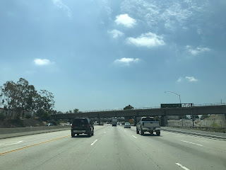
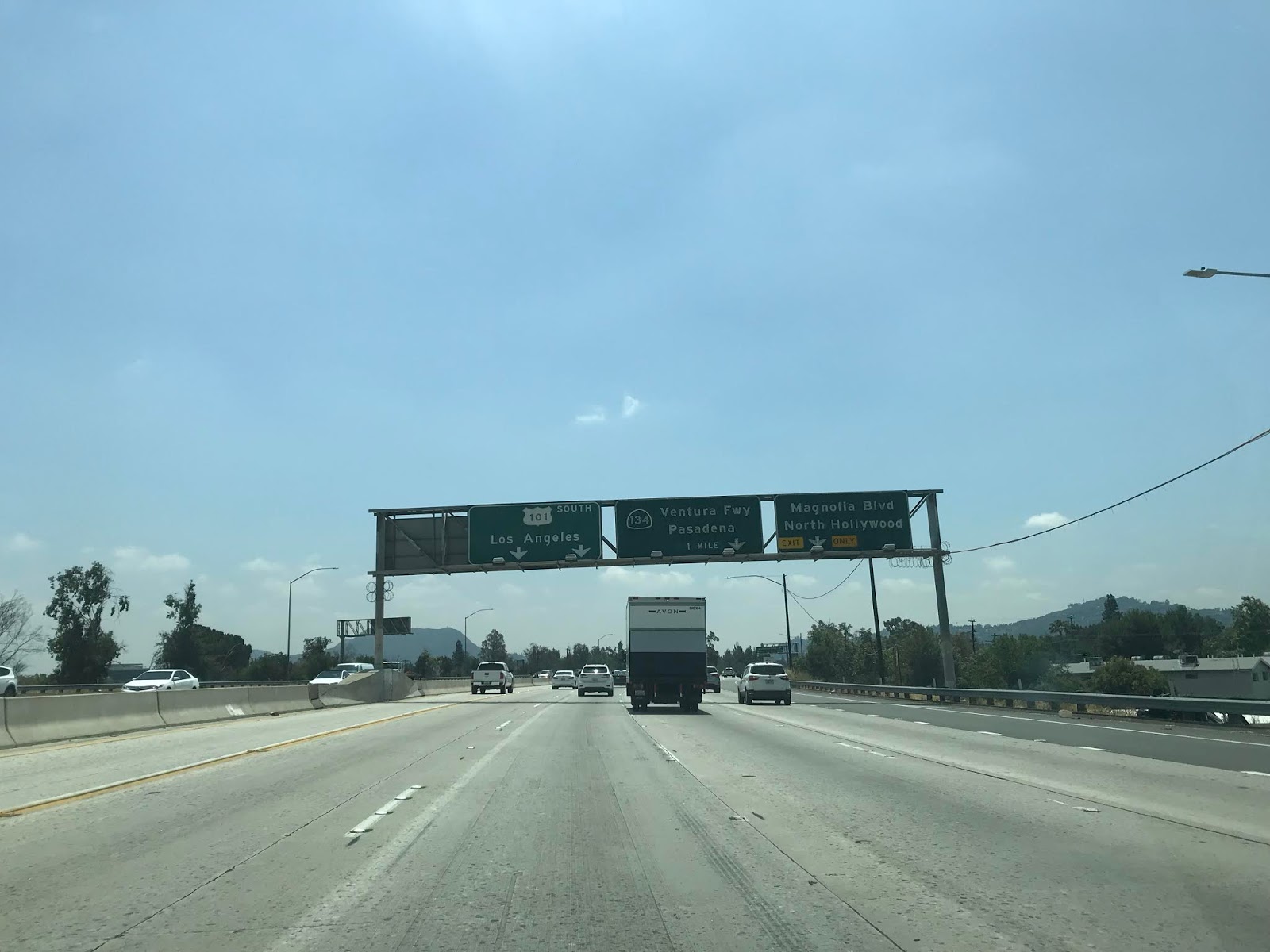
CA 134/Ventura Freeway signage first appears approaching CA 170 south Exit 6B at Magnolia Boulevard.

CA 170 south accesses Riverside Drive/Camarillo Street via Exit 6A.

At the junction for CA 134/Ventura Freeway the route of CA 170 south terminates, and the Hollywood Freeway continues towards Cahuenga Pass as US 101.

Cahuenga Pass was part of the Spanish El Camino Real and was the site of two battles during Mexican Rule. Cahuenga Pass is the lowest mountain pass in the Santa Monica Mountains at 745 feet above sea level.
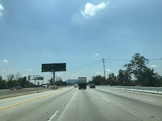
Signage on the US 101 south portion of the Hollywood Freeway is much newer. At Exit 12B there is access to Vineland avenue.

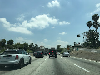
Suffice to say some of the views of the Hollywood Freeway creeping south through Cahuenga Pass are worth seeing when clear of traffic.

At US 101 south Exit 12A there is access to Lankershim Boulevard via Cahuenga Boulevard. Just north of the Exit US 101 south crosses the Los Angeles River. Lankershim Boulevard as noted above was the original alignment of LRN 159 and showed up on the 1963 Goshua Highway Map in error as US 6.

The bridge work on the US 101 portion of the Hollywood Freeway tends retain some of the classic Arc Deco designs that were common before once on Californian Highways. In the first photo below the Barham Boulevard Bridge can be seen. Accroding to Daniel Faigin of CAhighways.org the clips of the electric trolley line can be seen beneath the Barham Boulevard Bridge.

Barham Boulevard is notable as can be used as access to the Hollywood Reservoir and the Wonder View Trail in Griffith Park. More information can be found at the end of this blog.
Access to the Hollywood Museum is signed from US 101 south via Exit 9C for Highland Avenue. Highland Avenue south to Santa Monica Boulevard until 2015 was an unrelinquished spur of CA 170 which dated back to when LRN 160 was first added to the State Highway system.


Exit 9 on US 101 south accesses Cahuenga Boulevard.


Exit 9A on US 101 south accesses Vine Street.

Exit 8C on US 101 south accesses Gower Street whereas Exit 8B accesses Hollywood Boulevard.


At Exit 8A US 101 south accesses Sunset Boulevard.

At Exit 7 US 101 south accesses the unsigned CA 258 on Western Avenue and picks up CA 2 east from Santa Monica Boulevard. From at minimum 1954 until the 1964 State Highway Renumbering US 66 would have multiplexed US 101 on the Hollywood Freeway from here to the Four Level Interchange.

At US 101 south/CA 2 east Exit 6B there is signed access to Melrose Avenue and Normandie Avenue.

At US 101 south/CA 2 east Exit 6A there is signed access to Vermont Avenue.

At US 101 south/CA 2 east Exit 5B there is signed access to Silver Lake Boulevard whereas Exit 5A accesses Benton Way.


CA 2 east splits from US 101 south at Exit 4B for Alvarado Street.


US 101 south Exit 4A accesses Glendale Boulevard and Union Avenue.


US 101 south accesses CA 110 via the Four Level Interchange in downtown Los Angeles via Exit 3B. The Hollywood Freeway terminates at the Four Level Interchange and US 101 continues on the Santa Ana Freeway. I turned southward on CA 110 towards downtown Los Angeles.


As noted above the Hollywood Reservoir and western sections of Griffith Park are accessible in close proximity to the Hollywood Freeway in Cahuenga Pass. Trailhead parking for the Wonder View Trail (officially Burbank Peak Trail) can be found on Lake Hollywood Drive overlooking the Hollywood Reservoir and Mulholland Dam.

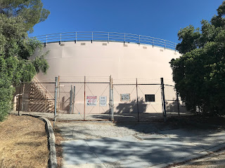
To access the Wonder View Trail foot traffic must ascend the residential of Wonder View Drive to a water tank.


Griffith Park is a large municipal park maintained by the City of Los Angeles which is sprawled out through over 4,310 acres of the eastern Santa Monica Mountains. Griffith Park is one of the oldest municipal parks in the United States having been created in 1896 when Griffith J. Griffith donated over 3,000 acres of his own land to the city. Griffith Park is mostly known for the trail the Hollywood Sign but includes numerous trails and the notable Griffith Observatory.
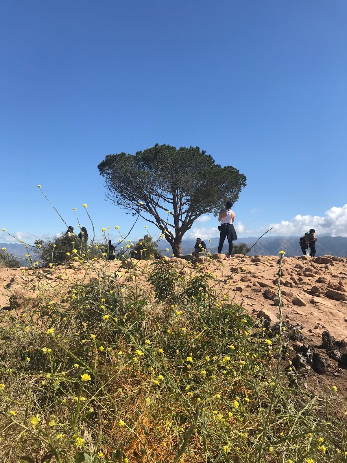
From the water tank the trailhead mark for the Wonder View Trail can be located. Burbank Peak and the Wisdom Tree are shown as only 0.5 miles away. The Wisdom Tree can be seen above the trailhead marker atop Burbank Peak.


The climb to Burbank Peak and the Wisdom Tree is very steep in addition to being somewhat rocky. The Hollywood Hills Reservoir and Mulholland Dam is very apparent during the lower portions of the trail.

Mulholland Dam is notable since it has an almost identical design to St. Francis Dam which had a catastrophic failure in San Francisquito Canyon in 1928. The Mulholland Dam just as St. Francis Dam was designed by engineer William Mulholland. Mulholland Dam began construction in 1923 and was completed in 1924, the reservoir has a maximum depth of 183 feet. Despite concerns over Mulholland Dam failing much like St. Francis Dam they were largely abated when the latter was discovered to have been built atop a fault line in San Francisquito Canyon. Despite the concerns over Mulholland Dam largely being a thing of the past the structure was featured in the 1974 disaster movie Earthquake. More on failure of the St. Francis Dam can be found on the blog below.
Legend of the Ridge Route; a history of crossing the moutains between the Los Angeles Basin to San Joaquin Valley
Atop Burbank Peak at 1,690 feet above sea level is the Wisdom Tree. The Wisdom Tree is the last surviving tree from a 2007 wildfire which torched Burbank Peak.


Atop Burbank Peak much of the Los Angeles Basin can be seen to the south along with San Fernando Valley to the north. Cahuenga Pass and the Hollywood Freeway can be seen looking southward. From right-to-left in the photo below the following can be seen; Cahuenga Pass/Hollywood Freeway, Hollywood Reservoir/Mulholland Dam, downtown Los Angeles and the edge of the Hollywood Sign.

- Cahuenga Boulevard through Cahuenga Pass to Sunset Boulevard.
- Sunset Boulevard to Macy Street (modern Cesar E. Chavez Avenue)
- Macy Street over the Los Angeles River to Pleasant Avenue.
- Pleasant Avenue to Boyle Avenue.
- Boyle Avenue to Whittier Boulevard.
The surface alignment of US 101 described above can be seen on the 1935 California Division of Highways Map of downtown Los Angeles.
Division of Highways Map of downtown Los Angeles
The AASHTO would approve an extension of US 66 to Santa Monica in June of 1935 which became effective in January 1936. The new alignments of the US 101 and US 66 can be seen on the 1936-37 State Highway Map.
1936-37 State Highway Map City Insert
Further, the shift of US 66 west to Santa Monica by proxy truncated CA 2 to US 101/US 66 at Sunset Boulevard via Hyperion Avenue. The original 1934 definition of CA 2 had it end in Santa Monica.
1934 Department of Public Works Guide Announcing the Signed State Highways
The first segment of the Hollywood Freeway opened in June of 1940 through a new 1.5 mile segment in Cahuenga Pass. This new freeway was known at the time as the Cahuenga Pass Freeway and was notable since it featured trolleys running through the center median until 1952. The 1940 doesn't really display in great deal the new freeway through Cahuenga Pass.
1940 State Highway Map City Insert
By 1944 the planned route US 101 of the Hollywood Freeway south from Cahuenga Pass through downtown appears on the State Highway Map City insert along with a small portion of what would become the Santa Ana Freeway.
1944 State Highway Map City Insert
A small portion of the Hollywood Freeway is shown completed from the Arroyo Seco Parkway in downtown Los Angeles past Alvarado Street on the 1951 State Highway Map City Insert. It isn't clear if US 101 was shifted onto the opened portion of the Hollywood Freeway. Reportedly the Four Level Interchange had been completed by 1949 but didn't open to traffic until 1953.
1951 State Highway Map City Insert
The 1953 State Highway Map shows the Hollywood Freeway complete to Sunset Boulevard and US 101 aligned onto it. It isn't clear if US 66 immediately multiplexed US 101 on the Hollywood Freeway from the Four Level Interchange to Santa Monica Boulevard or remained on the surface routing on Sunset Boulevard in 1953.
1953 State Highway Map City Insert
The Hollywood Freeway was completely open from San Fernando Valley to downtown Los Angeles by April of 1954. The 1954 State Highway Map shows a small portion of unconstructed freeway whereas the 1955 edition shows the entire route from San Fernando Valley to downtown Los Angeles complete. The 1954 maps seems to imply that the former surface routing of US 101 on Sunset Boulevard was deleted as part of LRN 2. This would conclusively put US 66 on the Hollywood Freeway between the Four Level Interchange to Santa Monica Boulevard.
1954 State Highway Map City Insert
1955 State Highway Map City Insert
The northern segment of the Hollywood Freeway on CA 170 in San Fernando Valley was originally part of LRN 159. LRN 159 was routed on Lankershim Boulevard between LRN 2 and LRN 4. LRN 159 was adopted into the State Highway system by 1933 according to CAhighways.org.
CAhighways.org on CA 170
The planned northern extension of the Hollywood Freeway on LRN 159 to the Golden State Freeway first appears on the 1963 State Highway Map. CA 2 was also realigned onto Glendale Avenue where it terminated at US 101/US 66 on the Hollywood Freeway. Previously CA 2 had ended at the Hollywood Freeway on Santa Monica Boulevard.
Interestingly it appears that before the 1964 State Highway Renumbering there were plans to route US 6 on the Hollywood Freeway. There appears to have even been a possible planned interim route for US 6 on Lankershim Boulevard. The Lankershim Boulevard route of US 6 was actually published in error on the 1963 Goshua Highway map of California.
Photo of the 1963 Goshua Highway Map of Los Angeles
Apparently there was even signage plans mocked up to show US 6 on the Hollywood Freeway at the present I-5/CA 170 interchange.
AAroads Forum; US 6 and the Hollywood Freeway
1963 State Highway Map City Insert
By 1964 the State Highway renumbering had occurred and CA 170 was assigned to the Hollywood Freeway extension on what was LRN 159. Interestingly CA 170 was intended to utilized what was the planned Laurel Canyon Freeway south to I-405/San Diego Freeway on what what had been LRN 160. The Laurel Canyon Freeway was ultimately never constructed and officially deleted legislatively in 1985. Small portions of La Cienega Bouelvard were upgraded to freeway standards in anticipation of the Laurel Canyon Freeway being built. The 1964 State Highway Map also displays the truncation of US 66 off the Hollywood Freeway and Arroyo Seco Parkway to Pasadena. The truncation of US 66 led to CA 2 being extended over the Hollywood Freeway and restored to it's original terminus City in Santa Monica.
1964 State Highway Map City Insert
The Hollywood Freeway is shown completed north of CA 134 on the Ventura Freeway by 1965. CA 170 does not appear to have been signed on the new segment of the Hollywood Freeway.
1965 State Highway Map City Insert
The 1967 State Highway Map shows the Hollywood Freeway extended further north of the Ventura Freeway.
1967 State Highway Map City Insert
The CA 170 portion of the Hollywood Freeway was completed to the Golden State Freeway (I-5) in 1968 and can be seen on the 1969 State Highway Map.
1969 State Highway Map City Insert
My approach to the CA 170 portion of Hollywood Freeway was from I-5 south on the Golden State Freeway.


Present CA 170 is only 8 miles in length and is completed carried by the north end of the Hollywood Freeway. CA 170 south traffic is greeted almost immediately by a "CA 170 Holly Freeway" sign.

CA 170 south Exit 10 accesses Roscoe Boulevard.

CA 170 south Exit 9 accesses Sherman Way. Most signage on the CA 170 portion of the Hollywood Freeway is still in button-copy format.

CA 170 south Exit 8B accesses Victory Boulevard whereas Exit 8A accesses Oxnard Street.


CA 170 south Exit 7 accesses Burbank Boulevard.

CA 134/Ventura Freeway signage first appears approaching CA 170 south Exit 6B at Magnolia Boulevard.

CA 170 south accesses Riverside Drive/Camarillo Street via Exit 6A.

At the junction for CA 134/Ventura Freeway the route of CA 170 south terminates, and the Hollywood Freeway continues towards Cahuenga Pass as US 101.

Cahuenga Pass was part of the Spanish El Camino Real and was the site of two battles during Mexican Rule. Cahuenga Pass is the lowest mountain pass in the Santa Monica Mountains at 745 feet above sea level.
Signage on the US 101 south portion of the Hollywood Freeway is much newer. At Exit 12B there is access to Vineland avenue.

Suffice to say some of the views of the Hollywood Freeway creeping south through Cahuenga Pass are worth seeing when clear of traffic.

At US 101 south Exit 12A there is access to Lankershim Boulevard via Cahuenga Boulevard. Just north of the Exit US 101 south crosses the Los Angeles River. Lankershim Boulevard as noted above was the original alignment of LRN 159 and showed up on the 1963 Goshua Highway Map in error as US 6.

The bridge work on the US 101 portion of the Hollywood Freeway tends retain some of the classic Arc Deco designs that were common before once on Californian Highways. In the first photo below the Barham Boulevard Bridge can be seen. Accroding to Daniel Faigin of CAhighways.org the clips of the electric trolley line can be seen beneath the Barham Boulevard Bridge.

Barham Boulevard is notable as can be used as access to the Hollywood Reservoir and the Wonder View Trail in Griffith Park. More information can be found at the end of this blog.
Access to the Hollywood Museum is signed from US 101 south via Exit 9C for Highland Avenue. Highland Avenue south to Santa Monica Boulevard until 2015 was an unrelinquished spur of CA 170 which dated back to when LRN 160 was first added to the State Highway system.


Exit 9 on US 101 south accesses Cahuenga Boulevard.


Exit 9A on US 101 south accesses Vine Street.

Exit 8C on US 101 south accesses Gower Street whereas Exit 8B accesses Hollywood Boulevard.


At Exit 8A US 101 south accesses Sunset Boulevard.

At Exit 7 US 101 south accesses the unsigned CA 258 on Western Avenue and picks up CA 2 east from Santa Monica Boulevard. From at minimum 1954 until the 1964 State Highway Renumbering US 66 would have multiplexed US 101 on the Hollywood Freeway from here to the Four Level Interchange.

At US 101 south/CA 2 east Exit 6B there is signed access to Melrose Avenue and Normandie Avenue.

At US 101 south/CA 2 east Exit 6A there is signed access to Vermont Avenue.

At US 101 south/CA 2 east Exit 5B there is signed access to Silver Lake Boulevard whereas Exit 5A accesses Benton Way.


CA 2 east splits from US 101 south at Exit 4B for Alvarado Street.


US 101 south Exit 4A accesses Glendale Boulevard and Union Avenue.


US 101 south accesses CA 110 via the Four Level Interchange in downtown Los Angeles via Exit 3B. The Hollywood Freeway terminates at the Four Level Interchange and US 101 continues on the Santa Ana Freeway. I turned southward on CA 110 towards downtown Los Angeles.


As noted above the Hollywood Reservoir and western sections of Griffith Park are accessible in close proximity to the Hollywood Freeway in Cahuenga Pass. Trailhead parking for the Wonder View Trail (officially Burbank Peak Trail) can be found on Lake Hollywood Drive overlooking the Hollywood Reservoir and Mulholland Dam.

To access the Wonder View Trail foot traffic must ascend the residential of Wonder View Drive to a water tank.


Griffith Park is a large municipal park maintained by the City of Los Angeles which is sprawled out through over 4,310 acres of the eastern Santa Monica Mountains. Griffith Park is one of the oldest municipal parks in the United States having been created in 1896 when Griffith J. Griffith donated over 3,000 acres of his own land to the city. Griffith Park is mostly known for the trail the Hollywood Sign but includes numerous trails and the notable Griffith Observatory.
From the water tank the trailhead mark for the Wonder View Trail can be located. Burbank Peak and the Wisdom Tree are shown as only 0.5 miles away. The Wisdom Tree can be seen above the trailhead marker atop Burbank Peak.


The climb to Burbank Peak and the Wisdom Tree is very steep in addition to being somewhat rocky. The Hollywood Hills Reservoir and Mulholland Dam is very apparent during the lower portions of the trail.

Mulholland Dam is notable since it has an almost identical design to St. Francis Dam which had a catastrophic failure in San Francisquito Canyon in 1928. The Mulholland Dam just as St. Francis Dam was designed by engineer William Mulholland. Mulholland Dam began construction in 1923 and was completed in 1924, the reservoir has a maximum depth of 183 feet. Despite concerns over Mulholland Dam failing much like St. Francis Dam they were largely abated when the latter was discovered to have been built atop a fault line in San Francisquito Canyon. Despite the concerns over Mulholland Dam largely being a thing of the past the structure was featured in the 1974 disaster movie Earthquake. More on failure of the St. Francis Dam can be found on the blog below.
Legend of the Ridge Route; a history of crossing the moutains between the Los Angeles Basin to San Joaquin Valley
Atop Burbank Peak at 1,690 feet above sea level is the Wisdom Tree. The Wisdom Tree is the last surviving tree from a 2007 wildfire which torched Burbank Peak.


Atop Burbank Peak much of the Los Angeles Basin can be seen to the south along with San Fernando Valley to the north. Cahuenga Pass and the Hollywood Freeway can be seen looking southward. From right-to-left in the photo below the following can be seen; Cahuenga Pass/Hollywood Freeway, Hollywood Reservoir/Mulholland Dam, downtown Los Angeles and the edge of the Hollywood Sign.

Comments