
This past month while visiting the Los Angeles Area I drove the entirety of California State Route 23. CA 23 is one of the most diverse State Highways I've driven in Southern California as it's alignment ranges from narrow mountain grades over fire scarred terrain, urban surface street, freeway and scenic back country.
CA 23 is a 32 mile north/south State Highway which begins at a southern terminus at CA 1 in Los Angeles County and ends at a north terminus at CA 126 in Fillmore of Ventura County. As stated above CA 23 is fairly unique given it traverses varying road designs and terrain. CA 23 was first signed in 1934 over the entirety of Legislative Route Number 155. LRN 155 was adopted into the State Highway System by 1933 according to CAhighways.org.
1934 Department of Public Works guide annoucing the Signed State Highways
CAhighways.org on LRN 155
CAhighways.org on CA 23
In 1964 all hidden Legislative Route numbers were eliminated during the California Highway Renumbering. LRN 155 can be seen being removed by comparing the 1963 State Highway Map to the 1964 Edition.
1963 State Highway Map
1964 State Highway Map
CA 23 compared to most State Highways the alignment shifts in CA 23 are on the surface somewhat minor. That said CA 23 between US 101 north to CA 118 is presently aligned on the Moorpark Freeway. According to CAhighways.org the Moorpark Freeway opened in segments between 1971 and 1994. The Moorpark Freeway was conceived as the Decker Freeway. The Decker Freeway was never completed to full scale as it was originally envisioned continuing beyond CA 118 north to CA 126 in Fillmore. The 1966 State Highway Map is the first edition to display the route of the planned Moorpark Freeway.
1966 State Highway Map
Much of the Moorpark Freeway between US 101 on the Ventura Freeway and Tierra Rejada Road can be seen opening by the 1975 State Highway Map. The shift in alignment can be seen by comparing the 1970 State Highway Map to the 1975 edition.
1970 State Highway Map
1975 State Highway Map
The 1977 State Highway Map shows the planned alignment for CA 23 on the Moorpark Freeway to connect to CA 118 on the Simi Valley Freeway.
1977 State Highway Map
The 1982 State Highway Map shows the Moorpark Freeway complete possibly north to CA 118 on Princeton Avenue.
1982 State Highway Map
The last State Highway Map to show the junction of CA 23 on the Moorpark Freeway meeting CA 118 on Princeton Avenue is the 1990 edition. The present junction of CA 23 on the Moorpark Freeway and CA 118 on the Simi Valley Freeway opened in 1994 as noted above.
1990 State Highway Map
At some point between 1990 and 2005 the Moorpark Freeway north to CA 126 appears to have been cancelled. The extension of the Moorpark Freeway to CA 126 does not appear on the 2005 State Highway Map.
2005 State Highway Map
For reference the surface alignment of CA 23 from CA 118 in Moorpark south to Thousand Oaks used to use the following route:
- From CA 118 Los Angeles Avenue south on Spring Road.
- Spring Road south to Tierra Rejada Road.
- Tierra Rejada Road east to Sunset Valley Road.
- Sunset Valley Road south to Reed Road.
- Reed Road west to Moorpark Road.
- Moorpark Road south to US 101 on Thousand Oaks Boulevard.
The original alignment of CA 23 within the vicinity of Moorpark can be seen on the 1935 California Division of Highways Map of Ventura County.
1935 Ventura County Highway Map
From CA 1 northbound in western Malibu I approach CA 23 north.


CA 23 north from it's southern terminus is aligned initially on Decker Canyon Road. Traffic is almost immediately warned that the area northward into the Santa Monica Mountains is an extreme fire hazard zone. Much of CA 23 in the Santa Monica Mountains was heavily impacted by the Woolsey Fire of 2018. The Woolsey Fire burned close to 100,000 acres of land in the Santa Monica Mountains, killed 3 and burned over 1,600 structures.

CA 23 snakes through Decker Canyon northward on a narrow grade that quickly ascends above 1,000 feet above sea level. The view south through Decker Canyon provides some decent views of the Pacific Ocean on clear days.


CA 23 north continues into the burn area of the Woolsey Fire on Decker Canyon Road before meeting Mulholland Highway. CA 23 north makes a right hand turn onto Mulholland Highway.


CA 23 is the only State Highway to carry any segment of Mulholland Highway or Mulholland Drive. Mulholland Highway and Mulholland Drive both skirt the crest of the Santa Monica Mountains as a singular scenic corridor through Los Angeles County. More on the history of Mulholland Highway and Mulholland Drive can be found below.
Mulholland Drive; Cahuenga Pass west to Sepulveda Pass (and the odd tale of cancelled CA 268)
CA 23 north follows Mulholland Highway through some of the worst burn areas of the Woolsey Fire to Westlake Boulevard.


From the intersection of Mulholland Highway and Westlake Boulevard the route of CA 23 south to the Pacific Ocean can be viewed in via the shoulder.

CA 23 turns onto Westlake Boulevard and begins to descend towards the Ventura County Line. At Eleanor Sentinel at Carlisle Road the route CA 23 north enters Ventura County and Thousand Oaks.


At Potrero Road the route of CA 23 north widens to multiple lanes. CA 23 continues through Thousand Oaks to the Ventura Freeway where it jumps onto a multiplex of US 101 north. Thousand Oaks lies in what is known as Conejo Valley.


The multiplex of CA 23 north on US 101 north/Ventura Freeway is short. CA 23 north splits onto the Moorpark Freeway at Exit 43B.


CA 23 north on the Moorpark Freeway makes a descent towards Simi Valley. Of note CA 23 north on the Moorpark Freeway has signed access to the Ronald Reagan Presidential Library at Exit 17 via Olsen Avenue. El Rancho Simi is accessible from CA 23 north Exit 19 on Tierra Rejada Road.


CA 23 north on the Moorpark Freeway enters Moorpark and meets CA 118/Simi Valley Freeway at Exit 20A/New Los Angeles Avenue. Interestingly CA 118 east on the Simi Valley Freeway acts as the freeway continuation whereas CA 23 north exits onto CA 118 west on New Los Angeles Avenue.


CA 23 north briefly multiplexes CA 118 west on New Los Angeles Avenue before the former splits away on Moorpark Avenue.

CA 23 north proceeds through downtown Moorpark on Moorpark Road. Moorpark Road becomes Walnut Canyon Road north of Moorpark City Hall.


CA 23 north continues on Walnut Canyon Road and makes a western jog onto Broadway Road.


CA 23 north makes a quick right hand turn off Broadway Road onto Grimes Canyon Road.


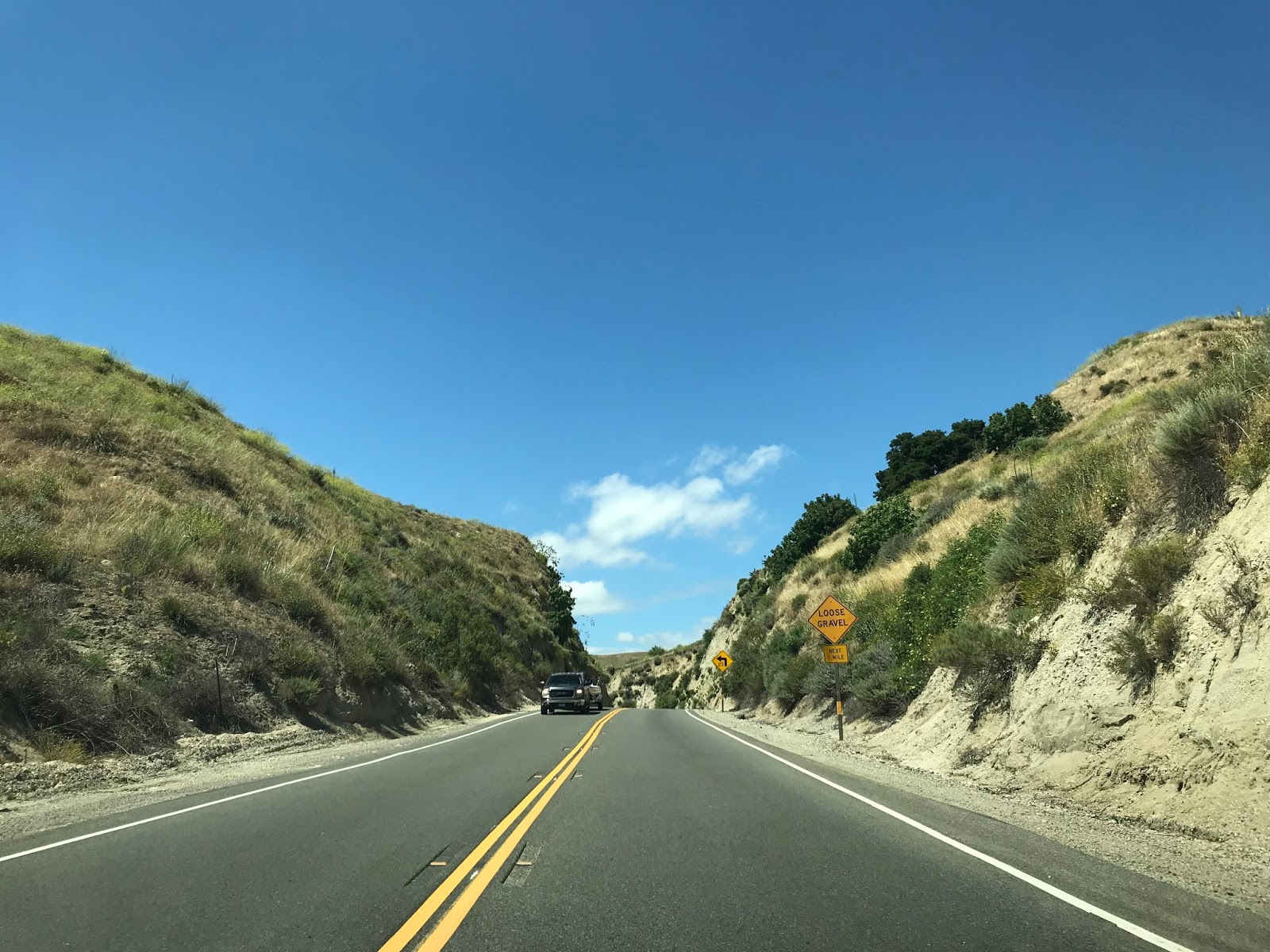
CA 23 north through Grimes Canyon via Grimes Canyon Road is highly scenic. Grimes Canyon Road descends through the winding Grimes Canyon as it overlooks the Santa Clara River Valley to the north. Unlike Decker Canyon Road the route of CA 23 north through Grimes Canyon is reasonably wide and offers a swift mountain grade that is easy to enjoy with numerous sweeping curves.


CA 23 north takes a right hand turn onto Bardsdale Avenue before making a quick left onto Chambersburg Road.


CA 23 north follows Chambersburg Road to the Santa Clara River where it enters the City of Fillmore.


CA 23 north enters Fillmore via A Street and terminates at CA 126 on Ventura Street.


1934 Department of Public Works guide annoucing the Signed State Highways
CAhighways.org on LRN 155
CAhighways.org on CA 23
In 1964 all hidden Legislative Route numbers were eliminated during the California Highway Renumbering. LRN 155 can be seen being removed by comparing the 1963 State Highway Map to the 1964 Edition.
1963 State Highway Map
1964 State Highway Map
CA 23 compared to most State Highways the alignment shifts in CA 23 are on the surface somewhat minor. That said CA 23 between US 101 north to CA 118 is presently aligned on the Moorpark Freeway. According to CAhighways.org the Moorpark Freeway opened in segments between 1971 and 1994. The Moorpark Freeway was conceived as the Decker Freeway. The Decker Freeway was never completed to full scale as it was originally envisioned continuing beyond CA 118 north to CA 126 in Fillmore. The 1966 State Highway Map is the first edition to display the route of the planned Moorpark Freeway.
1966 State Highway Map
Much of the Moorpark Freeway between US 101 on the Ventura Freeway and Tierra Rejada Road can be seen opening by the 1975 State Highway Map. The shift in alignment can be seen by comparing the 1970 State Highway Map to the 1975 edition.
1970 State Highway Map
1975 State Highway Map
The 1977 State Highway Map shows the planned alignment for CA 23 on the Moorpark Freeway to connect to CA 118 on the Simi Valley Freeway.
1977 State Highway Map
The 1982 State Highway Map shows the Moorpark Freeway complete possibly north to CA 118 on Princeton Avenue.
1982 State Highway Map
The last State Highway Map to show the junction of CA 23 on the Moorpark Freeway meeting CA 118 on Princeton Avenue is the 1990 edition. The present junction of CA 23 on the Moorpark Freeway and CA 118 on the Simi Valley Freeway opened in 1994 as noted above.
1990 State Highway Map
At some point between 1990 and 2005 the Moorpark Freeway north to CA 126 appears to have been cancelled. The extension of the Moorpark Freeway to CA 126 does not appear on the 2005 State Highway Map.
2005 State Highway Map
For reference the surface alignment of CA 23 from CA 118 in Moorpark south to Thousand Oaks used to use the following route:
- From CA 118 Los Angeles Avenue south on Spring Road.
- Spring Road south to Tierra Rejada Road.
- Tierra Rejada Road east to Sunset Valley Road.
- Sunset Valley Road south to Reed Road.
- Reed Road west to Moorpark Road.
- Moorpark Road south to US 101 on Thousand Oaks Boulevard.
The original alignment of CA 23 within the vicinity of Moorpark can be seen on the 1935 California Division of Highways Map of Ventura County.
1935 Ventura County Highway Map
From CA 1 northbound in western Malibu I approach CA 23 north.


CA 23 north from it's southern terminus is aligned initially on Decker Canyon Road. Traffic is almost immediately warned that the area northward into the Santa Monica Mountains is an extreme fire hazard zone. Much of CA 23 in the Santa Monica Mountains was heavily impacted by the Woolsey Fire of 2018. The Woolsey Fire burned close to 100,000 acres of land in the Santa Monica Mountains, killed 3 and burned over 1,600 structures.

CA 23 snakes through Decker Canyon northward on a narrow grade that quickly ascends above 1,000 feet above sea level. The view south through Decker Canyon provides some decent views of the Pacific Ocean on clear days.


CA 23 north continues into the burn area of the Woolsey Fire on Decker Canyon Road before meeting Mulholland Highway. CA 23 north makes a right hand turn onto Mulholland Highway.


CA 23 is the only State Highway to carry any segment of Mulholland Highway or Mulholland Drive. Mulholland Highway and Mulholland Drive both skirt the crest of the Santa Monica Mountains as a singular scenic corridor through Los Angeles County. More on the history of Mulholland Highway and Mulholland Drive can be found below.
Mulholland Drive; Cahuenga Pass west to Sepulveda Pass (and the odd tale of cancelled CA 268)
CA 23 north follows Mulholland Highway through some of the worst burn areas of the Woolsey Fire to Westlake Boulevard.


From the intersection of Mulholland Highway and Westlake Boulevard the route of CA 23 south to the Pacific Ocean can be viewed in via the shoulder.

CA 23 turns onto Westlake Boulevard and begins to descend towards the Ventura County Line. At Eleanor Sentinel at Carlisle Road the route CA 23 north enters Ventura County and Thousand Oaks.


At Potrero Road the route of CA 23 north widens to multiple lanes. CA 23 continues through Thousand Oaks to the Ventura Freeway where it jumps onto a multiplex of US 101 north. Thousand Oaks lies in what is known as Conejo Valley.


The multiplex of CA 23 north on US 101 north/Ventura Freeway is short. CA 23 north splits onto the Moorpark Freeway at Exit 43B.


CA 23 north on the Moorpark Freeway makes a descent towards Simi Valley. Of note CA 23 north on the Moorpark Freeway has signed access to the Ronald Reagan Presidential Library at Exit 17 via Olsen Avenue. El Rancho Simi is accessible from CA 23 north Exit 19 on Tierra Rejada Road.


CA 23 north on the Moorpark Freeway enters Moorpark and meets CA 118/Simi Valley Freeway at Exit 20A/New Los Angeles Avenue. Interestingly CA 118 east on the Simi Valley Freeway acts as the freeway continuation whereas CA 23 north exits onto CA 118 west on New Los Angeles Avenue.


CA 23 north briefly multiplexes CA 118 west on New Los Angeles Avenue before the former splits away on Moorpark Avenue.

CA 23 north proceeds through downtown Moorpark on Moorpark Road. Moorpark Road becomes Walnut Canyon Road north of Moorpark City Hall.


CA 23 north continues on Walnut Canyon Road and makes a western jog onto Broadway Road.


CA 23 north makes a quick right hand turn off Broadway Road onto Grimes Canyon Road.


CA 23 north through Grimes Canyon via Grimes Canyon Road is highly scenic. Grimes Canyon Road descends through the winding Grimes Canyon as it overlooks the Santa Clara River Valley to the north. Unlike Decker Canyon Road the route of CA 23 north through Grimes Canyon is reasonably wide and offers a swift mountain grade that is easy to enjoy with numerous sweeping curves.


CA 23 north takes a right hand turn onto Bardsdale Avenue before making a quick left onto Chambersburg Road.


CA 23 north follows Chambersburg Road to the Santa Clara River where it enters the City of Fillmore.


CA 23 north enters Fillmore via A Street and terminates at CA 126 on Ventura Street.


Comments