While returning from the Mariposa Area this month I decided that I wanted to visit the quasi-ghost town of Raymond and take a "off the beaten path" roadway to get there. I found just what I was looking for in Ben Hur Road in Mariposa County which reaches Raymond as Road 613 in Madera County.

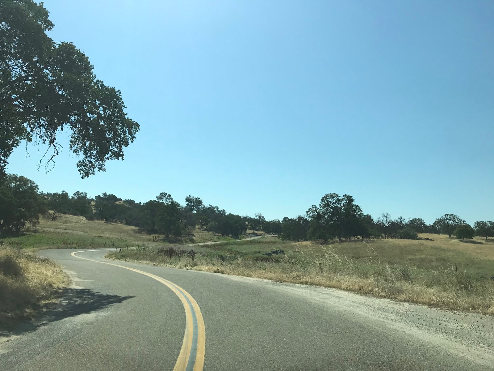
Ben Hur Road begins on the outskirts of Mariposa near Mormon Bar at CA 49. From CA 49 the route to Raymond is signed as being 23 miles to the south.

Interestingly Ben Hur Road isn't named after the famous 1959 movie but rather a ghost town along the roadway. The community of Ben Hur has records showing it had a Post Office by said name in 1890 which obviously implies the community was named after the 1880 novel. Unlike most roads of this kind the story of Ben Hur Road has been told previously by several newspapers in the 20th Century.
Oakland Tribune (September 1950) Trip to Mariposa via Ben Hur Road
Rock Fence is label of history on Quick Rance (Fresno Bee 1954)
The Oakland Tribune story details a trip leaving Mariposa via Ben Hur Road. Ben Hur Road and the entire road network in Mariposa County is described rough which required a solid day to traverse. The article describes the town site of Ben Hur and history of Quick Ranch which was created in 1859. Quick Ranch apparently at the time was famed for the stone walls which were constructed circa 1862. The Fresno Bee Article continues by describing the history of Quick Ranch and Ben Hur into the 20th Century.
The location of Ben Hur is shown on a 1935 Division of Highways Map of Mariposa County near Becknell Creek. Ben Hur Road is shown on the map as a major county maintained roadway.
1935 Mariposa County Highway Map
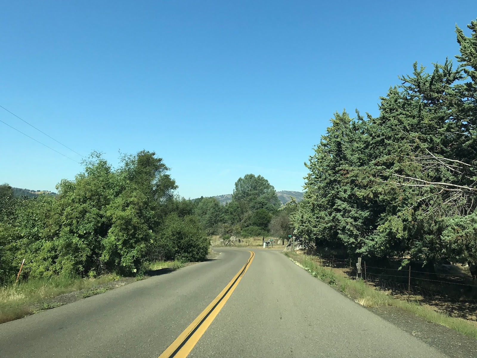
Near Mormon Bar the route of Ben Hur Road is briefly signed as 25 MPH before opening up into a 55 MPH zone.


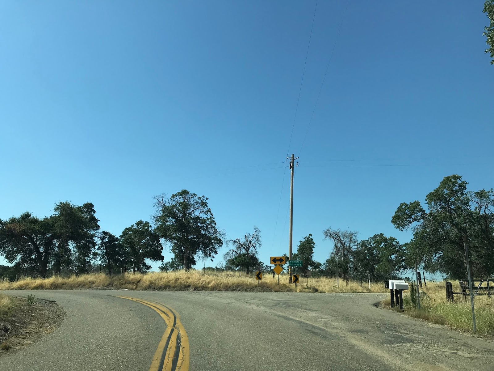
Ben Hur Road has a generally southwestward direction through the Sierra Nevada Mountains before taking a southerly turn at the junction for Buckeye Road. From Buckeye Road the route of Ben Hur Road is signed as 20 miles from Raymond.


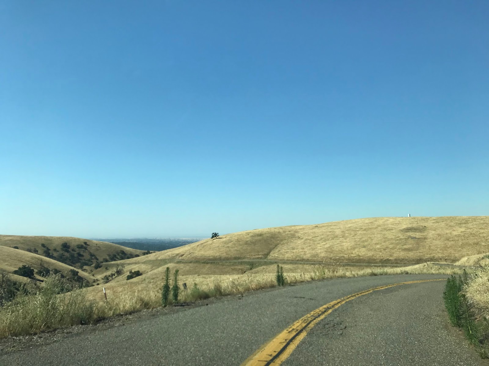
Ben Hur Road continues southward through 13.5 miles of curved but mild terrain before approaching a bluff overlooking San Joaquin Valley. Near the bluff traffic is advised that Ben Hur Road narrows and there are high grades.


Southbound Ben Hur road approaches Becknell Creek and is advised there is 9 miles of curves ahead. The stone walls of Quick Ranch can be seen east of Ben Hur Road and are the only trace of the community in modern times.

Ben Hur Road traverses a canyon grade alongside Becknell Creek. At the bottom of the canyon grade there was once a community known as Stouts which appears on the 1935 Division of Highways Map of Mariposa County linked above.


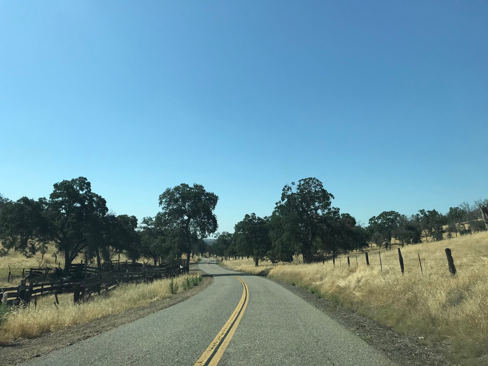
Ben Hur Road continues south through the Sierra Foothills dipping through the terrain before taking a sudden eastern turn towards the Madera County Line.


Ben Hur Road approaches the Madera County Line where Road 613 begins.


Road 613 continues eastward over Chapman Creek and the Chowchilla River to the Raymond Bridge Trailhead along Eastman Lake.


Eastman Lake was created when Buchanan Dam was completed in 1975 along the Chowchilla River. Eastman Lake was built for flood control measures by the U.S. Army Corps of Engineers.

There is an abandoned bridge structure north of the modern crossing of the Chowchilla River on Road 613. I have been unable to locate the vintage of said bridge but the concrete design suggests it was from the early 20th Century.


Road 613 appears on the 1935 California Division of Highways Map of Madera County as Green Mountain Road.
1935 Madera County Highway Map
Road 613 continues southeast through the Sierra Foothills and terminates at Road 600 in Raymond.


Raymond was founded as Wild Cat Station and was the north terminus of the San Joaquin Valley and Yosemite Railroad which was opened by the Southern Pacific Railroad in February 1886. The San Joaquin Valley and Yosemite Railroad received it's first passengers by March of 1886 and the community of Wild Cat Station became a popular trailhead for stages heading to the Wawona Road of Yosemite National Park. Postal Service was established in July of 1886 and the community name was changed to Raymond. The name Raymond was chosen due to the community frequently being the used to ship materials from the nearby Raymond Granite Quarry. In addition to the Yosemite Stage and Granite the community of Raymond also had a substantial lumber shipping industry sourced by nearby Fresno Flats (modern Oakhurst). The 21 mile San Joaquin Valley and Yosemite Railroad was shuttered in 1946.


The entire line of the San Joaquin Valley and Yosemite Railroad can be seen on the above Division of Highways Map of Madera County. There was a spur route of the San Joaquin Valley and Yosemite Valley Railroad which ended in nearby Knowles. The importance of Raymond to the development of the Wawona Road can't be understated and it's history can be found below.
History of the Wawona Road (Yosemite National Park)
The grade of the San Joaquin Valley and Yosemite Railroad was situated between Road 600 and Road 608. Road 600 was once known as Raymond Road and grade of the rails is obvious from Road 608. Raymond was a dying community but has numerous structures from it's heyday. The community of Raymond is now growing alongside the much larger nearby communities like Coarsegold and Oakhurst in modern times.


A small portion of the San Joaquin Valley and Yosemite Railroad is preserved by the Raymond Museum along Road 600.


Ben Hur Road begins on the outskirts of Mariposa near Mormon Bar at CA 49. From CA 49 the route to Raymond is signed as being 23 miles to the south.

Interestingly Ben Hur Road isn't named after the famous 1959 movie but rather a ghost town along the roadway. The community of Ben Hur has records showing it had a Post Office by said name in 1890 which obviously implies the community was named after the 1880 novel. Unlike most roads of this kind the story of Ben Hur Road has been told previously by several newspapers in the 20th Century.
Oakland Tribune (September 1950) Trip to Mariposa via Ben Hur Road
Rock Fence is label of history on Quick Rance (Fresno Bee 1954)
The Oakland Tribune story details a trip leaving Mariposa via Ben Hur Road. Ben Hur Road and the entire road network in Mariposa County is described rough which required a solid day to traverse. The article describes the town site of Ben Hur and history of Quick Ranch which was created in 1859. Quick Ranch apparently at the time was famed for the stone walls which were constructed circa 1862. The Fresno Bee Article continues by describing the history of Quick Ranch and Ben Hur into the 20th Century.
The location of Ben Hur is shown on a 1935 Division of Highways Map of Mariposa County near Becknell Creek. Ben Hur Road is shown on the map as a major county maintained roadway.
1935 Mariposa County Highway Map
Near Mormon Bar the route of Ben Hur Road is briefly signed as 25 MPH before opening up into a 55 MPH zone.


Ben Hur Road has a generally southwestward direction through the Sierra Nevada Mountains before taking a southerly turn at the junction for Buckeye Road. From Buckeye Road the route of Ben Hur Road is signed as 20 miles from Raymond.


Ben Hur Road continues southward through 13.5 miles of curved but mild terrain before approaching a bluff overlooking San Joaquin Valley. Near the bluff traffic is advised that Ben Hur Road narrows and there are high grades.


Southbound Ben Hur road approaches Becknell Creek and is advised there is 9 miles of curves ahead. The stone walls of Quick Ranch can be seen east of Ben Hur Road and are the only trace of the community in modern times.

Ben Hur Road traverses a canyon grade alongside Becknell Creek. At the bottom of the canyon grade there was once a community known as Stouts which appears on the 1935 Division of Highways Map of Mariposa County linked above.


Ben Hur Road continues south through the Sierra Foothills dipping through the terrain before taking a sudden eastern turn towards the Madera County Line.


Ben Hur Road approaches the Madera County Line where Road 613 begins.


Road 613 continues eastward over Chapman Creek and the Chowchilla River to the Raymond Bridge Trailhead along Eastman Lake.


Eastman Lake was created when Buchanan Dam was completed in 1975 along the Chowchilla River. Eastman Lake was built for flood control measures by the U.S. Army Corps of Engineers.

There is an abandoned bridge structure north of the modern crossing of the Chowchilla River on Road 613. I have been unable to locate the vintage of said bridge but the concrete design suggests it was from the early 20th Century.


Road 613 appears on the 1935 California Division of Highways Map of Madera County as Green Mountain Road.
1935 Madera County Highway Map
Road 613 continues southeast through the Sierra Foothills and terminates at Road 600 in Raymond.


Raymond was founded as Wild Cat Station and was the north terminus of the San Joaquin Valley and Yosemite Railroad which was opened by the Southern Pacific Railroad in February 1886. The San Joaquin Valley and Yosemite Railroad received it's first passengers by March of 1886 and the community of Wild Cat Station became a popular trailhead for stages heading to the Wawona Road of Yosemite National Park. Postal Service was established in July of 1886 and the community name was changed to Raymond. The name Raymond was chosen due to the community frequently being the used to ship materials from the nearby Raymond Granite Quarry. In addition to the Yosemite Stage and Granite the community of Raymond also had a substantial lumber shipping industry sourced by nearby Fresno Flats (modern Oakhurst). The 21 mile San Joaquin Valley and Yosemite Railroad was shuttered in 1946.


The entire line of the San Joaquin Valley and Yosemite Railroad can be seen on the above Division of Highways Map of Madera County. There was a spur route of the San Joaquin Valley and Yosemite Valley Railroad which ended in nearby Knowles. The importance of Raymond to the development of the Wawona Road can't be understated and it's history can be found below.
History of the Wawona Road (Yosemite National Park)
The grade of the San Joaquin Valley and Yosemite Railroad was situated between Road 600 and Road 608. Road 600 was once known as Raymond Road and grade of the rails is obvious from Road 608. Raymond was a dying community but has numerous structures from it's heyday. The community of Raymond is now growing alongside the much larger nearby communities like Coarsegold and Oakhurst in modern times.


A small portion of the San Joaquin Valley and Yosemite Railroad is preserved by the Raymond Museum along Road 600.


Comments
went 80 per
they hauled away
what had Ben Hur
Burma-Shave