Part 1; the history of US Route 101 in Bradley
Bradley was plotted by the Southern Pacific Railroad in
1886 as siding facility. Bradley is named in honor of Bradley V. Sargent who's property the siding facility was constructed upon. Bradley was set up alongside the nearby sidings of San Lucas and San Ardo. Although Bradley doesn't appear on the
1890 George F. Cram Railroad Map of California it was plotted approximately ten miles due south of San Ardo.
The era of State Highway Maintenance through Bradley ultimately begin with the 1909 First State Highway Bond Act which was approved by voters in 1910. One of the highways approved through the 1909 First State Highway Bond Act was a 481.8 mile highway originating at the City Limits of San Francisco which terminated in San Diego. This highway would ultimately come to be known in time as Legislative Route Number 2 ("LRN 2").
Bradley was ultimately part of the American El Camino Real which began being signed as an Auto Trail starting in 1906. Unlike the Spanish El Camino Real which was aligned largely west of the Salinas River to stay on path to Mission San Antonio de Padua and Mission Nuestra Senora de la Soledad the path of LRN 2 was aligned mostly through the center of Salinas Valley. Early LRN 2 and the American El Camino Real can be seen on what is now Bradley Road through Bradley on the 1917 California State Automobile Association Map.
Headed southbound US 101/LRN 2 originally crossed the Salinas River to Dixie Street. From Dixie Street US 101/LRN 2 swung via a couple 90 turns via Pleyto Street to Meadow Avenue. The July/August 1929 California Highways & Public Works noted that US 101/LRN 2 would be realigned and a new bridge over the Salinas River was being considered.
The November/December 1965 California Highways & Public Works notes that US 101 from San Miguel to Camp Roberts had recently been realigned to a freeway during August. Completion of the new bypass of Bradley was anticipated to be complete by summer of 1966.
US 101 is shown bypassing Bradley on the 1967 Division of Highways State Map.
Part 2; a drive on former US Route 101 on Bradley Road
Modern US 101 southbound accesses it's former alignment on Bradley Road at Exit 251.
Bradley Road quickly approaches the 1930 Bradley Bridge.
The Bradley Bridge is a Warren Truss design which features a total length of 1,668.1 feet. The 1888 Bradley Bridge pilings can be seen upstream in the Salinas River looking southward.
Bradley Road crosses the 1930 Bradley Bridge into Bradley.
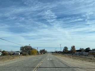
Bradley Road passes southward through the heart of Bradley.
Bradely Road departing Bradley is signed as 5 miles from modern US 101.
Bradley Road follows as a western frontage of the Union Pacific Railroad towards the confluence of the Salinas River and Nacimiento River. South of the confluence Bradley Road approaches the 1940 Salinas River Bridge.
Bradley Road crosses the 1940 Salinas River Bridge and terminates at modern US 101 on the outskirts of Camp Roberts.


Comments