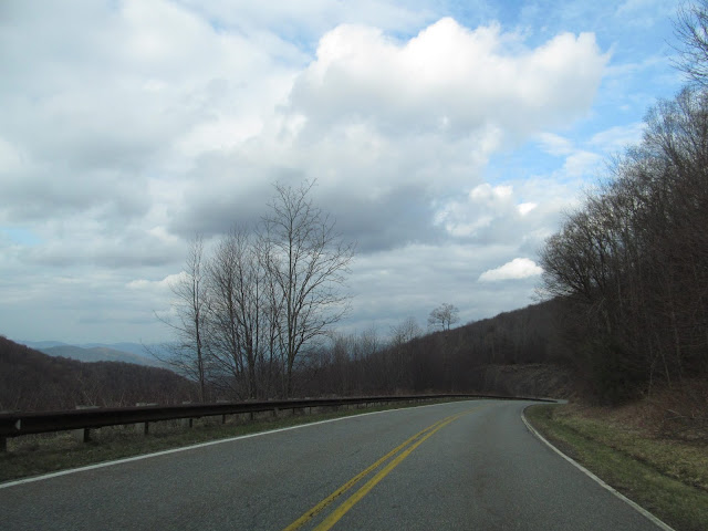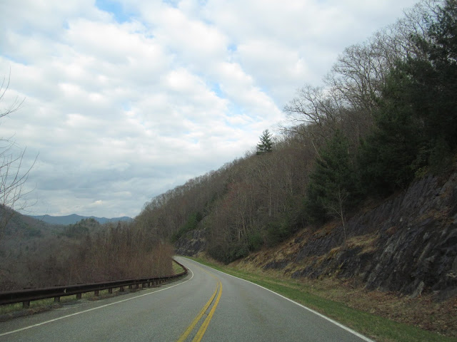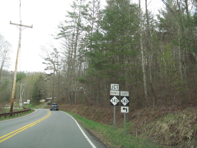
The Cherohala Skyway is a scenic parkway carving its way through 43 miles along the crest of the Great Smoky Mountains in southeastern Tennessee and far southwestern North Carolina. Signed in Tennessee as TN 165 and in North Carolina as NC 143, the 42 mile long byway climbs to over a mile above sea level, winding through hardwood forests and evergreens along with plenty of scenic overlooks on the way between Tellico Plains, Tennessee to Robbinsville, North Carolina. The Cherohala Skyway was designated as a National Scenic Byway shortly after it opened in October of 1996, it was the costliest road to build at the time in North Carolina. It took 34 years and $100 million to build the route, but some say the views along the route are worth every penny. The highway traverses four peaks that are over 5,000 feet in elevation and nine more mountains above 4,000 feet, offering amazing views of mountains, foliage, and waterfalls. The Cherohala Skyway climbs high into the Smokies, ascending from an elevation of just over 930 feet near Tellico Plains, Tennessee to 5,390 feet at the road's highest point at the Santeetlah Overlook in North Carolina. If you are traveling eastbound, nearly half of the elevation change along the Cherohala Skyway comes in the ten mile stretch just after crossing into North Carolina from Tennessee.
The name Cherohala Skyway comes from two national forests that the road goes through, the Cherokee National Forest in Tennessee and the Nantahala National Forest in North Carolina. The dream of the Cherohala Skyway began in 1958 because of a wagon train, believe it or not. A gentleman by the name of Sam Williams dreamed of leading his own wagon train from his home in Tellico Plains to the North Carolina after watching popular TV shows of the day. He brought up his idea at a local Kiwanis Club meeting mountains in the spring of 1958. After some laughter, the idea started to take a serious tone and the idea for a new wagon train road between the two locations was born. Six weeks after the original idea, 67 covered wagons and over 300 horseback riders gathered at the border between Tennessee and North Carolina, traveling to Murphy, North Carolina following the old Unicoi Turnpike. Politicians took notice and this would eventually evolve into the construction of a new highway between Tellico Plains and western North Carolina.
Efforts to assure the construction of a highway from Tellico Plains to western North Carolina took a turn in late 1962. It was determined that the original proposed routing from Tellico Plains to Murphy was not feasible. However, it was discovered that a highway could be built between Tellico Plains and Robbinsville entirely on federal land within the Cherokee and Nantahala National Forests. Robbinsville was the only Western North Carolina town to which such a route was possible. Late in 1962, Congress made the first allocation for the new highway. At that time, the US Forest Service estimated that 5 million cars a year would use the new road. That estimate seems to be a little generous, especially as I had the open road basically to myself for the entire drive I took across the Cherohala Skyway from west to east. I found the drive along the Cherohala Skyway to be extremely scenic and fun, especially along the North Carolina half of the road. There are numerous places to pull over along the way to admire the views of the surrounding mountainsides so you can take in the scenery. When I drove the Cherohala Skyway, it was during the first half of April, so the leaves hadn't really taken hold in the mountains yet. With that, let's enjoy a virtual ride along the Cherohala Skyway.
 |
Turning east onto TN 165 from TN 68 in Tellico Plains, Tennessee. There isn't much in terms of services between here and Robbinsville, North Carolina, so this might be a good time to get a snack or some gas before hitting the open road.
|
 |
Entering the Cherohala Skyway, a scenic byway in its own right.
|
 |
TN 360 ahead to the left.
|
 |
The Cherohala Skyway follows the Tellico River for a few miles at this point, before the road starts the march up the mountains.
|
 |
Make a right to follow the Tellico River. Eventually, you will find your way to Bald River Falls and Baby Falls.
|
 |
Meanwhile, the Cherohala Skyway veers to the left and starts its climb to the top of the Smokies.
|
 |
But quickly back to hitting the road again.
|
 |
Reaching 2000 feet above sea level just after the turnoff to the Indian Boundary Recreation Area.
|
 |
The views from the Turkey Creek Overlook can be pretty invigorating.
|
 |
That's Indian Boundary Lake down below.
|
 |
Lake View Overlook.
|
 |
As you can tell, the opportunities for recreation and to catch scenic vistas has increased as we continue east along the Cherohala Skyway.
|
 |
More driving and scenic views ahead.
|
 |
Just around the bend, something is going to change.
|
 |
Tennesseein' is Tennebelievin', but now we enter the Old North State of North Carolina. The Cherohala Skyway will closely follow near the state border on the North Carolina side between here and Big Junction before veering away from the border.
|
 |
In North Carolina, the Cherohala Skyway carries the route designation of NC 143.
|
 |
Only 30 miles to Robbinsville, North Carolina. But what a worthwhile 30 miles they are.
|
 |
The first thing we encounter in North Carolina is the No Name Gap.
|
 |
Even though there is a downhill grade, we'll be back to climbing soon. We're still roughly 1000 feet in elevation below the highest point along the Cherohala Skyway.
|
 |
Bridge over the Stratton Meadows.
|
 |
Sweeping curves are prominently found along the North Carolina section of the Cherohala Skyway.
|
 |
The views from Haw Knob at 4,480 feet above sea level.
|
 |
Big Junction, big views of the surrounding Smokies. At 5,235 feet, we're just below a mile above sea level at this point.
|
 |
At 5,377 feet above sea level, Santeetlah is the highest point along the Cherohala Skyway. That is even slightly higher that Mount Marcy, the highest mountain in New York State.
|
 |
Time to start the scenic descent down the Cherohala Skyway. We'll stay above 5,000 feet above sea level for a few miles, passing by the Hooper Bald and Huckleberry trailheads along the way. I'm just going to let the photos do the talking for a while.
|
 |
Some ten miles and a drop of about 2300 feet in elevation later, we reach Hooper Cove, which has one of my favorite views along the entire Cherohala Skyway.
|
 |
Elevation: 3000 feet.
|
 |
Santeetlah Gap.
|
 |
At this point, the Cherohala Skyway is ending, but there is still a scenic drive along the Snowbird Creek to be had.
|
 |
I think this is a good place to stop. I hope you enjoyed your virtual journey along the scenic Cherohala Skyway.
|
How to Get There:
Sources and Links:
National Geographic - Road Trip: Cherohala Skyway, Tennessee and North Carolina
Cherohala Skyway - Mile High Legend - 43 mile National Scenic Byway
Romantic Asheville - Cherohala Skyway National Scenic Byway
Tail of the Dragon - Cherohala Skyway Map


Comments