The Alligator Alley segment of Interstate 75 refers to a portion of the freeway from the US Route 27 at the Andy Town Interchange in Broward County westward through the Everglades and Big Cypress Swamp to the vicinity of Naples in Collier County. Alligator Alley contains a cardinal direction change for Interstate 75 from a normally north/south alignment to one that is east/west. Alligator Alley is one of the straightest segments in the Interstate System and also is a source of numerous recreational opportunities.
Part 1; the history of Alligator Alley
As originally conceived and constructed Interstate 75 ("I-75") terminated in downtown Tampa at the Malfunction Junction Interchange with Interstate 4. As the original planned route of I-75 was nearing completion it was becoming increasingly apparent that US Route 41 ("US 41") on the Tamiami Trail was no longer sufficient to carry traffic from Tampa to Miami. A limited access roadway connecting Tampa to Naples was first proposed in 1964 as the West Coast Turnpike. The West Coast Turnpike would connect to the planned toll road extension of Florida State Road 84 ("FL 84") from Andy Town of Broward County through the Everglades and Big Cypress Swamp to Collier County. FL 84 can be seen aligned from US 1 in Fort Lauderdale following the North Fork New River Canal west to US 27 in Andy Town on the 1964 Official Florida State Road Department.

North New River Canal is a heavy modification of the north fork of the New River. Construction of the North Fork New River Canal began in 1906 and was completed by 1912. The North Fork New River Canal can be seen on a
1917 Rand McNally Map of Florida flowing south from Lake Okeechobee towards Broward County.

The North Fork New River Canal would form the basis upon for what is now US 27 from South Bay through the Everglades towards I-75 in Andy Town. Additionally the North Fork New River Canal would form the basis for I-75, FL 84 and I-595 from Andy Town eastward towards Fort Lauderdale. Pre-1945 FL 26 can be seen partially complete through the Everglades south of South Bay following the North Fork New River Canal on the
1939 Rand McNally Map of Florida. Notably a spur of Pre-1945 FL 26 terminating at Pre-1945 FL 149 near Davie can be seen completed following the North Fork New River Canal towards the Atlantic Ocean. This spur Pre-1945 FL 26 follows modern FL 84 and Interstate 75 east of the Andytown Interchange. FL 26 east from Andy Town would become FL 84 following the 1945 Florida State Road Renumbering.

Pre-1945 FL 26 south of the Andytown Interchange towards Miami can be seen completed on the
1940 Rand McNally Map of Florida. In 1948 US 27 was extended to Miami via what had been the northern spur of pre-1945 FL 26 to South Bay (renumbered to FL 25 in 1945). Andy Town was a small community which developed at the intersection of US 27 and FL 84 after World War II.

The planned West Coast Turnpike was cancelled in 1968 when the U.S. Secretary of Transportation announced I-75 would be extended to Miami. Under the provisions of the 1968 Federal Aid-Highway Act the Federal Government would fund 90% of the extension of I-75 from Tampa to Miami. The announced extension of I-75 to Miami would see numerous alignment shifts within the Tampa area in the immediate intervening years. In 1969 I-75 would consume I-4 west to St. Petersburg and I-75E was designated as the eastern bypass of Tampa. I-75 being shifted to a eastern bypass and
I-275 being created a spur loop through St. Petersburg occurred during 1973.
Construction of FL 84 west from Andy Town through the Everglades began in 1964. This alignment of FL 84 was chosen due to concerns about the obstruction of waterflow through the Everglades National Park via the corridor of US 41 and the Tamiami Trail. The extension of FL 84 was originally known as the "Everglades Expressway" and was conceived as a 78 mile toll facility. The
1963-1964 Florida State Road Department Biennial states construction of the Everglades Expressway was underway.
The Everglades extension of FL 84 was controversial and was nicknamed "Alligator Alley" by the American Automobile Association during it's planning phases. The State of Florida adopted the name "Alligator Alley" as the official name of the Everglades extension of FL 84 through the Everglades in 1966. The
1965-1966 Florida State Road Department Biennial cites the Everglades Expressway from Naples 21 miles east to FL 29 as opened to traffic on November 21st, 1966. The 1965-1966 Biennial notes that the Everglades Expressway carried a nickname of "Alligator Alley" and the remaining 57 miles east to US 27 in Andy Town was anticipated to be completed by Fall 1967. The remainder of Alligator Alley east of FL 29 to US 27 would open to traffic during February of 1968.


Andy Town was demolished in 1979 to make way for the expansion of Alligator Alley. FL 84 and the two lane Alligator Alley in time became infamous for a being a substandard facility which saw numerous accidents related to passing attempts. Between 1986-1992 Alligator Alley was converted to four-lane Interstate Standards and numerous environmental improvements were made to the corridor to ensure water would flow more freely through the Everglades. Alligator Alley was signed as I-75 by November 1992 which completed the final link in the freeway from Tampa to Miami. The State Road designation for Alligator Alley would change to hidden FL 93 to bring it in line with the new I-75 designation.
Part 2; a drive on Interstate 75 west from Andy Town through Alligator Alley
US 27 northbound near the outskirts of Weston in Broward County approaches the Andy Town Interchange. Traffic from US 27 can access both travel directions of I-75 in addition to the eastern segment of FL 84. I-75 northbound is signed with numerous placards denoting it as Alligator Alley. Note; the Andy Town Interchange is located on I-75 Exit 23.
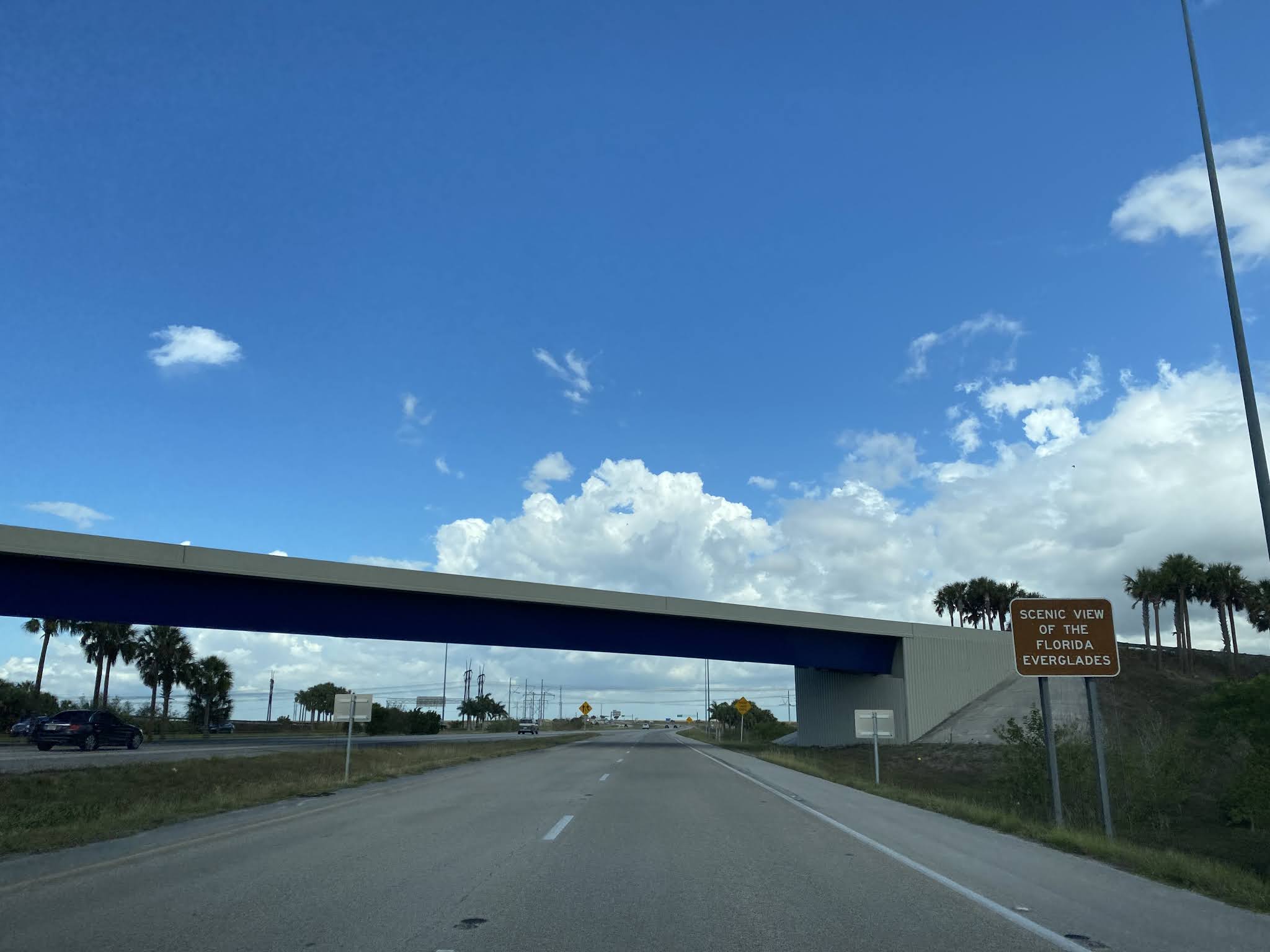
Traffic pulling onto I-75 northbound and Alligator Alley is advised they are about to partake in a scenic view of the Everglades.
I-75 northbound traffic is advised of all the different toll transponders now accepted at the Eastern Toll Plaza.
Northbound I-75 traffic is advised of the $3.25 car toll at the East Toll Plaza. An additional toll schedule can be observed for vehicles with additional axles approaching the East Toll Plaza.
Departing the East Toll Plaza northbound I-75 is signed with a 70 MPH speed limit.
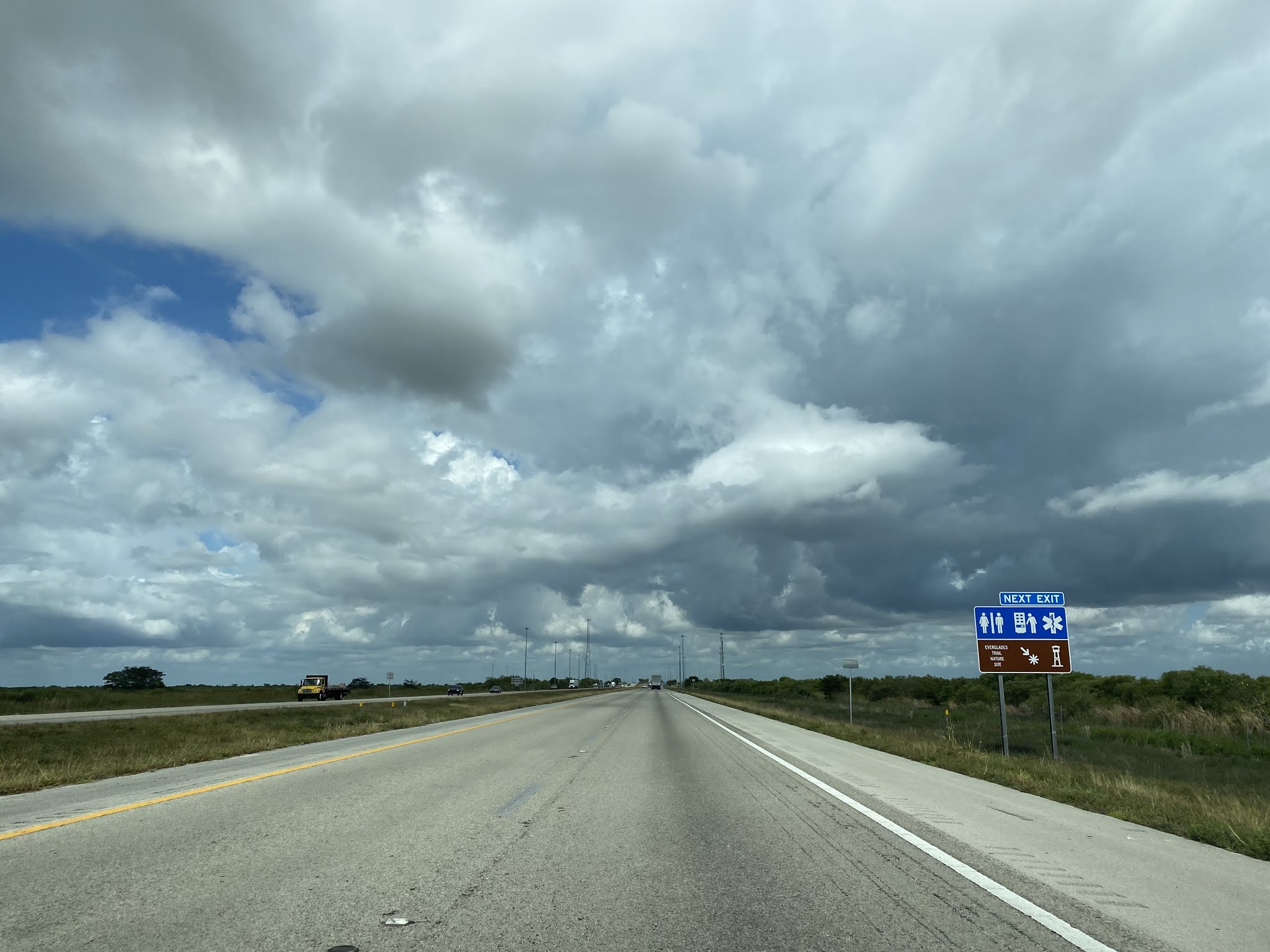
Northbound I-75 traffic passes through the Everglades and can access numerous recreational areas approaching the Mile Marker 35 Rest Area.
Both travel directions of Alligator Alley can access the Mile Marker 35 Rest Area on the southern flank of I-75. Northbound I-75 traffic must cross under the freeway structure to access the Mile Marker 35 Rest Area. The freeway underpass is a good display of the free flowing waterway Alligator Alley utilizes to distribute water into the Everglades. The Mile Marker 35 Rest Area can be used as a turnaround point for traffic to return to the Miami Metro Area on southbound I-75.
The Mile Marker 35 Rest Area contains numerous displays regarding the Everglades watershed.
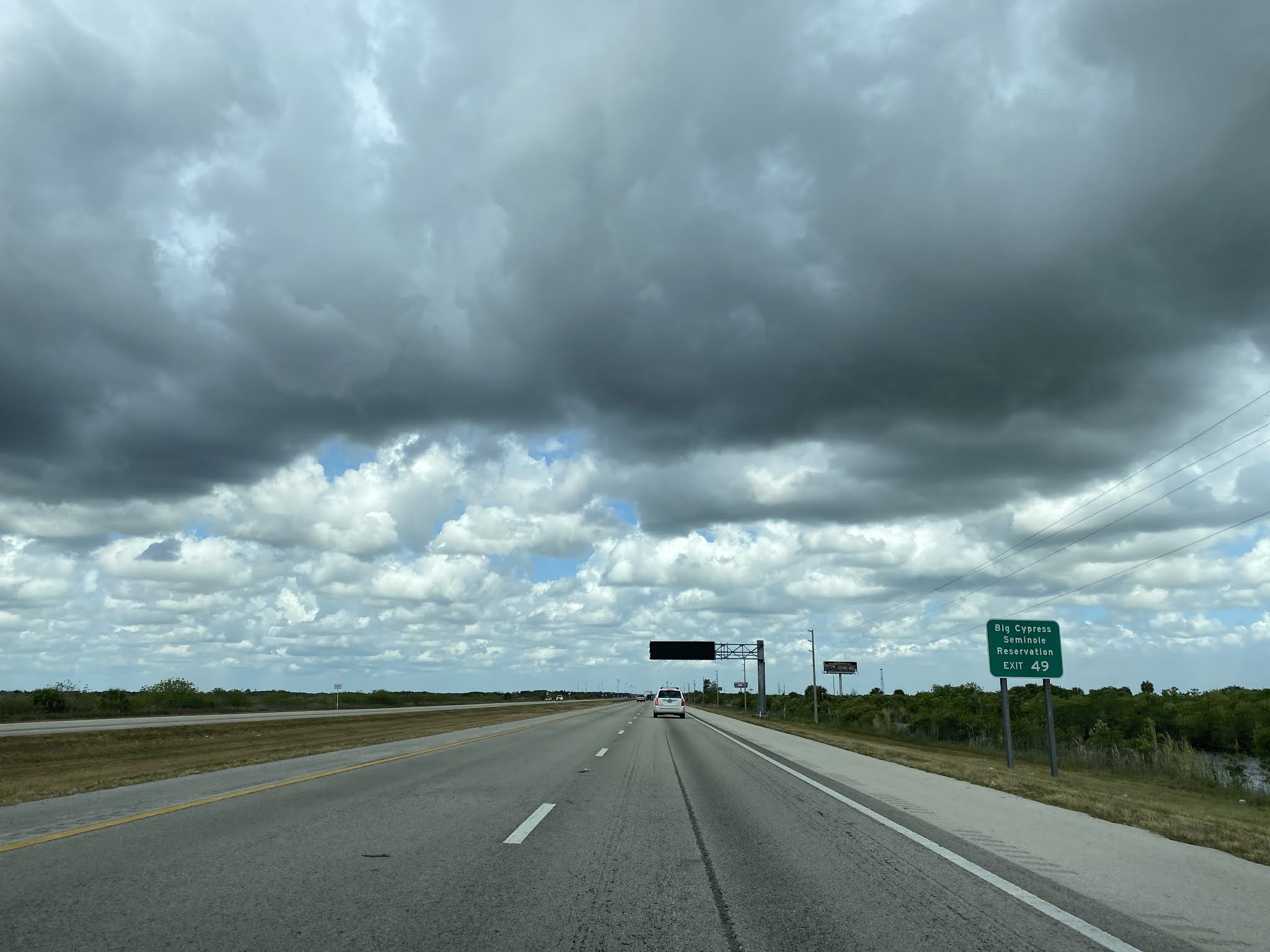
Returning to northbound I-75 the freeway passes through the Everglades and enters Big Cypress Swamp where the Miccosukee Indian Reservation is located.
Northbound I-75 Exit 49 accesses Broward County Route 833 at Snake Road.
I-75 northbound beyond Snake Road enters Collier County.
Alligator Alley northbound at Mile Marker 51 enters the Big Cypress National Preserve.
I-75 northbound accesses the Collier County Rest Area at Mile Marker 62.
A Big Cypress National Preserve parking lot can be found along northbound I-75 beyond the Collier County Rest Area.
I-75 northbound encounters one of it's few curves and approaches FL 29 at Exit 80.
I-75 northbound departs the Big Cypress National Preserve at FL 29 and enters the Florida Panther National Wildlife Refuge.
A guide sign on I-75 in the Florida Panther Wildlife Refuge indicate I-275 as being 129 miles and I-4 as 162 miles.
I-75 northbound departs Alligator Alley at the West Toll Plaza and accesses the western segment of FL 84 in addition to Collier County Route 951 near the outskirts of Naples.


Comments