Former US Route 99 from the Klamath River towards the Oregon State Line originally passed through the community of Hornbrook via what is Hornbrook Highway. US Route 99 entered Oregon via what is now Jefferson Road where it climbed towards Siskiyou Pass. Pictured above is the 1916 Southern Pacific Railroad Subway which was present on US Route 99 north of Hornbrook approaching Bailey Hill. Pictured below is former US Route 99 as depicted on the 1935 Division of Highways Map of Siskiyou County climbing from the Klamath River towards the Oregon State Line via Hornbrook.
According to the Oregonian the Oregon Territorial Legislature granted a twenty year toll franchise to Micheal Thomas & Associates to operate the Siskiyou Wagon Road Company. Thomas would later sell his franchise toll road rights to Captain Lindsay Applegate. The Siskiyou Mountain Wagon Road would subsequently open on August 28th, 1859. Applegate would later sell his toll franchise rights which in turn eventually changed hands to the possession Clay Dollarhide and George Patterson. Given Oregon had become a State in February of 1859 an agreement was reached which would keep the Siskiyou Mountain Wagon Road under lease for ten years which would then be purchased by Jackson County. By 1869 Jackson County did not have the money to purchase the Siskiyou Mountain Wagon Road which was subsequently purchased fully by the Dollarhide family.
The Siskiyou Mountain Wagon Road can be seen connecting Ashland, Oregon to Henley, California on the 1872 Bancroft's Map of Oregon, Washinginton, Idaho, Montana, and British Columbia.
The California-Oregon Trail can be seen south of Henley crossing the Klamath River and following the Anderson Grade on a bypass of the Shasta River Canyon towards Yreka via Hawkinsville on the 1873 Bancroft's Map of California.
Anderson Grade Road be seen on a topographical map (courtesy Kevin Walsh of the Map Scans Facebook Group) published in the 1890s. Originating from Henley the alignment of Anderson Grade Road skirted the eastern rim of the Shasta River Canyon which required only single crossings of the Shasta River and Klamath River. In the case of the Klamath River the California-Oregon Trail on Anderson Grade Road utilized a ferry crossing.
By 1887 the Southern Pacific Railroad completed it's line over Siskiyou Pass following the construction of Tunnel #13. The Southern Pacific Railroad followed much of the grade of the Siskiyou Mountain Wagon Road and established siding facilities. Within Siskiyou County, California on the 1892 Rand McNally Map of California the Southern Pacific Railroad is seen entering the state via the siding of Coles. From Coles the Southern Pacific Railroad is shown bypassing Yreka through Shasta Valley via; Zuleka, Hornbrook, Ager and Snowdon towards Montague.
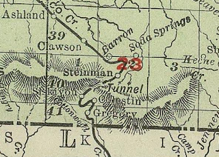
The 1903 Rand McNally Map of Oregon shows numerous sidings (Steinman, Siskiyou, Colestin, and Gregory) flanking the Southern Pacific Railroad and Siskiyou Mountain Wagon Road.
The 1909 San Francisco Motor Club Map of the Yreka Area (courtesy Kevin Walsh of the Map Scans Facebook group) shows two routes from Yreka north towards the Oregon State Line. The primary highway north of Yreka is shown to follow what is now Yreka-Ager Road and much of Siskiyou County Route A28 towards Hornbrook. The secondary road is shown to follow what is now Anderson Grade Road from Yreka towards Hornbrook. Both routes from Yreka converged in Hornbrook passing northward through the sidings of Zuleka and Coles approaching the Oregon State Line.
The emergence of the automobile in the early 20th Century in California led to the 1909 First State Highway Bond Act which was approved by voters during 1910. The majority of the highways approved as part of the First State Highway Bond Act were largely well established routes of travel. One such highway was Legislative Route Number 3 ("LRN 3") which was defined as a highway from "Sacramento to the Oregon Line."
The 1912 California State Automobile Map (courtesy Kevin Walsh of the Map Scans Facebook group) only shows present Yreka-Montague Road and Siskiyou County Route A28 as a highway between Yreka-Hornbrook.
In 1913 the Pacific Highway was established as an organized Auto Trail Association borne out of the Good Roads movement. According to the Oregonian a new route for the Pacific Highway was plotted following much of the existing Siskiyou Mountain Wagon Road. The State of Oregon faced numerous hurdles attempting to purchase the necessary right-of-way from the Dollarhide Family. Initially only the right-of-way from Barson Ranch to Steinman had been purchased by the State of Oregon but not south to the California State Line. This early right-of-way purchase led to the construction of the 1914 Steinman Overcrossing which can be seen in the photo below during 1920 (credit Daniel Nauman of the Historic Highway 99 Facebook Group).
The July 1914 California Highway Bulletin noted a contract to construct Pacific Highway/LRN 3 north from Hornbrook to the Oregon State Line had been awarded. What is now known as Old Shasta River Road also appears as part of a survey for construction/relocation of LRN 3 north of Yreka to the Oregon State Line.
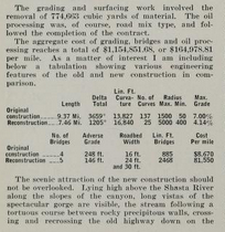
The July 1914 California Highway Bulletin elaborates the design of the upcoming Pacific Highway/LRN 3 originating at Bailey Hill at the California/Oregon State Line.
The January 1915 California Highway Bulletin noted the Pacific Highway and LRN 3 had been nearly completed by November 28th, 1914 north of Hornbrook to the Oregon State Line.
The Dollarhide Family lost a court injunction in 1915 to block the construction of the Pacific Highway. Subsequent to losing their court battle the Dollarhide's sold their remaining right-of-way to the State of Oregon for $1,000 dollars. The incomplete Pacific Highway can be seen utilizing what remained of the Siskiyou Mountain Wagon Road south of Steinman on the 1917 California State Automobile Association Map. Notably; the incomplete Pacific Highway can be seen entering Siskiyou County, California near the siding of Coles (near modern day Hilt) and following LRN 3 via Hornbrook Highway southward towards the Klamath River. LRN 3 south of the Klamath River to Yreka is shown following Anderson Grade Road.
The July 1916 California Highway Bulletin shows LRN 3 was to be graded north of Yreka through the Shasta River Canyon north to the Oregon State Line. It is not fully clear what the exact time frame was for the relocation of LRN 3/Pacific Highway onto Old Shasta River Road but it appears not have been conveyed to the CSAA by 1917.
The Pacific Highway can be seen aligned on LRN 3 from the Oregon State Line south through the Shasta River Canyon via Hornbrook towards Yreka on the 1920 Clason Highway Map of California.
According to the Oregonian the Pacific Highway was completed over Siskiyou Pass by 1920 and reportedly was the first fully paved Auto Trail in the County. This new route over Siskiyou Pass was a vast improvement over the Siskiyou Mountain Wagon Road and was designated as part of Oregon Route 1 in 1917. The Pacific Highway would have crossed into California and Siskiyou County onto LRN 3 via what is now Jefferson Road towards Hornbrook. The Pacific Highway can be crossing from Jackson County, Oregon into Siskiyou County, California during the 1920s in this photo sourced from Daniel Nauman of the Historic US Highway 99 Facebook page.
Below another photo of the Pacific Highway entering California southbound during the 1920s sourced from Jason Gross of the Historic US Highway 99 Facebook page can be observed.
The Pacific Highway, National Park to Park Highway, and Oregon Route 1 can all be seen crossing Siskiyou Pass on the 1924 Rand McNally Map of Washington, Oregon, and Idaho.
The Pacific Highway and National Park-to-Park Highway can be seen co-signed on LRN 3 from the Oregon State Line south through the Shasta River Canyon to Yreka on the 1924 Rand McNally Auto Trail Map of the West Coast.
Thusly US 99 appears on the 1925 Rand McNally Map of California as being routed through Hornbrook southward towards Yreka.
According to the Oregonian US 99 over Siskiyou Pass became quickly inadequate to meet the needs of modern highway traffic. This led to a new alignment for US 99 between Ashland to Sikiyou Pass being plotted out. The first segment of this new alignment of US 99 from Ashland to Wall Creek broke ground during October 1933. This new alignment of US 99 may have been part of the reasoning of why US 97 was shifted to a new terminus in Weed, California during 1934. The 1935 Goshua West Coast Road Map shows US 97 shifted off it's original route to California and being replaced with OR 66.
The 1935 Gousha Oregon Map shows the shift of US 97 and the newly designated OR 66 in greater detail.
As noted in the intro; pictured below is former US Route 99 as depicted on the 1935 Division of Highways Map of Siskiyou County climbing from the Klamath River towards the Oregon State Line via Hornbrook.
According to the January/February 1950 California Highways & Public Works US 99/LRN 3 in California north from Hornbrook to the Oregon State Line was moved to a new 1.84 mile realignment to meet the improved highway over Siskiyou Pass in Oregon circa 1941. The new 1.84 mile approach to the Oregon State Line moved US 99 off of Jefferson Road westward closer to Hilt.
On June 29th, 1956 the Federal Highway Aid Act of 1956 was signed into law on the Federal Level. The Federal Highway Aid Act of 1956 was the genesis point of the Interstate Highway System which would in the coming decade sew the demise via of US 99 north of Redding Bluff to the Oregon State Line via replacement by Interstate 5.
The first CA 263 was defined by 1965 Legislative Chapter 1401 as a highway running from CA 96 at the confluence of the Shasta River and Klamath River north over US 99 to Interstate 5. The same legislation extended CA 96 through the Shasta River Canyon via US 99 through Yreka to Interstate 5. These legislative changes along with the planned route of Interstate 5 bypassing the Shasta River Canyon can be seen on the 1966 Division of Highways State Map. It is likely CA 96 was never signed through the Shasta River Canyon nor the first iteration of CA 263.
CA 96 in the Shasta River Canyon and the first CA 263 appear on the 1967 Division of Highways State Map as stand alone highways as US 99 had been eliminated from California. It is likely both routes were probably both signed as Temporary Interstate 5 along with former US 99 north from the Klamath River to the Oregon State Line.
1968 Legislative Chapter 282 swapped CA 96 in the Shasta River Canyon with the first CA 263. The second CA 263 thusly was given a definition of; Route 96 near the confluence of the Shasta and Klamath Rivers southwesterly to Route 5 near the north city limit of Yreka. The change to CA 96 along with the second/current CA 263 in the Shasta River Canyon first appear on the 1970 Division of Highways State Map.
Interstate 5 north from the Klamath River to the Oregon State line was completed to freeway standards during 1974 (as indicated from the bridge date stamps on overpass structures). Interstate 5 can be seen built fully to freeway standards from Yreka to the Oregon State Line via the Klamath River and Hornbrook on the 1975 Caltrans Map.


Comments