California State Route 107 is a north/south State Highway aligned on Hawthorne Boulevard in the Los Angeles Area. Legislatively California State Route 107 begins on Hawthorne Boulevard at the southern city limit of Lawndale and terminates at California State Route 1 in Torrance. California State Route 107 is still signed from Interstate 405 as evidenced by the cover photo of this blog. California State Route 107 began its existence as part of the original California State Route 7 and is generally considered to be one of the few child State Routes to have existed in California.
The history of California State Route 107
During 1933 the state removed the barriers which prevented the Division of Highways from maintaining mileage in incorporated cities. Thusly, 1933 saw the addition of numerous new State Highways in urban areas. One such route was
Legislative Route Number 164 (LRN 164) created by 1933 Legislative Chapter 767 which would become the basis for California State Route 107 (CA 107). The original definition of LRN 164 was as follows:
- LRN 60 at Torrance via Hawthorne Avenue to Mines Field-San Fernando Road
LRN 164 first appears on the
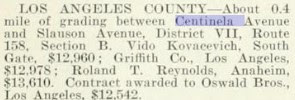
1934 Division of Highways Map with a simplified definition of "LRN 60 at Torrance to LRN 158 via Hawthorne Avenue. This definition of LRN 164 would be codified during 1935. LRN 164 appears following Centinela Avenue and Hawthorne Avenue from the unbuilt segment of LRN 158 near Mines Field (Los Angeles Municipal Airport).
The initial run of Sign State Routes were announced in the
August 1934 California Highways & Public Works. CA 7 was announced as a highway originating at CA 3/LRN 60 in Torrance northward to the Nevada State Line which connected through the Reno Area to a second segment to the Oregon State Line. CA 7 as originally defined followed the entirety of LRN 164 from CA 3/LRN 60 north to LRN 158.
CA 7/LRN 164 appears in detail on the
1935 Division of Highways Map of Los Angeles County. The entirety of CA 7 on LRN 164 is shown as complete but the connecting highway via the planned LRN 158/Sepulveda Boulevard extension is shown not to be yet constructed.
The
1938 Division of Highways Map displays LRN 158/Sepulveda Boulevard constructed south of LRN 164/Centinela Avenue to US Route 101A/LRN 60 near the grounds of Los Angeles Municipal Airport. A small segment of LRN 158/Sepulveda Boulevard north of LRN 164/Centinela Avenue is shown as unconstructed. CA 7 shown to be realigned following LRN 158/Sepulveda Boulevard south to a terminus at US Route 101A/LRN 158. LRN 164 is displayed for the first time as being assigned as CA 107. CA 107 seemingly was designated as a child route of CA 7 based off the fact it was part of the original routing of the highway.
The
March 1939 California Highways & Public Works features a newly opened segment of CA 7/LRN 158 on Sepulveda Boulevard between Brand Boulevard and US Route 99-6/LRN 4 at San Fernando Road. A segment of CA 7/LRN 158 from Jefferson Boulevard south to CA 107/LRN 164 at Centinela Avenue is stated to not have been yet constructed due to it requiring extensive drainage.
The entirety of CA 107/LRN 164 was added to the Freeways & Expressway System when it was created during 1959. The corridor of CA 107 would in time become host to the failed Torrance Freeway concept.
During the 1964 State Highway Renumbering the Legislative Route Numbers were dropped in favor of field signage. Thusly CA 107 was retained through the 1964 State Highway Renumbering intact to how it was aligned on LRN 164. The newly legislatively designated CA 107 first appears on the
1964 Division of Highways Map. CA 107 was defined as "Route 1 near Torrance to Route 405 near Culver City."
Los Angeles County Route N7 was defined in 1964 from the terminus of CA 107 in Torrance on Hawthorne Avenue south to Point Vicente. It is unclear if Los Angeles County Route N7 is a coincidental numbering or is intended to reference CA 7 or CA 107.
A 1964 Survey Map in the
March/April 1965 California Highways & Public Works displays CA 107 south of Interstate 405 to CA 11 as being under study for freeway development. The volume later referred to the studied corridor of CA 107 as the Hawthorne Freeway.
CA 107 was truncated via 1965 Legislative Chapter 1372 to a north terminus at Interstate 405 near Lawndale. Despite the legislative definition being updated on the 1966 Division of Highways map CA 107 appears still signed northward to Centinela Avenue.
CA 107 appears truncated to Lawndale on the 1967 Division of Highway Map.
According to cahighways.org the proposed routings of the CA 107/Torrance Freeway were presented at Public Hearing on July 15th, 1968, along with a "no build" option. The proposed routings of the Torrance Freeway below appeared in the August 12th, 1968, Daily Breeze.
All the proposed routings of the Torrance Freeway passed through Lomita which saw it become very unpopular. Lomita's favoring of the no build option for the Torrance Freeway effective saw the corridor die and ensured CA 107 would remain a surface highway.
1998 Assembly Bill, Chapter 877 signed on September 26th updated the definition of CA 107 to permit the highway within Lawndale if the city and state could come to a relinquishment agreement. 2003 Assembly Bill 1717, Chapter 525 on September 25th updated the definition of CA 107 to note the relinquishment from Lawndale. The
2005 Caltrans Map reflects the relinquishment of CA 107 in the city of Lawndale.
2008 Assembly Bill 2326, Chapter 639 signed on September 30th authorized the relinquishment of CA 107 in the city of Torrance. To date the California Transportation Commission has not authorized the relinquishment of CA 107 in the city of Torrance.


Comments