Part 1; the history of Hawaii Route 39 and Maui County Route 390
The Island of Maui seemingly was not part of the original World War II era Hawaii Route System. Circa 1955 the United States Bureau of Public Roads renumbered the Hawaii Route System. The 1955 Hawaii Route Renumbering saw most of the conventions utilized by the current Hawaii State Route System established. Primary Hawaii Routes were given two-digit numbers whereas Secondary Hawaii Routes were given three-digit numbers. The Hawaii Routes were assigned in sequence for what Island/County they were located on coupled with what Federal Aid Program number they were tied to. In the case of the Island of Maui it was assigned numbers in the range of 30-40.
Hawaii Route 39 was aligned from Paia to Makawao via 7 miles of Baldwin Avenue and 5.1 miles of Olinda Road to Olinda. Hawaii Route 39 can be seen on the 1959 Gousha Highway Map of Hawaii.
The southern terminus of Hawaii Route 39 in Olinda is shown on the 1957 United States Geological Survey Map of Kilohana to end at the Kailua Gulch Jeep Trail near Olinda Prison Camp. The Kailua Gulch Trail is shown to connect Hawaii Route 39 to Hawaii Route 378/Haleakala Highway near the boundary to Haleakala annex of Hawaii Volcanos National Park.
Hawaii Route 39 seems primarily to have existed to service Olinda Prison Camp. Olinda Prison Camp was in operation from 1926 until it shuttered during 1973. Reportedly Olinda Prison Camp had a declining inmate population and difficulties keeping staffing in a remote location on Haleakala's northern flank. According to hawaiihighways.com, the Hawaii Department of Transportation once considered upgrading the Kailau Gulch Jeep Trail as part of Hawaii Route 39 during the 1960s but had abandoned the idea by no later than 1967. According to hawaiihighways.com, Maui County Route 390 appears on a 1976 Maui County planning map and the 1981 Maui County Route log.
Part 2; scenes around Maui County Route 390
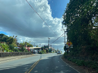
Maui County Route 390 begins in Paia via Baldwin Avenue south from Hawaii Route 36/Hana Highway. No Maui County Route 390 signage appears on Hawaii Route 36 in Paia approaching Baldwin Avenue. Paia was founded in 1880 as the site of a Hawaiian Commercial & Sugar mill and siding of the Kahului Railroad.
From Hawaii Route 378/Haleakala the Kailau Gulch Jeep Trail can still be identified (behind the pylons) near the Haleakala National Park boundary. It isn't clear if the Kailau Gulch Jeep Trail can still be used to reach Maui County Route 390.


Comments