Arizona State Route 95 Truck is a 0.85-mile-long spur of Arizona State Route 95 located in Parker. Arizona State Route 95 Truck follows California Avenue north of Riverside Drive to California State Route 62 at the Colorado River Bridge. What is now Arizona State Route 95 Truck was originally a ferry crossing of the Colorado River and later part of Arizona State Route 72. The Colorado River in Parker was bridged by a pontoon highway crossing during late 1935 with a permanent span being completed during 1937. Arizona State Route 95 Truck was created in 1962 when the mainline highway was extended north of Parker. The current Colorado River Bridge carrying Arizona State Route 95 Truck and California State Route 62 opened during 2014. Featured as the blog cover is the 1937 Colorado River Bridge when it was part of Arizona State Route 72.
Part 1; the history of Arizona State Route 95 Truck
In 1908 Parker was established in what was then Yuma County as a siding of the Arizona & California Railway. Parker was named in honor of Ely S. Parker who had been Commissioner of Indian Affairs under the Presidency of Ulysses Grant. The Arizona & California Railway was originally a short line subdivision of the Atchison, Topeka & Santa Railway. The Arizona & California Railway originated in Cadiz, California and ended at Matthie siding near Wickenburg. The Arizona & California Railway crossed the Colorado River via a truss span which still stands in Parker.
Originally no highway service existed from Parker over the Colorado River into California. This changed during May 1915 when ferry service was established in Parker via a paddle-wheel ship known as the "Iola."
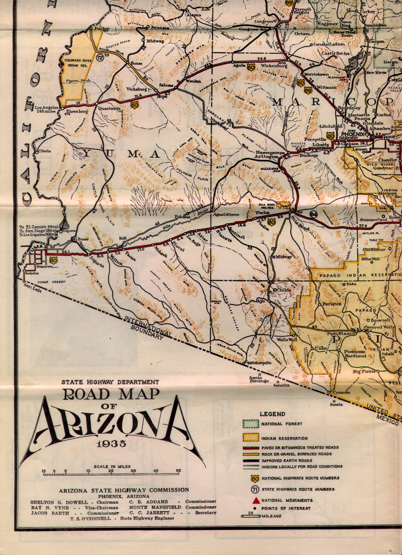
What is now Arizona State Route 95 Truck was commissioned into the Arizona State Highway System as a component of Arizona State Route 72 in the early 1930s. Arizona State Route 72 as originally began at US Route 60 at Hope and ended at the Colorado River Ferry in Parker. Arizona State Route 72 can be seen in detail between Hope-Parker on the 1935 State Highway Department Map of Arizona.
During December 1935 a pontoon bridge crossing the Colorado River in Parker was erected. This pontoon structure was made possible due to the upstream Hoover Dam slowing the currents of the Colorado River. The Colorado River Pontoon Bridge was located at the western terminus of Arizona State Route 72. The Colorado River Pontoon Bridge can be seen from Parker in a University of California hosted photo.
The pontoon bridge at the Colorado River was intended to be a temporary crossing until a permanent structure could be built. The October 1937 Arizona Highways features the completed Colorado River Bridge in Parker. The article stub notes the Colorado River Bridge to be located at the western terminus of Arizona State Route 72. The Colorado River Bridge was constructed with funds via State appropriations and from the Bureau of Public Roads. The paved highway on the California side of the Colorado River in San Bernardino County was constructed by the Metropolitan Water District of Southern California as part of the Colorado River Aqueduct project.
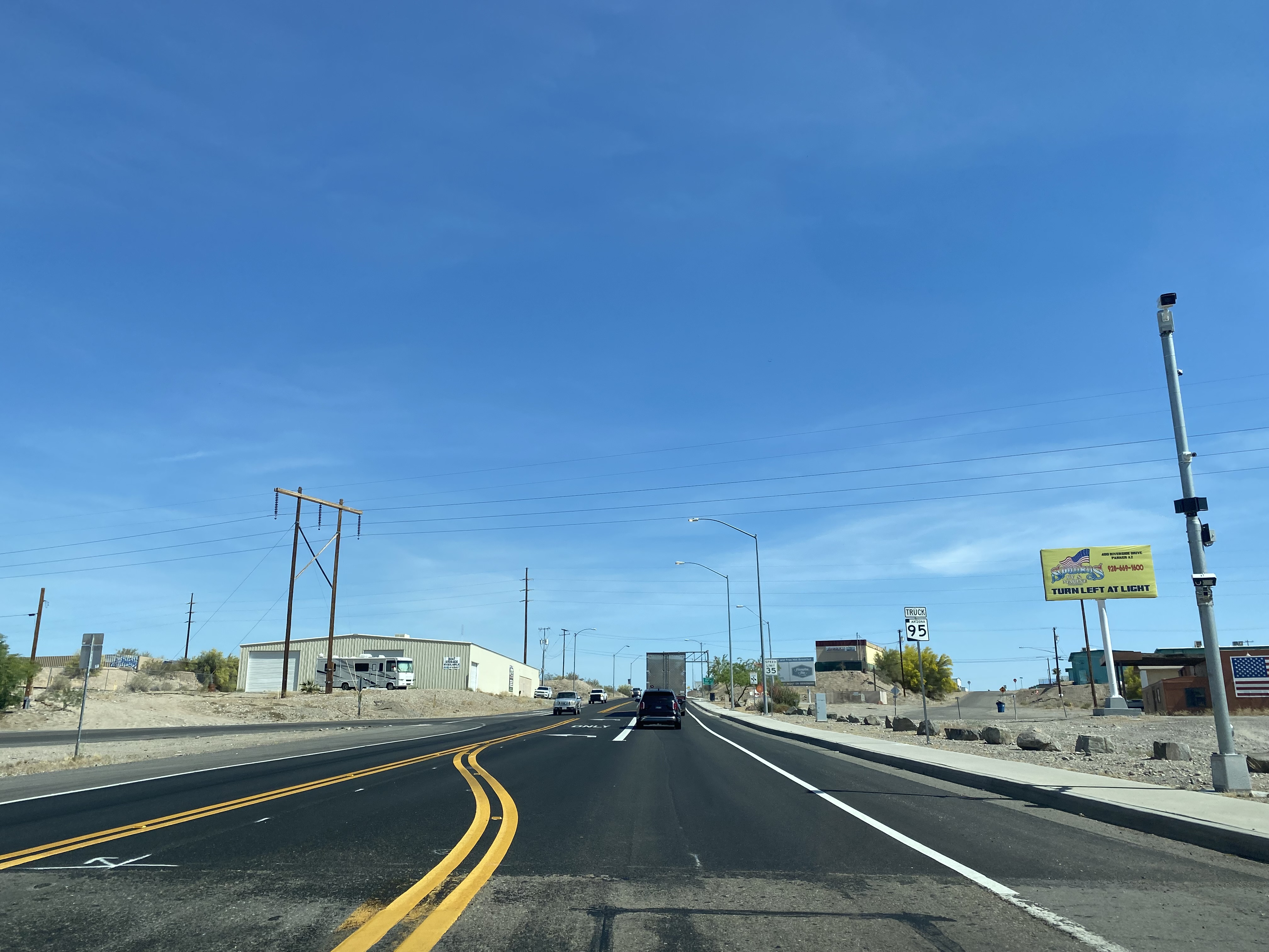
Parker would incorporate as a town during 1948. During the early 1960s Arizona State Route 95 had been straightened directly north of Quartzsite. During 1962 Arizona State Route 95 was extended and replaced Arizona State Route 172 north of Parker. Subsequently Arizona State Route 72 was truncated to a junction with Arizona State Route 95 in the southern outskirts of Parker. The Colorado River Bridge in Parker and California Avenue north of Riverside Drive were reassigned as Arizona State Route 95 Truck.
1970 California Legislative Chapter 1473 extended California State Route 62 from Twentynine Palms east to the Colorado River Bridge at the Arizona state line. The California Division of Highways assumed maintenance of the existing Aqueduct Road which connected US Route 95 at Vidal Junction to The Colorado River Bridge. California State Route 62 can be seen terminating at the Colorado River Bridge near Parker on the 1975 Caltrans Map.
Parker became the seat of the newly created La Paz County on January 1, 1983. On April 12, 2010, the Metropolitan Water District received an application from Caltrans and the Arizona Department of Transportation to replace the Colorado River Bridge. The stream under the Colorado River Bridge is noted to have dropped twenty feet which led to the loss of lateral support and embedment in the structure pilings.
The current Colorado River Bridge opened during 2014 and was dedicated on October 1st of said year. The current Colorado River Bridge can be seen in a YouTube video by BigRiver Drone. The 1937 Colorado River Bridge was demolished following the opening of the current span.
Part 2; a drive on Arizona State Route 95 Truck
From the community of Earp in San Bernardino County eastbound California State Route 62 makes a right-hand turn from Aqueduct Road towards the Colorado River Bridge.
California State Route 62 eastbound crosses under the 1908 Arizona & California Railway Bridge to a terminus at the foot of the Colorado River Bridge. The 1908 Arizona & California Railway Bridge partially burned during September 2019, but the structure did not fail. The Arizona & California Railway came under the ownership of RailAmerica during 2012.
California Avenue crosses the Colorado River Bridge and becomes Arizona State Route 95 Truck. An Arizona State Route 95 Truck shield can be found as the highway enters Parker.
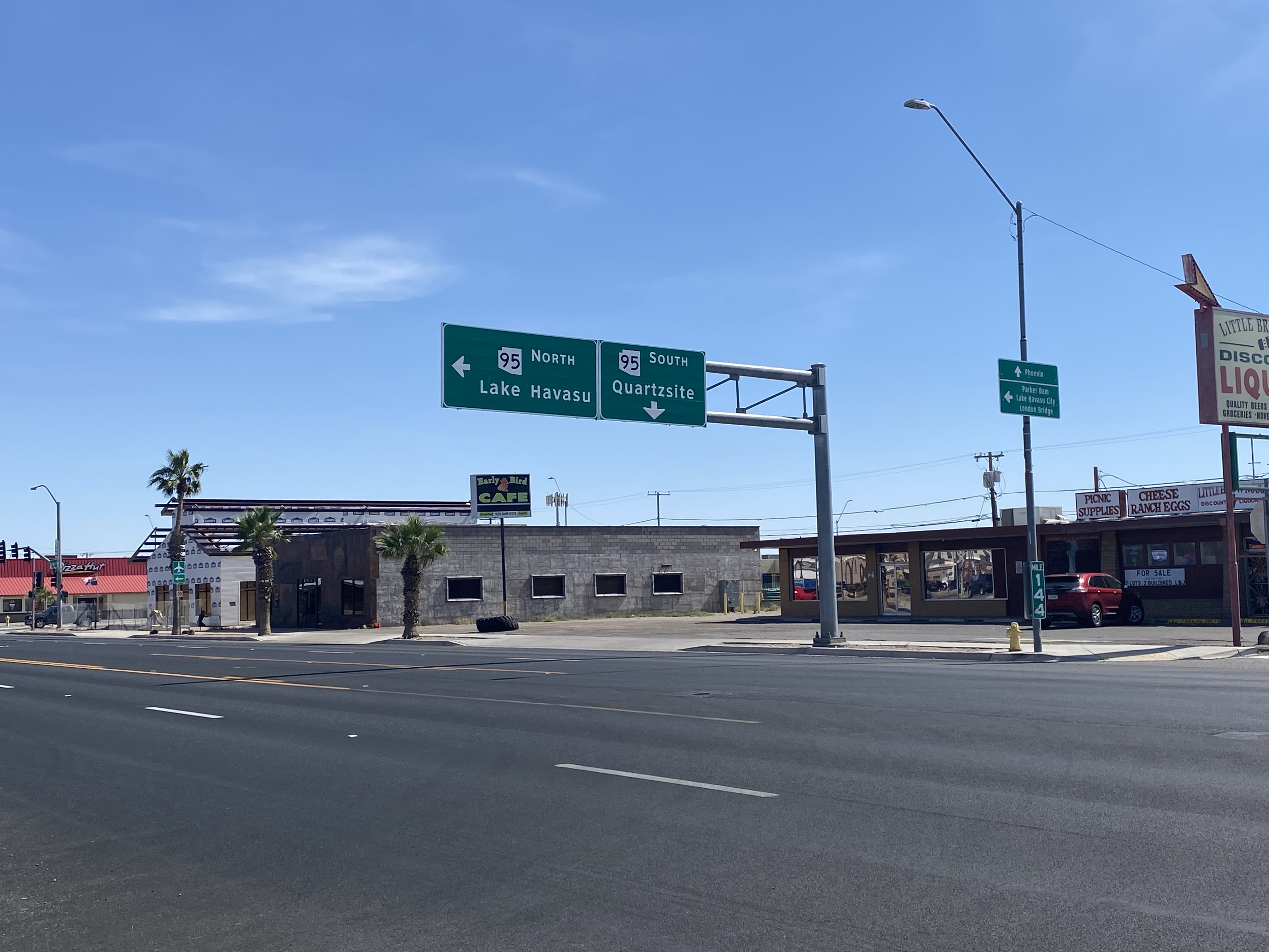
Arizona State Route 95 Truck follows California Avenue to a terminus at mainline Arizona State Route 95 at Riverside Drive.
From northbound Arizona State Route 95 a guide sign denotes Arizona State Route 95 Truck as "To California State Route 62."
Alberta operates six ferries scattered throughout the province. Roughly twenty to twenty-five kilometers up the Red Deer River from the town of Drumheller is one of the most scenic ferry crossings in all of Wild Rose Country, the Bleriot Ferry. Using the North Dinosaur Trail (Alberta Highway 838, or AB 838), the Bleriot Ferry provides a scenic river cruise of sorts in the Canadian Badlands. The Bleriot Ferry started operating in 1913 as the Munson Ferry when a few bridges crossed the Red Deer River. The ferry was started by Andre Bleriot, the brother of famed early aviator Louis Bleriot, who became famous for being the first person to fly over the English Channel. At the time, the Alberta provincial government commissioned local residents to run the ferries. There were several ferries along the Red Deer River, and not only did they serve as vital transportation links, but they also served as local social hubs, since everyone had to take the ferries to go places. Over time, as the...
The Pollasky Bridge near modern day Friant is a ruined highway bridge which was completed during early 1906 as part of the Fresno-Fresno Flats Road. The structure is one of the oldest known arch concrete spans to have been constructed in California. The bridge briefly carried California State Route 41 following the destruction of the Lanes Bridge in 1940. The Pollasky Bridge itself was destroyed by flooding during 1951, but the ruins can still be found on the Madera County side of the San Joaquin River. Pictured as the blog cover is the Pollasky Bridge as it was featured in the 1913 book "The Concrete Bridge." The structure can be seen crossing the San Joaquin River near Friant below on the 1922 United States Geological Survey Map. Part 1; the history of the Pollasky Bridge The Pollasky Bridge site is near modern day Friant of Fresno County. The community of Friant was established as Converse Ferry during 1852 on the San Joaquin Rive...
Welcome to another annual review of progress in constructing North Carolina's New and Future Interstate routes. While 2024 was not too exciting, with no new segments of major routes opening, there was 1 new interstate signing, another proposed new interstate route, and the near opening of a new segment for 2 routes. As tradition, I will start off with a review of what happened with I-73 and I-74 and then move on to the major news of the year about the other new and future routes. Work continued on the I-73/I-74 Rockingham Bypass through the year. The last few months have been hoping for news of its opening before 2025, without luck. Signs of its near completion included the placement of new signs, many with interstate shields uncovered, along the Bypass and intersecting roadways. For example, these went up along US 74 East: Overhead signage at Business 74 exit which contains the future ramp to I-73 North/I-74 West. Signage was also updated heading west on US 74 approaching the unop...


Comments