Arizona State Route 95 Truck is a 0.85-mile-long spur of Arizona State Route 95 located in Parker. Arizona State Route 95 Truck follows California Avenue north of Riverside Drive to California State Route 62 at the Colorado River Bridge. What is now Arizona State Route 95 Truck was originally a ferry crossing of the Colorado River and later part of Arizona State Route 72. The Colorado River in Parker was bridged by a pontoon highway crossing during late 1935 with a permanent span being completed during 1937. Arizona State Route 95 Truck was created in 1962 when the mainline highway was extended north of Parker. The current Colorado River Bridge carrying Arizona State Route 95 Truck and California State Route 62 opened during 2014. Featured as the blog cover is the 1937 Colorado River Bridge when it was part of Arizona State Route 72.
Part 1; the history of Arizona State Route 95 Truck
In 1908 Parker was established in what was then Yuma County as a siding of the Arizona & California Railway. Parker was named in honor of Ely S. Parker who had been Commissioner of Indian Affairs under the Presidency of Ulysses Grant. The Arizona & California Railway was originally a short line subdivision of the Atchison, Topeka & Santa Railway. The Arizona & California Railway originated in Cadiz, California and ended at Matthie siding near Wickenburg. The Arizona & California Railway crossed the Colorado River via a truss span which still stands in Parker.
Originally no highway service existed from Parker over the Colorado River into California. This changed during May 1915 when ferry service was established in Parker via a paddle-wheel ship known as the "Iola."
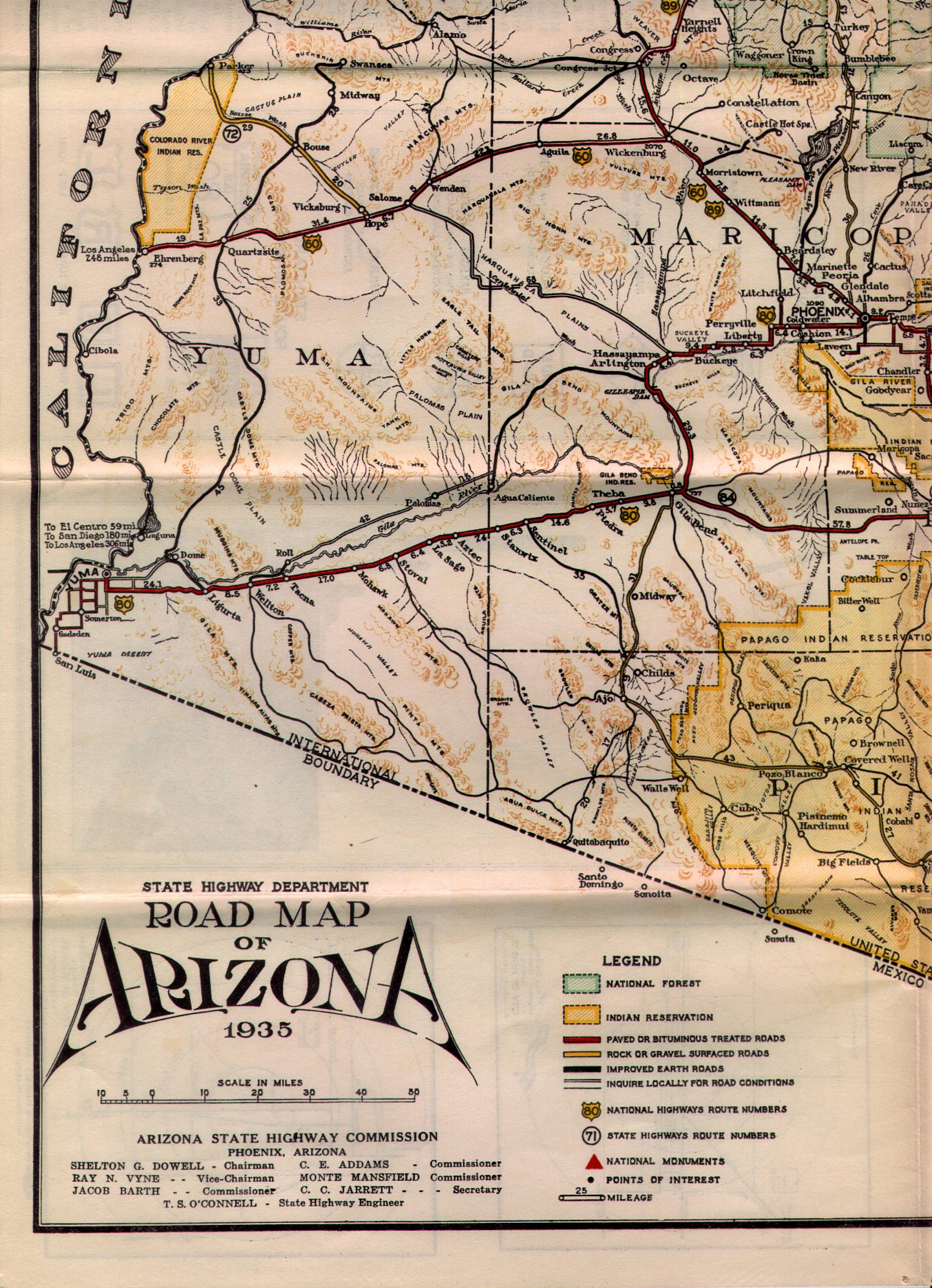
What is now Arizona State Route 95 Truck was commissioned into the Arizona State Highway System as a component of Arizona State Route 72 in the early 1930s. Arizona State Route 72 as originally began at US Route 60 at Hope and ended at the Colorado River Ferry in Parker. Arizona State Route 72 can be seen in detail between Hope-Parker on the 1935 State Highway Department Map of Arizona.
During December 1935 a pontoon bridge crossing the Colorado River in Parker was erected. This pontoon structure was made possible due to the upstream Hoover Dam slowing the currents of the Colorado River. The Colorado River Pontoon Bridge was located at the western terminus of Arizona State Route 72. The Colorado River Pontoon Bridge can be seen from Parker in a University of California hosted photo.
The pontoon bridge at the Colorado River was intended to be a temporary crossing until a permanent structure could be built. The October 1937 Arizona Highways features the completed Colorado River Bridge in Parker. The article stub notes the Colorado River Bridge to be located at the western terminus of Arizona State Route 72. The Colorado River Bridge was constructed with funds via State appropriations and from the Bureau of Public Roads. The paved highway on the California side of the Colorado River in San Bernardino County was constructed by the Metropolitan Water District of Southern California as part of the Colorado River Aqueduct project.
Parker would incorporate as a town during 1948. During the early 1960s Arizona State Route 95 had been straightened directly north of Quartzsite. During 1962 Arizona State Route 95 was extended and replaced Arizona State Route 172 north of Parker. Subsequently Arizona State Route 72 was truncated to a junction with Arizona State Route 95 in the southern outskirts of Parker. The Colorado River Bridge in Parker and California Avenue north of Riverside Drive were reassigned as Arizona State Route 95 Truck.
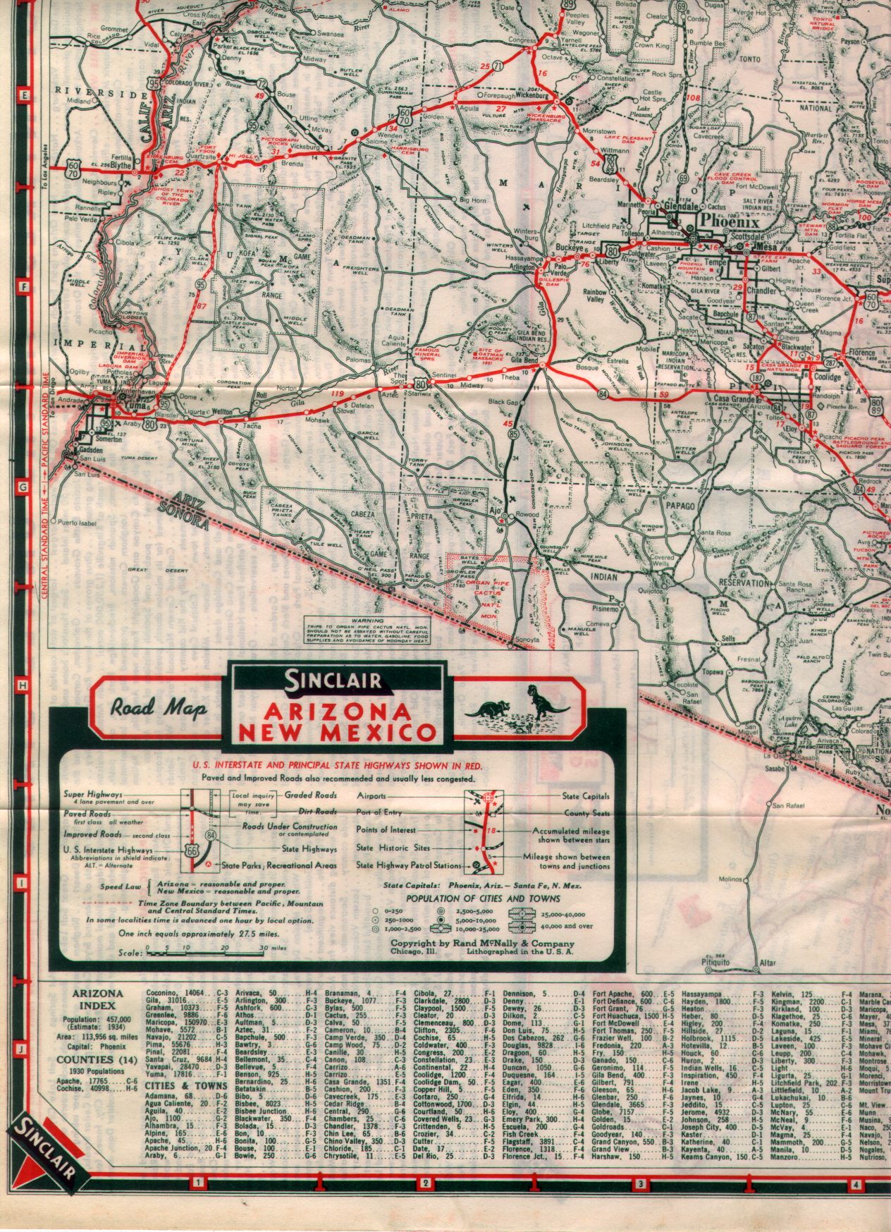
1970 California Legislative Chapter 1473 extended California State Route 62 from Twentynine Palms east to the Colorado River Bridge at the Arizona state line. The California Division of Highways assumed maintenance of the existing Aqueduct Road which connected US Route 95 at Vidal Junction to The Colorado River Bridge. California State Route 62 can be seen terminating at the Colorado River Bridge near Parker on the 1975 Caltrans Map.
Parker became the seat of the newly created La Paz County on January 1, 1983. On April 12, 2010, the Metropolitan Water District received an application from Caltrans and the Arizona Department of Transportation to replace the Colorado River Bridge. The stream under the Colorado River Bridge is noted to have dropped twenty feet which led to the loss of lateral support and embedment in the structure pilings.
The current Colorado River Bridge opened during 2014 and was dedicated on October 1st of said year. The current Colorado River Bridge can be seen in a YouTube video by BigRiver Drone. The 1937 Colorado River Bridge was demolished following the opening of the current span.
Part 2; a drive on Arizona State Route 95 Truck
From the community of Earp in San Bernardino County eastbound California State Route 62 makes a right-hand turn from Aqueduct Road towards the Colorado River Bridge.
California State Route 62 eastbound crosses under the 1908 Arizona & California Railway Bridge to a terminus at the foot of the Colorado River Bridge. The 1908 Arizona & California Railway Bridge partially burned during September 2019, but the structure did not fail. The Arizona & California Railway came under the ownership of RailAmerica during 2012.
California Avenue crosses the Colorado River Bridge and becomes Arizona State Route 95 Truck. An Arizona State Route 95 Truck shield can be found as the highway enters Parker.
Arizona State Route 95 Truck follows California Avenue to a terminus at mainline Arizona State Route 95 at Riverside Drive.
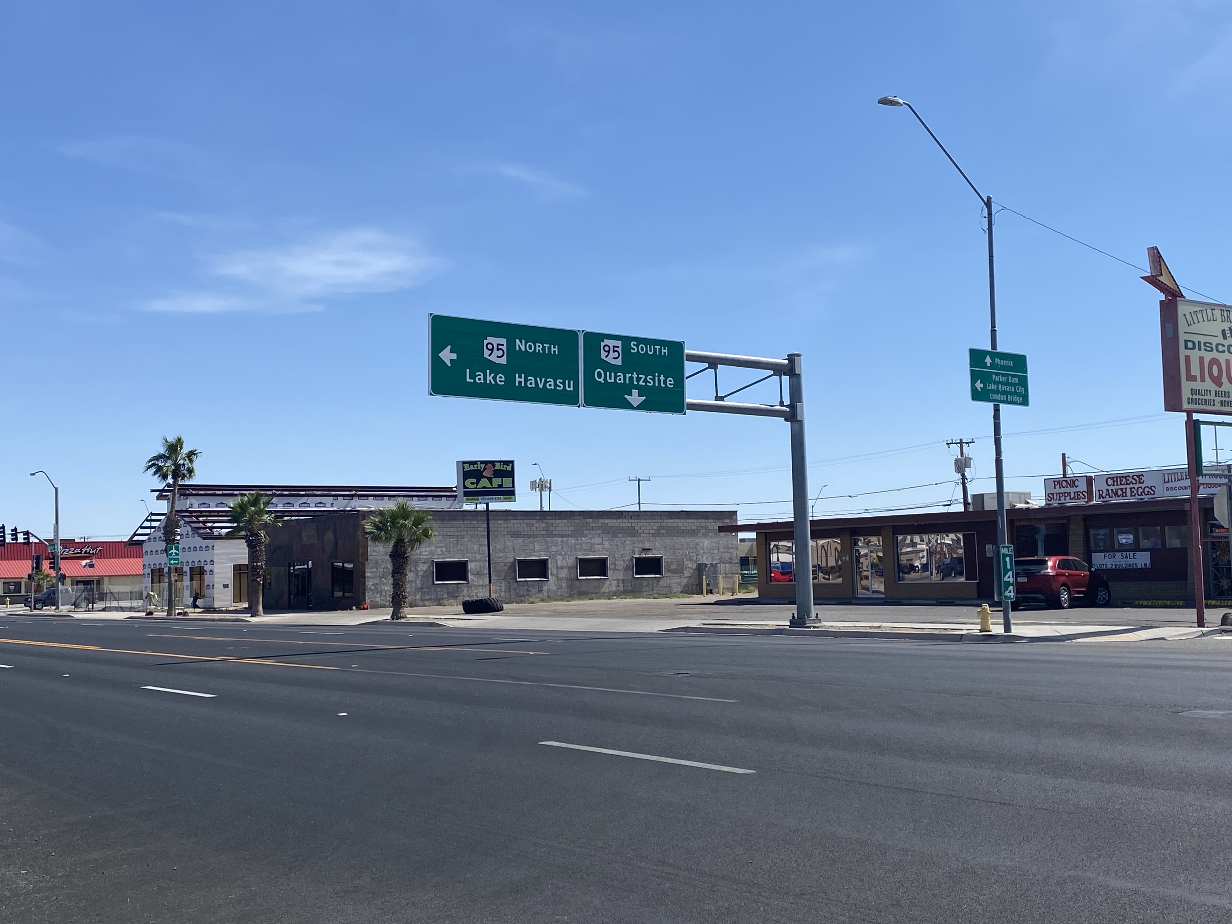
From northbound Arizona State Route 95 a guide sign denotes Arizona State Route 95 Truck as "To California State Route 62."
Back in 2016 I explored some of the derelict roadways of the Sonoran Desert of Riverside County which were part of US Route 60/70; Chuckwalla Valley Road and Ragsdale Road. US 60 and US 70 were not part of the original run of US Routes in California. According to USends.com US 60 was extended into California by 1932. US 60 doesn't appear on the California State Highway Map until the 1934 edition. USends.com on US 60 endpoints 1934 State Highway Map Conversely US 70 was extended into California by 1934, it first appears on the 1936 State Highway Map. USends.com on US 70 endpoints 1936 State Highway Map When US 60 and US 70 were extended into California they both utilized what was Legislative Route Number 64 from the Arizona State Line west to Coachella Valley. LRN 64 was part of the 1919 Third State Highway Bond Act routes. The original definition of LRN 64 routed between Mecca in Blythe and wasn't extended to the Arizona State Line until 1931 acc...
Along southbound California State Route 170 (the Hollywood Freeway Extension) approaching the Hollywood Freeway/Ventura Freeway interchange a white California State Route 134 Sign State Route Spade can be observed on guide sign. These white spades were specifically used during the 1956-63 era and have become increasingly rare. This blog is intended to serve as a brief history of the Sign State Route Spade. We also ask you as the reader, is this last 1956-63 era Sign State Route Spade or do you know of others? Part 1; the history of the California Sign State Route Spade Prior to the Sign State Route System, the US Route System and the Auto Trails were the only highways in California signed with reassurance markers. The creation of the US Route System by the American Association of State Highway Officials during November 1926 brought a system of standardized reassurance shields to major highways in California. Early efforts to create a Sign State Route ...
The Hawaiian Island of O'ahu is home to four Interstate Highways; H-1, H-2, H-3 and H-201. Had history gone slightly differently during the 1960s a fifth Interstate corridor on O'ahu could have been constructed through downtown Honolulu and the neighborhood of Waikiki. The proposed corridor of Interstate H-4 can be seen above as it was presented by the Hawaii Department of Transportation during October 1968 . This page is part of the Gribblenation O'ahu Highways page. All Gribblenation and Roadwaywiz media related to the highway system of O'ahu can be found at the link below: https://www.gribblenation.org/p/gribblenation-oahu-highways-page.html The history of proposed Interstate H-4 The corridor of Interstate H-4 was conceived as largely following what is now Hawaii Route 92 on Nimitz Highway and Ala Moana Boulevard. Prior to the Statehood the first signed highways within Hawaii Territory came into existence during World War II. Dur...


Comments