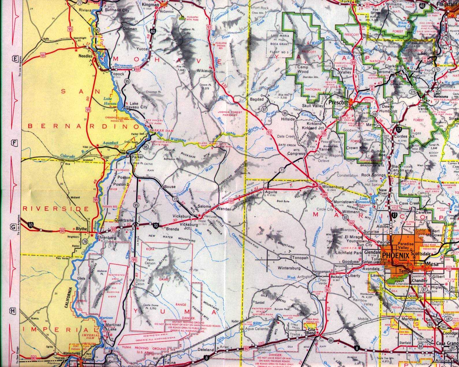
Arizona State Route 95 Detour is a signed highway which is located in Needles, California. From Interstate 40/US Route 95 Exit 142 the Arizona State Route 95 Detour alignment follows J Street, Broadway Street, Needles Highway and K Street to Arizona State Route 95 at the Needles Bridge. Arizona State Route 95 Detour in Needles came into existence due to the relinquishment of Arizona State Route 95 north of Interstate 40 to Mohave Valley during June 1992. The below sketch depicts Arizona State Route 95 Detour as it signed through Needles.
Part 1; the history of Arizona State Route 95 Detour in Needles
On
June 28, 1970, Arizona State Route 95 was extended north of Interstate 40/US Route 66 to Arizona State Route 68. The extension of Arizona State Route 95 incorporated Mohave County Routes 10, 1 and 227. Mohave County Route 10 between Topock and Golden Shores was part of the 1926-1952 alignment of US Route 66 along Oatman Highway.


According to Cameron Kaiser's
Floodgap Roadgap page, Arizona State Route 95 north of Interstate 40 to Mohave Valley was relinquished to over a disputed right of way deed. When the Arizona Department of Transportation attempted to purchase the right of way formally the local property owners and Mohave County raised their asking price. Rather than pay the elevated price the Arizona Department of Transportation opted to relinquish Arizona State Route 95 north of Interstate 40 to Mohave Valley back to Mohave County. Harbor Avenue south of Courtright Road to the Needles Bridge was adopted as part of Arizona State Route 95. Arizona State Route 95 Detour was signed through Needles along K Street, Needles Highway, Broadway Street and J Street to Interstate 40 via an agreement with Caltrans. Arizona State Route 95 Detour was intended to be signed along Interstate 40 to the Arizona state line, but this appears to have never made it to the field.
The relinquishment of Arizona State Route 95 from Mile Marker 211.34 to 227.26 was made formal by resolution on June 19, 1992. The former routing of Arizona State Route 95 north of Needles to Mohave Valley reverted to Mohave County Routes 10, 1 and 227.
The adoption of Arizona State Route 95 south of Courtright Road (Mohave County Route 227) via Harbor Avenue to the Needles Bridge was made official by resolution on June 19, 1992. To date the Arizona Department of Transportation has made no additional attempts to purchase the right of way of Mohave County Routes 227, 1 and 10.
Part 2; a drive on Arizona State Route 95 Detour through Needles
Arizona State Route 95 southbound in Mohave Valley intersects Mohave County Route 227 at Courtright Road. Southbound Arizona State Route 95 would have originally turned left towards Topock and Interstate 40.
Arizona State Route 95 southbound follows Harbor Avenue to the Colorado River and Needles Bridge. The Needles Bridge enters the state of California and city of Needles via K Street.
According to the Arizona Department of Transportation, the Needles Bridge was constructed during 1978 and is co-owned with the city of Needles. A
2022 report on the Needles Bridge rehabilitation displays K Street, Needles Highway and Broadway Street in Needles as a continuation Arizona State Route 95.
Signage on southbound K Street approaching Needles Highway indicates Interstate 40 in addition to US Route 95 can be reached via a right-hand turn. The US Route 95 shield is an Arizona Department of Transportation specification blank US Route shield as opposed to the Caltrans spec cutout.
Traffic on westbound Needles Highway is advised southbound Arizona State Route 95 can be followed by turning left onto Broadway Street. Broadway Street was part of the historic alignments of US Route 66 and US Route 95 in Needles prior to the completion of Interstate 40 in the city.
Signage from Interstate 40/US Route 95 Exit 142 indicates J Street can be used to reach northbound Arizona State Route 95 and Bullhead City.
From J Street traffic following the northbound Arizona State Route 95 Detour is directed to turn left onto Broadway Street.
From Broadway Street traffic following the northbound Arizona State Route 95 Detour is directed to turn right onto Needles Highway.
From Needles Highway traffic following the northbound Arizona State Route 95 Detour is directed to turn left onto K Street towards the Needles Bridge and Arizona state line.


Comments