Canal Street-Algiers Point Ferry (New Orleans, LA)


The Canal Street-Algiers Point Ferry is one of two crossings of the Mississippi River located at downtown New Orleans, connecting the foot of Canal Street in town with the Algiers Point section of the city on the river’s west bank. Like its neighboring ferries downriver, this crossing requires the payment of a toll and ferries depart from each landing every 30 minutes on most days. Unlike the other ferries, this crossing is not open to vehicles and is a pedestrian-only river crossing. The ferry is located at the deepest part of the Mississippi River, where the depth is about 210 ft across from Jackson Square. At this point, the typical flowrate is 600,000 cubic feet per second. That volume is roughly the equivalent of seven Olympic-sized swimming pools for every second that passes.

The initial French settlement of New Orleans in 1718 was centered around what’s now Jackson Square and the historic French Quarter neighborhood in the city. The area around Algiers Point was first developed as a plantation in 1719 and an informal ferry service was started and remained present in the following 100 years. The commercialization of the ferry service at this location was made official in 1827, making this ferry one of the longest-running commercial operations on the Mississippi River. The ferry became essential as time went on, as Algiers grew in the 19th Century as its own community, and following the annexation of the area into the city of New Orleans in 1870. It was not until the 1950s when the construction of the Greater New Orleans Bridge (nowadays known as the Crescent City Connection) enabled residents to directly access both sides of the city by vehicle.

Algiers is sometimes also known as the 15th Ward, one of the city’s 17 Wards and the only such subdivision located on the west bank of the river, while downtown and the remainder of the city limit is located on the river’s east bank. Since the Mississippi River flows due north for a substantial distance in this area, an anomaly along the lower river, the river’s west bank is in fact located compass east of downtown and the river’s east bank, and vice versa.
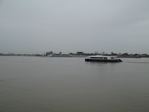

The Canal Street Ferry operates on a passenger-only catamaran-style vessel like the one pictured here bound for the Algiers ferry terminal.

This ferry is my personal favorite of the services on the lower Mississippi River. The ride across the river affords passengers the opportunity to take in the sweeping views of downtown, the French Quarter, and the Crescent City Connection and along with the city’s famous streetcar lines, is a quintessential New Orleans transportation experience that should not be passed up if you ever get the chance to visit.

The following pictures from my visits to the Canal Street Ferry in February 2024 showcase the Algiers Point Ferry Terminal on the west bank of the Mississippi River in the historic Algiers Point neighborhood of New Orleans. Click on each photo to see a larger version.


The following pictures from my visits to the Canal Street Ferry in February 2024 showcase the Canal Street Ferry Terminal on the east bank of the Mississippi River in downtown New Orleans. Click on each photo to see a larger version.


The following pictures from my visits to the Canal Street Ferry in February 2024 showcase the round trip voyage on the ferry, including the interiors of the ferry itself and the surrounding scenery. Click on each photo to see a larger version.


The following pictures from my visits to the Canal Street Ferry in February 2024 showcase general views of the ferry and its surrounding scenery on the Mississippi River. Click on each photo to see a larger version.

How To Get There:

Bridges, Crossings, and Structures of the Lower Mississippi River
Next Crossing upriver: Crescent City Connection Bridge (New Orleans, LA)
Next Crossing downriver: Chalmette-Lower Algiers Ferry (Chalmette, LA)
Return to the Bridges of the Lower Mississippi River Home Page
__________________________________________________

Comments

Popular posts from this blog

Interstate 40's Tumultuous Ride Through the Pigeon River Gorge

In the nearly 60 years Interstate 40 has been open to traffic through the Pigeon River Gorge in the mountains of Western North Carolina, it has been troubled by frequent rockslides and damaging flooding, which has seen the over 30-mile stretch through North Carolina and Tennessee closed for months at a time. Most recently, excessive rainfall from Hurricane Helene in September 2024 saw sections of Interstate 40 wash away into a raging Pigeon River. While the physical troubles of Interstate 40 are well known, how I-40 came to be through the area is a tale of its own. Interstate 40 West through Haywood County near mile marker 10. I-40's route through the Pigeon River Gorge dates to local political squabbles in the 1940s and a state highway law written in 1921. A small note appeared in the July 28, 1945, Asheville Times. It read that the North Carolina State Highway Commission had authorized a feasibility study of a "...water-level road down [the] Pigeon River to the Tennessee l...

Massena Center Suspension Bridge

The Massena Center Bridge, also known as the Holton D. Robinson Bridge, has had quite the tumultuous history. Situated on the Grasse River just east of Massena, New York in the hamlet of Massena Center, the Massena Center Bridge is a reminder of the efforts the community has made in order to connect over the river. The first and only other known bridge to be built at Massena Center was built in 1832, but that bridge was never long for this world. During the spring of 1833, the Grasse River dammed itself due to an ice dam, flooded and lifted the bridge off its foundation, destroying the bridge in the process.  The floods were frequent in the river during the spring, often backing up the river from Hogansburg and past Massena Center, but not to nearby Massena. After the first bridge disappeared, local residents had to resort to traveling seven miles west to Massena to cross the next closest bridge, and that was no easy task for a horse and buggy. However, it was many decades befo...

The Dead Man's Curve of Interstate 90 and Innerbelt Freeway in Cleveland

"Dead Man's Curve" refers to the transition ramp Interstate 90 takes between Cleveland Memorial Shoreway onto the Innerbelt Freeway in downtown Cleveland, Ohio.  Said curve includes a sharp transition between the two freeways which is known for a high rate of accidents.  Currently the curve (not officially named) has a 35 MPH advisory speed and numerous safety features intended to mitigate crashes.  When the Interstate System was first conceived during 1956, Interstate 90 was intended to use the entirety Cleveland Memorial Shoreway and connect to the Northwest Freeway through Lakewood.  The Innerbelt Freeway was initially planned as the northernmost segment of Interstate 71.  The extension of Cleveland Memorial Shoreway west of Edgewater Park was never constructed which led to Interstate 90 being routed through the Innerbelt Freeway.   Part 1; the history of Cleveland's Innerbelt Freeway and Deadman's Curve The Federal Aid Highway Act of 1956 was signe...