
Del Puerto Canyon Road is a twenty-four-mile highway which connects Patterson in Stanislaus County west to San Antonio Valley in Santa Clara County. From Patterson sixteen miles west to Frank Raines Park the grade of Del Puerto Canyon Road was built atop the grade of the Patterson & Western Railroad. Said line had been completed in 1916 during World War I to the magnesite mine of Jones and was abandoned by 1920. Stanislaus County and Santa Clara County later facilitated repurposing the railroad grade into a public highway to San Antonio Valley. The completed Del Puerto Canyon Road would open to traffic during 1942.

Part 1; the history of Del Puerto Canyon Road
What is now Del Puerto Canyon Road from Patterson west to Frank Raines Park was originally constructed as the grade of the Patterson & Western Railroad. Said line was constructed as narrow gauge in 1916 from the Southern Pacific Railroad West Side Line in downtown Patterson to the magnesite mine known as Jones.
The Patterson & Western Railroad began operations on September 20, 1916. The western terminus of the line connecting to a 3,000-foot-long tramway to the site of the Jones mine. Magnesite was considered an essential metal during World War I which spurred the development of the Jones mine. Quicksilver and manganese chrome was also mined at Jones.
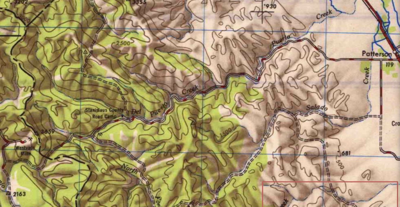
The Patterson & Western Railroad can be seen on the 1919 United States Geological Survey map of Orestimba.

The Patterson & Western Railroad shuttered operations on August 14, 1920. The right-of-way occupied by the line was subsequently abandoned to Stanislaus County. Stanislaus County along with Santa Clara County commissioned a Depression relief program which would repurpose the railroad grade as part of a highway to San Antonio Valley. The first vehicles to travel from Patterson to San Jose via the completed Del Puerto Canyon Road crossed the Diablo Range in 1942.
Below an E. Clampus Vitus historic plaque regarding the history of the Patterson & Western Railroad can be seen (courtesy hmdb.org and Andrew Ruppenstein).

Del Puerto Canyon Road can be seen on the 1947 United States Geological Survey map of San Jose.
Currently California State Route 130 has an eastern terminus at Mount Hamilton in Santa Clara County. The highway has an unconstructed and unadopted legislative extension which terminates in Patterson. For unclear reasons Santa Clara County signs California State Route 130 east from the official terminus at Mount Hamilton to the Stanislaus County line via San Antonio Valley Road and Del Puerto Canyon Road.

Part 2; a drive on Del Puerto Canyon Road
The westbound beginning of Del Puerto Canyon Road can be found a short distance west of Interstate 5 in Patterson via Diablo Grande Parkway. Traffic is advised that Frank Raines Parkway is sixteen miles away as westbound Del Puerto Canyon Road begins.


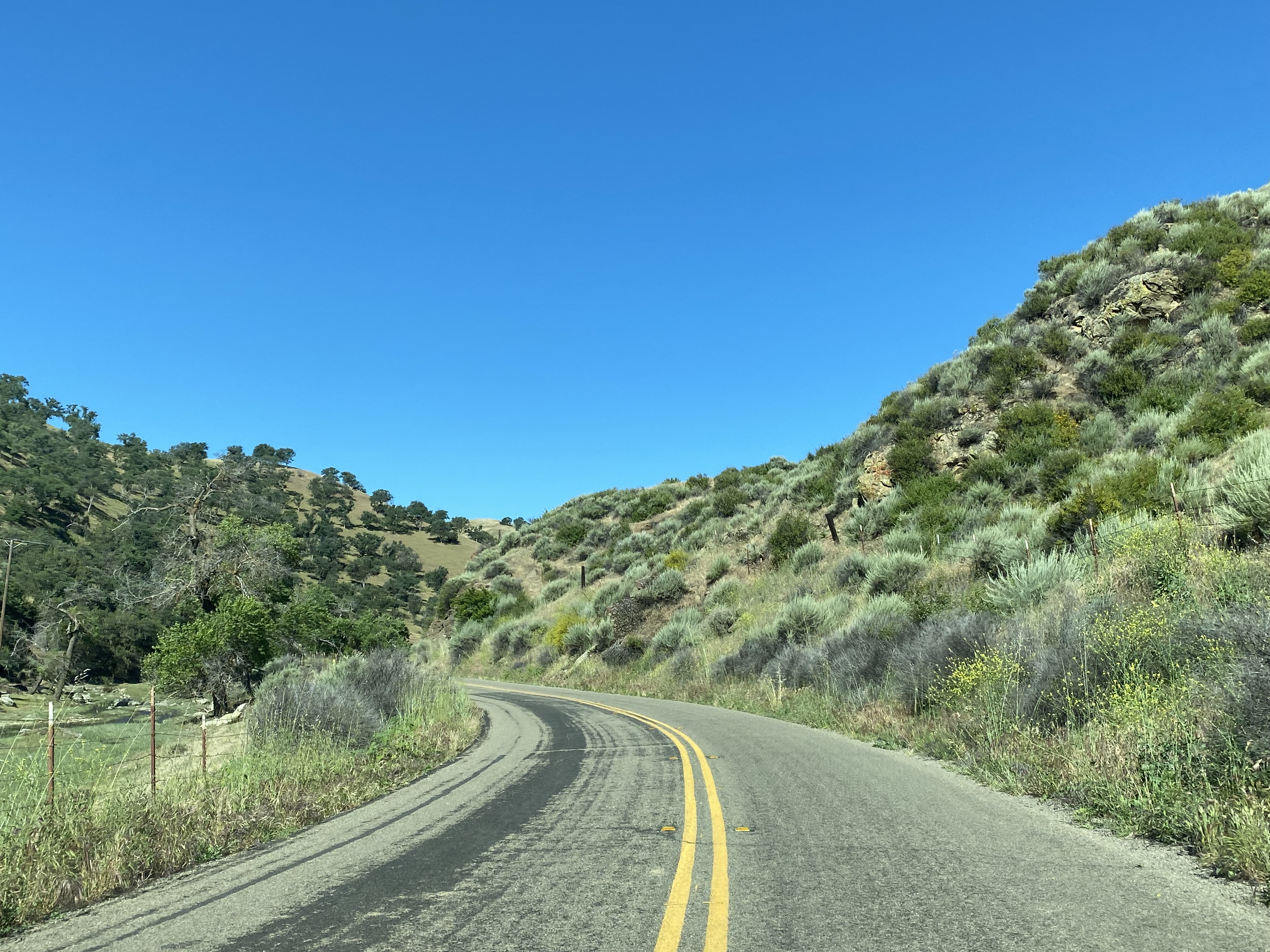
Del Puerto Canyon Road west to Frank Raines Park is mostly aligned atop the grade of the Patterson & Western Railroad. The roadway is extremely curvy but offers numerous scenic views the slopes of Del Puerto Canyon. The ruins of a railroad bridge over Del Puerto Creek can be found in the overgrowth a short distance east of Frank Raines Park.


Del Puerto Canyon Road west from Frank Raines Park ascends further into the Diablo Range and enters Santa Clara County.


Westbound Del Puerto Canyon Roads terminates at fork which serves as the beginning of San Antonio Valley Road and Mines Road. Traffic wishing to follow California State Route 130 is directed to follow San Antonio Valley Road.


Comments